• Skip to main content
  • Skip to secondary menu
  • Skip to primary sidebar
  • Skip to secondary sidebar
  • Skip to footer
  • DroneRacingLife
  • DroneFlyers
  • Newsletter
DroneLife

DRONELIFE

Stay up to date on all the latest Drone News

  • News
  • Products
  • Industries
    • Agriculture
    • Construction
    • Delivery
    • Dual Use
    • Inspection
    • Public Safety
    • Surveying
  • Enthusiasts
  • Regulations
  • Business
  • Video
  • Podcasts

SimActive’s Correlator3D™ 10.3: Revolutionizing Large-Scale Mapping with Enhanced Speed and Flexibility

January 21, 2025 by Miriam McNabb Leave a Comment

The latest update tackles big data challenges with optimized workflows and multi-platform integration, delivering powerful solutions for commercial and military applications.

by DRONELIFE Staff Writer Ian J. McNabb

Quebec-based software developer SimActive Inc. recently announced the release of the new Correlator3D™ Version 10.3, updating their popular mapping solution to better tackle large-scale projects. This latest version introduces many optimizations of the underlying product architecture to make dealing with larger datasets easier and faster.

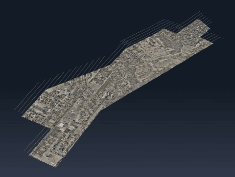
In the status quo, large projects (those involving thousands of different images, all of which need to be collated into a legible map) can be bottlenecked by existing technology solutions, with some processing steps taking much longer than others. Version 10.3 brings additional feedback throughout the processing workflow as well as “more fluid interaction” with data, increasing speed and ensuring that clients have the maximum amount of insight into what’s happening at that moment.

“Optimizations made in Version 10.3 greatly enhance user experience when working with very large projects,” said Louis Simard, CTO at SimActive. “Having a fluidity when dealing with huge datasets not only improves user experience, but also allows for the processing of even more extensive projects.”

Initially developed for large-format aerial cameras, Correlator3D™ has since adapted to integrate drone and satellite imagery. This versatility has proven valuable in both commercial and military applications. For example, SimActive recently showcased the work that Correlator3D is doing in New Zealand working in agriculture, environmental assessment, and engineering design. Correlator3D is also used in militaries across the world to provide high-quality aerial mapping that supports a range of mission sets.

One of the standout features of SimActive’s Correlator3D™ is its ability to integrate data from various sources, including drones, manned aircraft, and satellites. This versatility is invaluable in military and commercial operations. “Our software accepts imagery regardless of the platform it is captured on. Imagery from any of the formats can be combined to allow for rapid processing of areas of interest,” says Simard.

SimActive’s software continues to evolve to meet the growing demand for fast, flexible mapping solutions. Its capacity to handle data from multiple platforms ensures it remains a valuable tool for users in a wide range of industries.

More information on Simactive and Correlator3D Version 10.3 is available here.

Want DRONELIFE news delivered to your inbox every weekday?  Sign up here.

Read more:

  • Mastering Drone Mapping: Expert Tips for Success from SimActive’s Eric Andelin
  • How SimActive’s Correlator3D™ is Revolutionizing Military Mapping: An Exclusive Interview with CEO Philippe Simard
  • SimActive Software Enhances Construction Mapping for Bullseye Construction


Miriam McNabb

Miriam McNabb is the Editor-in-Chief of DRONELIFE and CEO of JobForDrones, a professional drone services marketplace, and a fascinated observer of the emerging drone industry and the regulatory environment for drones. Miriam has penned over 3,000 articles focused on the commercial drone space and is an international speaker and recognized figure in the industry.  Miriam has a degree from the University of Chicago and over 20 years of experience in high tech sales and marketing for new technologies.
For drone industry consulting or writing, Email Miriam.

TWITTER:@spaldingbarker

Subscribe to DroneLife here.

Filed Under: Drone News, Drone News Feeds, News, Products Tagged With: aerial mapping, correlator3d, data integration, drone imagery, geospatial solutions, large-scale mapping, mapping software, military mapping, satellite imagery, SimActive

Reader Interactions

Leave a Reply Cancel reply

Your email address will not be published. Required fields are marked *

Primary Sidebar

LATEST

If Pilots Stop Trusting Safety Broadcasts, What Happens to Universal Conspicuity?

AOPA’s opposition to ADS-B billing highlights a growing issue for both crewed and uncrewed aviation News and Commentary. A new…

Continue Reading If Pilots Stop Trusting Safety Broadcasts, What Happens to Universal Conspicuity?

The Drone Industry’s Battery Problem Has a New Challenger

Factorial Expands Solid-State Drone Battery Partnerships Across Three Continents New collaborations aim to improve drone endurance, power, and cold-weather performance…

Continue Reading The Drone Industry’s Battery Problem Has a New Challenger

Commercial UAV Expo Releases 2026 Conference Program Focused on “Actionable Insights”

Community feedback shapes event agenda centered on real-world drone operations and practical takeaways Commercial UAV Expo has announced its 2026…

Continue Reading Commercial UAV Expo Releases 2026 Conference Program Focused on “Actionable Insights”

US Drone Makers Are Building a Different Kind of Factory

Additive Manufacturing Helps Build Flexibility, Scale, and Supply Chain Resilience At AUVSI’s XPONENTIAL 2026 conference in Detroit, one theme surfaced…

Continue Reading US Drone Makers Are Building a Different Kind of Factory

Pentagon Backs AI Counter-Drone Startup with $500 Million Deal

JITF 401 signs $500 million contract with fast-growing startup By DRONELIFE Features Editor Jim Magill The Pentagon plans to acquire…

Continue Reading Pentagon Backs AI Counter-Drone Startup with $500 Million Deal

Under the Ice: New SYOS Underwater Drone Targets Maritime Security and Antarctic Exploration

SYOS Introduces SU10 Underwater Drone for Multi-Domain Operations New uncrewed underwater vehicle expands company portfolio from air, land, and sea…

Continue Reading Under the Ice: New SYOS Underwater Drone Targets Maritime Security and Antarctic Exploration

Amprius and Matternet Expand Drone Delivery Battery Partnership

Silicon anode battery technology aims to improve range, charging time, and delivery economics for commercial drone operations Battery manufacturer Amprius…

Continue Reading Amprius and Matternet Expand Drone Delivery Battery Partnership

Kansas City Builds a World Cup-Era Drone Defense Network

Airspace Link and regional public safety agencies deploy a shared drone coordination and counter-UAS platform designed to support FIFA World…

Continue Reading Kansas City Builds a World Cup-Era Drone Defense Network

Autel Challenges FCC Covered List Decision, Distances Itself from DJI

Drone maker argues FCC relied on broad assumptions instead of company-specific analysis In a sharply worded filing with the Federal…

Continue Reading Autel Challenges FCC Covered List Decision, Distances Itself from DJI

Terra Drone Deploys Terra A2 Interceptor Drone to Ukraine Frontlines

The Japanese drone company brings its long-range, wide-area air defense platform into Ukrainian service alongside Terra A1 through a joint…

Continue Reading Terra Drone Deploys Terra A2 Interceptor Drone to Ukraine Frontlines

Secondary Sidebar

Footer

SPONSORED

Inspired Flight Gremsy IF800 VIO F1 drones geo week

What Will It Take to Strengthen U.S. Drone Manufacturing? A Conversation with Inspired Flight’s CEO

Global Mapper Mobile data collection

Collection Ground Control Points with Global Mapper Mobile

Military Drone Mapping Solutions

How SimActive’s Correlator3D™ is Revolutionizing Military Mapping: An Exclusive Interview with CEO Philippe Simard

Photogrammetry Accuracy Standards

SimActive Photogrammetry Software: Enabling Users to Meet Accuracy Standards for Over 20 Years

NACT Engineering Parrot ANAFI tether indoor shot

Smart Tether for Parrot ANAFI USA from NACT Engineering

Blue Marble, features global mapper, features Blue Marble

Check Out These New Features in Global Mapper v25 from Blue Marble

About Us | Contact Us | Advertise With Us | Write for Us | Privacy Policy | Terms of Service

The Trusted Source for the Business of Drones.

This website uses cookies and third party services. By clicking OK, you are agreeing to our privacy policy. ACCEPT

Manage consent

Privacy Overview

This website uses cookies to improve your experience while you navigate through the website. Out of these, the cookies that are categorized as necessary are stored on your browser as they are essential for the working of basic functionalities of the website. We also use third-party cookies that help us analyze and understand how you use this website. These cookies will be stored in your browser only with your consent. You also have the option to opt-out of these cookies. But opting out of some of these cookies may affect your browsing experience.
Necessary
Always Enabled
Necessary cookies are absolutely essential for the website to function properly. These cookies ensure basic functionalities and security features of the website, anonymously.
CookieDurationDescription
cookielawinfo-checkbox-analytics11 monthsThis cookie is set by GDPR Cookie Consent plugin. The cookie is used to store the user consent for the cookies in the category "Analytics".
cookielawinfo-checkbox-functional11 monthsThe cookie is set by GDPR cookie consent to record the user consent for the cookies in the category "Functional".
cookielawinfo-checkbox-necessary11 monthsThis cookie is set by GDPR Cookie Consent plugin. The cookies is used to store the user consent for the cookies in the category "Necessary".
cookielawinfo-checkbox-others11 monthsThis cookie is set by GDPR Cookie Consent plugin. The cookie is used to store the user consent for the cookies in the category "Other.
cookielawinfo-checkbox-performance11 monthsThis cookie is set by GDPR Cookie Consent plugin. The cookie is used to store the user consent for the cookies in the category "Performance".
viewed_cookie_policy11 monthsThe cookie is set by the GDPR Cookie Consent plugin and is used to store whether or not user has consented to the use of cookies. It does not store any personal data.
Functional
Functional cookies help to perform certain functionalities like sharing the content of the website on social media platforms, collect feedbacks, and other third-party features.
Performance
Performance cookies are used to understand and analyze the key performance indexes of the website which helps in delivering a better user experience for the visitors.
Analytics
Analytical cookies are used to understand how visitors interact with the website. These cookies help provide information on metrics the number of visitors, bounce rate, traffic source, etc.
Advertisement
Advertisement cookies are used to provide visitors with relevant ads and marketing campaigns. These cookies track visitors across websites and collect information to provide customized ads.
Others
Other uncategorized cookies are those that are being analyzed and have not been classified into a category as yet.
SAVE & ACCEPT