• Skip to main content
  • Skip to secondary menu
  • Skip to primary sidebar
  • Skip to secondary sidebar
  • Skip to footer
  • DroneRacingLife
  • DroneFlyers
  • Newsletter
DroneLife

DRONELIFE

Stay up to date on all the latest Drone News

  • News
  • Products
  • Industries
    • Agriculture
    • Construction
    • Delivery
    • Dual Use
    • Inspection
    • Public Safety
    • Surveying
  • Enthusiasts
  • Regulations
  • Business
  • Video
  • Podcasts

SimActive Integrates Phase One iXM-FS130 for High-Resolution Aerial Mapping

February 20, 2026 by Miriam McNabb 1 Comment

Correlator3D enables sub-centimeter processing for fixed-wing survey missions

SimActive has announced full support for the Phase One iXM-FS130 sensor in its Correlator3D platform. The integration allows mapping professionals to process sub-centimeter aerial imagery efficiently while maintaining speed and accuracy.

The company made the announcement on February 19, 2026. According to the press release, the integration enables mapping professionals to process sub-centimeter aerial imagery while maintaining speed and accuracy.

Sub-Centimeter Imagery for Fixed-Wing Missions

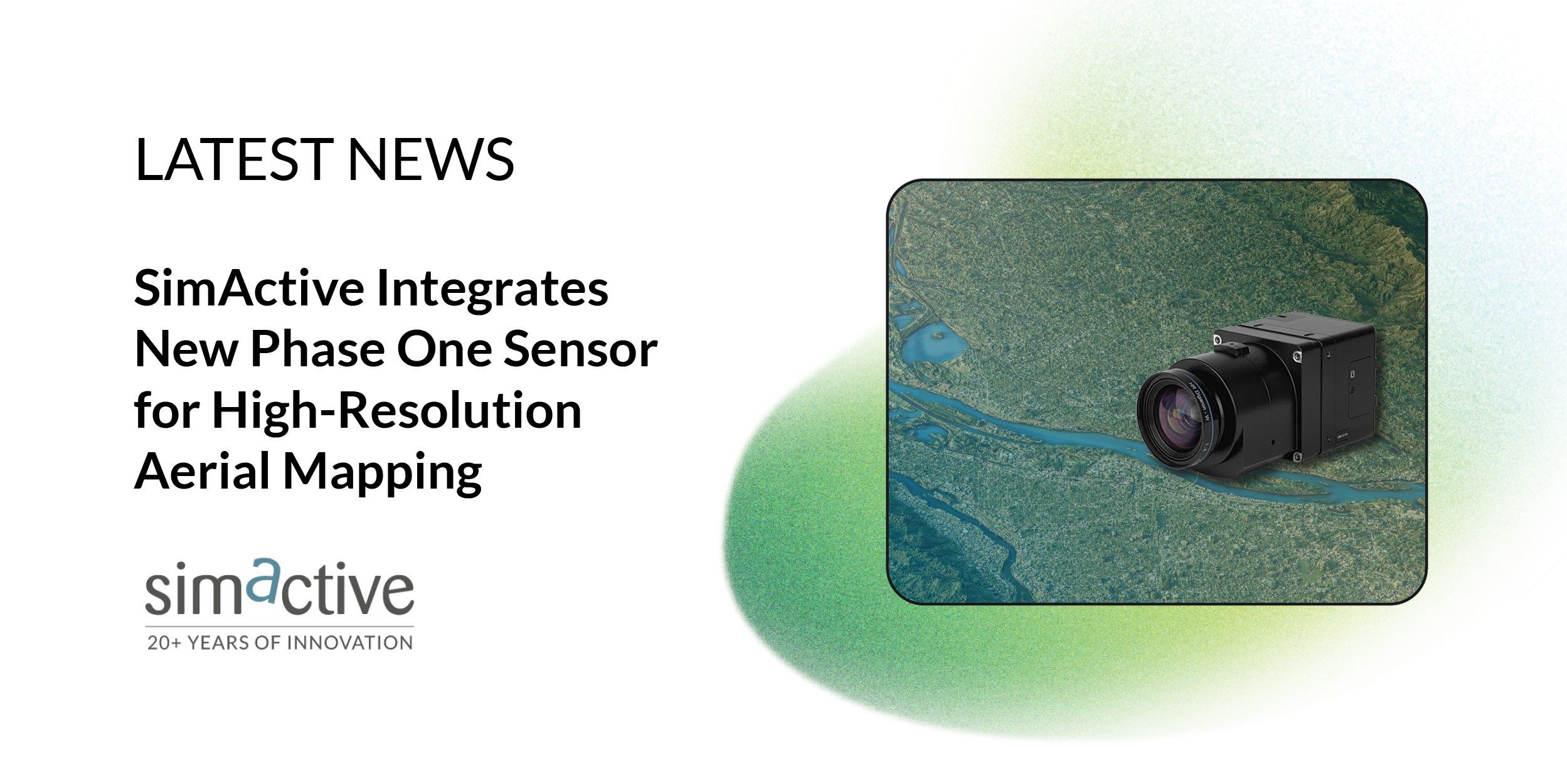
The Phase One iXM-FS130 delivers true 1 cm ground sample distance imagery optimized for fixed-wing aerial missions. Correlator3D processes the high-resolution datasets seamlessly, performing precise aerial triangulation, generating point clouds, dense surface models, and orthomosaics suited for demanding engineering and mapping projects.

High-resolution imagery at 1 cm ground sample distance allows surveyors and engineers to capture small surface features with clarity. This level of detail supports infrastructure inspection, corridor mapping, and large-scale engineering design. Fixed-wing platforms benefit from the ability to cover large areas while maintaining fine resolution.

“The integration of the iXM-FS130 ensures our clients can fully leverage its image quality within a robust and scalable processing environment,” said Louis Simard, CTO at SimActive. “Together, the technologies deliver unmatched detail and workflow efficiency for high-resolution aerial mapping.”

About SimActive and Correlator3D

SimActive develops Correlator3D™, a patented end-to-end photogrammetry solution for the generation of high-quality geospatial data from satellite and aerial imagery, including drones. Correlator3D performs aerial triangulation and produces dense digital surface models, digital terrain models, point clouds, orthomosaics, 3D models, and vectorized 3D features.

The software is powered by GPU technology and multi-core CPUs. This design increases processing speed and supports rapid production of large datasets. For mapping firms that manage complex projects, processing speed can directly affect delivery timelines.

SimActive has been selling Correlator3D to leading mapping firms and government organizations around the world. The company positions its software as a production-grade platform built for accuracy and scale. Its tools support a wide range of applications, from drone-based surveys to large-area aerial and satellite mapping.

As demand grows for higher resolution data and more detailed digital twins, software must keep pace with advances in sensor technology. The addition of the iXM-FS130 reflects that trend. By aligning with high-resolution imaging systems, SimActive expands its support for operators who require precise and efficient workflows.

About Phase One

Phase One is a global provider of digital imaging technology. The company supports applications that range from professional photography to heritage digitization, industrial inspections, aerial mapping, security, and space.

For more than three decades, Phase One has developed core imaging technologies and digital cameras that set standards for resolution, dynamic range, color fidelity, and geometric accuracy. The company is headquartered in Copenhagen, Denmark, with regional offices in North America, Europe, and Asia.

Supporting High-Resolution Mapping Workflows

The integration highlights a broader industry trend toward pairing advanced sensors with scalable processing platforms. Hardware captures high-detail imagery. Software converts that imagery into usable geospatial products.

For mapping professionals, compatibility between sensor and processing platform remains critical. With full support for the iXM-FS130, Correlator3D users can process 1 cm imagery within an established workflow. The result is high-resolution output delivered efficiently and at production scale.

Read more:

  • SimActive Expands Mapping Capacity With Distributed Processing in Correlator3D
  • SimActive Software Supports Highway Ramp Expansion Through Integrated Lidar and Photogrammetry
  • SimActive Enables 3D Calculations from Drone Imagery at Mining Sites
Miriam McNabb

Miriam McNabb is the Editor-in-Chief of DRONELIFE and CEO of JobForDrones, a professional drone services marketplace, and a fascinated observer of the emerging drone industry and the regulatory environment for drones. Miriam has penned over 3,000 articles focused on the commercial drone space and is an international speaker and recognized figure in the industry.  Miriam has a degree from the University of Chicago and over 20 years of experience in high tech sales and marketing for new technologies.
For drone industry consulting or writing, Email Miriam.

TWITTER:@spaldingbarker

Subscribe to DroneLife here.

Filed Under: Applications, Cameras, Drone News, Drone News Feeds, Mapping, News Tagged With: aerial mapping, Aerial Triangulation, correlator3d, digital surface model, drone mapping, fixed-wing mapping, geospatial data, ground sample distance, high-resolution imagery, iXM-FS130, orthomosaic, Phase One, photogrammetry software, SimActive

Reader Interactions

Comments

  1. Gofrex says

    February 20, 2026 at 7:01 pm

    Fantastiskt hur du alltid hittar rätt ord för varje situation

    Reply

Leave a Reply Cancel reply

Your email address will not be published. Required fields are marked *

Primary Sidebar

LATEST

Vantis BVLOS System Adds New Partner, FAA Waiver Across 5,000 Square Miles

A new FAA aircraft-agnostic waiver lets Frontier Precision fly any NDAA-compliant drone under 55 pounds across more than 5,000 square…

Continue Reading Vantis BVLOS System Adds New Partner, FAA Waiver Across 5,000 Square Miles

MatrixSpace Validated in U.S. Army’s Operation Jailbreak Integration Sprint

The portable radar maker’s integration with Anduril Lattice and IBCS-M passed Army validation at Fort Carson, joining 55 companies in…

Continue Reading MatrixSpace Validated in U.S. Army’s Operation Jailbreak Integration Sprint

Army Medical Brigade Expands Drone Use for Battlefield Resupply

New training program helps medical personnel deliver critical supplies faster while reducing risk to soldiers The U.S. Army’s 44th Medical…

Continue Reading Army Medical Brigade Expands Drone Use for Battlefield Resupply

Counter-Drone Partnership Sends Ouster Shares Higher as Investors Focus on Airspace Security

Lidar company’s agreement with German counter-UAS firm highlights growing market for drone detection and interception technologies Shares of lidar manufacturer…

Continue Reading Counter-Drone Partnership Sends Ouster Shares Higher as Investors Focus on Airspace Security

Airport Drone Closures Raise a Bigger Question: What Do Authorities Actually Know?

Recent airport disruptions highlight a growing challenge: detecting an object in protected airspace is often easier than identifying it, locating…

Continue Reading Airport Drone Closures Raise a Bigger Question: What Do Authorities Actually Know?

Finding the Person Behind the Drone: Sky Spy Demonstrates Airborne Detection System with French Military

Drone-mounted system helps military users detect and locate drone operators, control stations, jammers, and other RF emitters in contested environments.…

Continue Reading Finding the Person Behind the Drone: Sky Spy Demonstrates Airborne Detection System with French Military

Congress Pushes for Expanded ADS-B Requirements Following Deadly D.C. Midair Collision

Bipartisan lawmakers urge aviation bill negotiators to adopt stronger aircraft visibility measures and preserve broader safety reforms The leaders of…

Continue Reading Congress Pushes for Expanded ADS-B Requirements Following Deadly D.C. Midair Collision

Motorola Solutions Makes $1.5 Billion Bet on Counter-Drone Technology

Acquisition Highlights Growing Demand for Airspace Security as Governments Expand Counter-UAS Authorities Motorola Solutions announced plans to acquire counter-drone company…

Continue Reading Motorola Solutions Makes $1.5 Billion Bet on Counter-Drone Technology

Government Signals Drive Rally in US Drone Stocks

Red Cat, Ondas, and Unusual Machines Gain as Investors Respond to Growing Federal Support for U.S. Drone Industry Several publicly…

Continue Reading Government Signals Drive Rally in US Drone Stocks

FAA Creates World Cup No-Drone Zones Across U.S. Host Cities

Temporary flight restrictions will cover stadiums, fan events, team hotels, training sites, and base camps during FIFA World Cup 2026…

Continue Reading FAA Creates World Cup No-Drone Zones Across U.S. Host Cities

Secondary Sidebar

Footer

SPONSORED

Inspired Flight Gremsy IF800 VIO F1 drones geo week

What Will It Take to Strengthen U.S. Drone Manufacturing? A Conversation with Inspired Flight’s CEO

Global Mapper Mobile data collection

Collection Ground Control Points with Global Mapper Mobile

Military Drone Mapping Solutions

How SimActive’s Correlator3D™ is Revolutionizing Military Mapping: An Exclusive Interview with CEO Philippe Simard

Photogrammetry Accuracy Standards

SimActive Photogrammetry Software: Enabling Users to Meet Accuracy Standards for Over 20 Years

NACT Engineering Parrot ANAFI tether indoor shot

Smart Tether for Parrot ANAFI USA from NACT Engineering

Blue Marble, features global mapper, features Blue Marble

Check Out These New Features in Global Mapper v25 from Blue Marble

About Us | Contact Us | Advertise With Us | Write for Us | Privacy Policy | Terms of Service

The Trusted Source for the Business of Drones.

This website uses cookies and third party services. By clicking OK, you are agreeing to our privacy policy. ACCEPT

Manage consent

Privacy Overview

This website uses cookies to improve your experience while you navigate through the website. Out of these, the cookies that are categorized as necessary are stored on your browser as they are essential for the working of basic functionalities of the website. We also use third-party cookies that help us analyze and understand how you use this website. These cookies will be stored in your browser only with your consent. You also have the option to opt-out of these cookies. But opting out of some of these cookies may affect your browsing experience.
Necessary
Always Enabled
Necessary cookies are absolutely essential for the website to function properly. These cookies ensure basic functionalities and security features of the website, anonymously.
CookieDurationDescription
cookielawinfo-checkbox-analytics11 monthsThis cookie is set by GDPR Cookie Consent plugin. The cookie is used to store the user consent for the cookies in the category "Analytics".
cookielawinfo-checkbox-functional11 monthsThe cookie is set by GDPR cookie consent to record the user consent for the cookies in the category "Functional".
cookielawinfo-checkbox-necessary11 monthsThis cookie is set by GDPR Cookie Consent plugin. The cookies is used to store the user consent for the cookies in the category "Necessary".
cookielawinfo-checkbox-others11 monthsThis cookie is set by GDPR Cookie Consent plugin. The cookie is used to store the user consent for the cookies in the category "Other.
cookielawinfo-checkbox-performance11 monthsThis cookie is set by GDPR Cookie Consent plugin. The cookie is used to store the user consent for the cookies in the category "Performance".
viewed_cookie_policy11 monthsThe cookie is set by the GDPR Cookie Consent plugin and is used to store whether or not user has consented to the use of cookies. It does not store any personal data.
Functional
Functional cookies help to perform certain functionalities like sharing the content of the website on social media platforms, collect feedbacks, and other third-party features.
Performance
Performance cookies are used to understand and analyze the key performance indexes of the website which helps in delivering a better user experience for the visitors.
Analytics
Analytical cookies are used to understand how visitors interact with the website. These cookies help provide information on metrics the number of visitors, bounce rate, traffic source, etc.
Advertisement
Advertisement cookies are used to provide visitors with relevant ads and marketing campaigns. These cookies track visitors across websites and collect information to provide customized ads.
Others
Other uncategorized cookies are those that are being analyzed and have not been classified into a category as yet.
SAVE & ACCEPT