
The Australian geospatial firm is using Correlator3D to generate orthomosaics from aerial imagery captured for wildfire prevention and land management projects. SimActive has announced that Landair Surveys is using its Correlator3D software to produce orthomosaics for planned burns mapping projects in Australia. The Montreal-based developer said the workflow is intended to … [Read more...] about Landair Surveys Uses SimActive Correlator3D for Planned Burns Mapping in Australia
orthomosaic
SimActive Integrates Phase One iXM-FS130 for High-Resolution Aerial Mapping
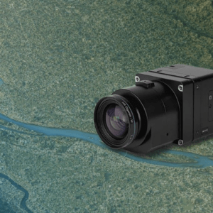
Correlator3D enables sub-centimeter processing for fixed-wing survey missions SimActive has announced full support for the Phase One iXM-FS130 sensor in its Correlator3D platform. The integration allows mapping professionals to process sub-centimeter aerial imagery efficiently while maintaining speed and accuracy. The company made the announcement on February 19, 2026. … [Read more...] about SimActive Integrates Phase One iXM-FS130 for High-Resolution Aerial Mapping
Spexi Orthomosaic Drone Imagery Now Available on SkyWatch Platform

SkyWatch has announced the addition of Spexi orthomosaic drone imagery to its platform, expanding access to standardized aerial data for mapping and analysis. The integration allows users to source ultra-high-resolution drone imagery directly through SkyWatch’s EXPLORE and HUB applications. With the launch, SkyWatch customers can access Spexi’s stitched, orthorectified imagery … [Read more...] about Spexi Orthomosaic Drone Imagery Now Available on SkyWatch Platform


