
Montreal photogrammetry developer overhauls tie point extraction, bundle adjustment and multi-camera workflows in the latest Correlator3D release. SimActive has released Correlator3D Version 11.1, a photogrammetry update centered on a rebuilt aerial triangulation engine. The company says the release improves tie point extraction, accelerates bundle adjustment and adds tools to … [Read more...] about Aerial Triangulation Gets Major Overhaul in SimActive’s Correlator3D Version 11.1
geospatial data
Niantic Spatial and Spexi Turn Drone Imagery Into Physical AI

A new partnership routes Spexi's aerial captures through Niantic Spatial's Reconstruction API to produce city-scale 3D Gaussian splats for enterprise customers. Niantic Spatial and Spexi Geospatial announced a strategic partnership that pairs Spexi's aerial data network with Niantic Spatial's 3D reconstruction pipeline. The deal positions drone imagery for physical AI as an … [Read more...] about Niantic Spatial and Spexi Turn Drone Imagery Into Physical AI
SimActive Integrates Phase One iXM-FS130 for High-Resolution Aerial Mapping
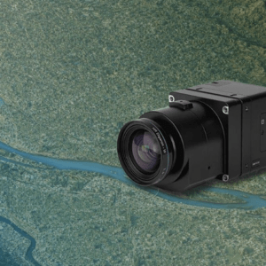
Correlator3D enables sub-centimeter processing for fixed-wing survey missions SimActive has announced full support for the Phase One iXM-FS130 sensor in its Correlator3D platform. The integration allows mapping professionals to process sub-centimeter aerial imagery efficiently while maintaining speed and accuracy. The company made the announcement on February 19, 2026. … [Read more...] about SimActive Integrates Phase One iXM-FS130 for High-Resolution Aerial Mapping
Spexi Orthomosaic Drone Imagery Now Available on SkyWatch Platform

SkyWatch has announced the addition of Spexi orthomosaic drone imagery to its platform, expanding access to standardized aerial data for mapping and analysis. The integration allows users to source ultra-high-resolution drone imagery directly through SkyWatch’s EXPLORE and HUB applications. With the launch, SkyWatch customers can access Spexi’s stitched, orthorectified imagery … [Read more...] about Spexi Orthomosaic Drone Imagery Now Available on SkyWatch Platform
Nearmap and New Light Deploy FEMA Disaster Response System.

Nearmap and New Light Technologies have deepened their collaboration to support the Federal Emergency Management Agency (FEMA) during major natural disasters. The partnership centers on using high‑recency aerial imagery and automated workflows to speed damage assessment, coordination, and relief‑funding decisions across presidential disaster declarations. How drones and … [Read more...] about Nearmap and New Light Deploy FEMA Disaster Response System.


