
Integrated platform cuts damage assessment time from months to 10 days following Super Typhoon Sinlaku FlyGuys and disaster intelligence company TerraFort have announced the results of a partnership that combines drone-based aerial data collection with AI-powered damage assessment. The companies say the approach helped complete a large-scale post-disaster assessment in the … [Read more...] about FlyGuys and TerraFort Cut Disaster Damage Assessments from Months to Days
drone mapping
How Rural Colorado Is Putting Drones to Work for Conservation

In this guest post, Vanessa Trout, Executive Director of the White River Conservation District, describes how rural conservation districts in Colorado are using drone technology to support agriculture, watershed management, and land stewardship. Her article explores how practical drone applications can help small communities monitor and manage natural resources more … [Read more...] about How Rural Colorado Is Putting Drones to Work for Conservation
Aerial Triangulation Gets Major Overhaul in SimActive’s Correlator3D Version 11.1

Montreal photogrammetry developer overhauls tie point extraction, bundle adjustment and multi-camera workflows in the latest Correlator3D release. SimActive has released Correlator3D Version 11.1, a photogrammetry update centered on a rebuilt aerial triangulation engine. The company says the release improves tie point extraction, accelerates bundle adjustment and adds tools to … [Read more...] about Aerial Triangulation Gets Major Overhaul in SimActive’s Correlator3D Version 11.1
GeoCue’s TrueView 641 Certified for Real-Time Robotics HERA Drone
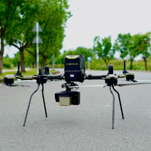
The companies say the integration gives customers a secure aerial mapping option that combines heavy-lift American-made drones with engineering-grade LiDAR. Huntsville, Ala.-based GeoCue has announced that its TrueView LiDAR payloads are now compatible with drones from Real-Time Robotics Inc., a pairing the companies say expands NDAA-compliant drone LiDAR options for customers … [Read more...] about GeoCue’s TrueView 641 Certified for Real-Time Robotics HERA Drone
BRINC Partnership Gives Public Safety Agencies an “Immediate Upgrade” in Incident Intelligence

BRINC and Nova Partner to Add Advanced Mapping and Thermal Intelligence for Public Safet Public safety drone manufacturer BRINC has announced a new partnership with Nova Software Company aimed at bringing advanced aerial mapping and data analysis capabilities to first responders. The companies say the integration will allow agencies using BRINC drones to turn aerial imagery … [Read more...] about BRINC Partnership Gives Public Safety Agencies an “Immediate Upgrade” in Incident Intelligence


