• Skip to main content
  • Skip to secondary menu
  • Skip to primary sidebar
  • Skip to secondary sidebar
  • Skip to footer
  • DroneRacingLife
  • DroneFlyers
  • Newsletter
DroneLife

DRONELIFE

Stay up to date on all the latest Drone News

  • News
  • Products
  • Industries
    • Agriculture
    • Construction
    • Delivery
    • Dual Use
    • Inspection
    • Public Safety
    • Surveying
  • Enthusiasts
  • Regulations
  • Business
  • Video
  • Podcasts

Mapping from a Drone vs. Mapping from Manned Aircraft or Satellite Data: The Difference is Getting Smaller All the Time with SimActive

July 11, 2018 by Sponsored Post 4 Comments

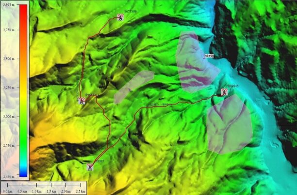
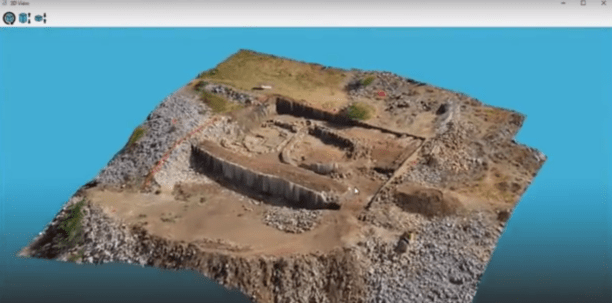
Creating 3D models and maps from aerial footage isn’t a new idea.  Sophisticated, survey grade models from satellite and aircraft images have been used for large scale environmental surveys, construction projects, and other applications.  That functionality is incredibly valuable – and until recently, reserved for government and large industry due to the expense.

Drones, however, have brought that functionality down a bit closer to earth – allowing more industries and applications the opportunity to take advantage of the benefits of accurate modeling without the price tag of satellite or manned aircraft data gathering.  The tools available for the drone market aren’t always exactly the same, however: many platforms specific to the UAV market don’t offer the speed and precision that large industry has come to expect.  Canadian company SimActive, a leading provider of mapping and photogrammetry software for manned aircraft and satellite data, is bridging the gap by expanding their mature processing platform to include the drone market.  SimActive’s Correlator 3D software takes data from any sensor and uses one software interface for processing.

Enterprise and government programs can now choose the most effective and least expensive sensor option for their projects – and drone service providers can now offer a more sophisticated deliverable to their clients.  The price is tailored for the UAV market and the different industries that drones serve, but the software maintains the speed, quality and flexibility developed for sophisticated customers.

SimActive’s processing time is a major differentiator: the 45 minute processing time offers a sharp contrast to the hours or days required by most drone data platforms.  The flexibility of the software is another advantage, one that brings enterprise grade functionality to the drone market.  As customers get more sophisticated, so do their security requirements.  In addition to the option to install on the cloud, SimActive offers a desktop license option.  Users can control the workflow, parameters, and deliverables, and can choose to automate the processing to create output overnight with scripts.

And that output offers enterprise level sophistication and accuracy.  The software offers Aerial Triangulation, DSM & Point Cloud Generation, DTM Extraction and Orthorectification processing modules. Editing tools include GCP creation, Tie Point Editing, DEM Editing, Mosaic Editing, and 3D Feature Extraction.  A wide variety of additional tools –  including NDVI Map Creation, Volume Calculations, and Point Cloud Colorization – expand applications across verticals like agriculture, surveying, construction, and emergency response.

Bringing the same functionality available for manned aircraft and satellite data to the drone market is another major step forward for the industry, expanding the potential of drone technology for serving enterprise and giving drone service providers the tools to deliver what high end customers expect.




Filed Under: Agriculture, Construction, News, Sponsored Content Tagged With: 3d mapping, 3D modeling, commercial mapping software, drone surveying, industrial mapping software, mapping software, SimActive

Reader Interactions

Trackbacks

  1. Alphabet's new businesses: internet balloons and delivery drones | Drone "Ki" says:
    August 11, 2018 at 12:54 am

    […] Creating 3D models and maps from aerial footage isn’t a new idea.  Sophisticated, survey grade models from satellite and aircraft images have been used for large scale environmental surveys, construction projects, and other applications.  That functionality is incredibly valuable – and until recently, reserved for government and large industry due to the expense. Drones, however, […] The post Mapping from a Drone vs. Mapping from Manned Aircraft or Satellite Data: The Difference is GettiSee Original Article […]

    Reply
  2. Mapping from a Drone vs. Mapping from Manned Aircraft or Satellite Data: The Difference is Getting Smaller All the Time with SimActive | News and Reviews about Drones, Quadcopter, Camera says:
    July 12, 2018 at 4:38 am

    […] Source link […]

    Reply
  3. Mapping from a Drone vs. Mapping from Manned Aircraft or Satellite Data: The Difference is Getting Smaller All the Time with SimActive - Drones Crunch says:
    July 12, 2018 at 12:39 am

    […] DRONELIFE […]

    Reply
  4. Mapping from a Drone vs. Mapping from Manned Aircraft or Satellite Data: The Difference is Getting Smaller All the Time with SimActive | Apis Insights says:
    July 11, 2018 at 6:47 pm

    […] Click here to view original web page at dronelife.com […]

    Reply

Leave a Reply Cancel reply

Your email address will not be published. Required fields are marked *

Primary Sidebar

LATEST

GeoComm and SkyfireAI Aim to Improve Location Intelligence for Drone as First Responder Programs

Partnership aims to give Drone as First Responder programs more complete location intelligence before aircraft launch GeoComm and SkyfireAI have…

Continue Reading GeoComm and SkyfireAI Aim to Improve Location Intelligence for Drone as First Responder Programs

Ericsson, AT&T Use Cellular Data to Detect Drones

With the FIFA World Cup tournament and most of the big celebrations of America’s 250th birthday now in the rear-view…

Continue Reading Ericsson, AT&T Use Cellular Data to Detect Drones

Air India, SkyDrive and Suzuki Partner for Medical Air Logistics Study

The three companies will study last-mile emergency medical logistics using SkyDrive’s eVTOL aircraft to bypass severe urban congestion in India.…

Continue Reading Air India, SkyDrive and Suzuki Partner for Medical Air Logistics Study

FAA Deputy Administrator Departure Highlights Leadership Turnover During Critical Aviation Reforms

Chris Rocheleau’s exit comes as the FAA continues work on long-term safety and drone integration initiatives. The Federal Aviation Administration…

Continue Reading FAA Deputy Administrator Departure Highlights Leadership Turnover During Critical Aviation Reforms

EagleNXT Reintroduces MicaSense RedEdge-MX Multispectral Sensor

The Texas-built sensor returns with updated hardware, DLS 2 light-sensor support and field-proven use in wheat fertilizer and fungicide research.…

Continue Reading EagleNXT Reintroduces MicaSense RedEdge-MX Multispectral Sensor

Military or Farm Tool? FCC’s Proposed Drone Categories Blur the Line

FCC proposal aimed at foreign “military-grade” drones could also affect agricultural spray platforms, highlighting emerging policy questions. When the Federal…

Continue Reading Military or Farm Tool? FCC’s Proposed Drone Categories Blur the Line

Swiss Company Adding Drones to NOAA’s Forecasting Toolbox

NOAA has long used balloons to collect data on atmospheric conditions and help predict the weather. Now, working with a…

Continue Reading Swiss Company Adding Drones to NOAA’s Forecasting Toolbox

UK Backs Sovereign Drone Ecosystem with £5 Billion Investment

Defence plan reflects growing allied focus on trusted supply chains and domestic drone manufacturing The UK government will invest more…

Continue Reading UK Backs Sovereign Drone Ecosystem with £5 Billion Investment

U.S. Drone Manufacturing’s New Advantage Isn’t Just Factories. It’s Agility.

As demand accelerates, drone companies are scaling by building flexible engineering teams instead of trying to do everything in-house. The…

Continue Reading U.S. Drone Manufacturing’s New Advantage Isn’t Just Factories. It’s Agility.

DoorDash Is Building More Than a Drone Delivery Service

With its own aircraft, FAA air carrier certificate, and delivery platform, DoorDash is taking a vertically integrated approach that echoes…

Continue Reading DoorDash Is Building More Than a Drone Delivery Service

Secondary Sidebar

Footer

SPONSORED

Inspired Flight Gremsy IF800 VIO F1 drones geo week

What Will It Take to Strengthen U.S. Drone Manufacturing? A Conversation with Inspired Flight’s CEO

Global Mapper Mobile data collection

Collection Ground Control Points with Global Mapper Mobile

Military Drone Mapping Solutions

How SimActive’s Correlator3Dâ„¢ is Revolutionizing Military Mapping: An Exclusive Interview with CEO Philippe Simard

Photogrammetry Accuracy Standards

SimActive Photogrammetry Software: Enabling Users to Meet Accuracy Standards for Over 20 Years

NACT Engineering Parrot ANAFI tether indoor shot

Smart Tether for Parrot ANAFI USA from NACT Engineering

Blue Marble, features global mapper, features Blue Marble

Check Out These New Features in Global Mapper v25 from Blue Marble

About Us | Contact Us | Advertise With Us | Write for Us | Privacy Policy | Terms of Service

The Trusted Source for the Business of Drones.

This website uses cookies and third party services. By clicking OK, you are agreeing to our privacy policy. ACCEPT

Manage consent

Privacy Overview

This website uses cookies to improve your experience while you navigate through the website. Out of these, the cookies that are categorized as necessary are stored on your browser as they are essential for the working of basic functionalities of the website. We also use third-party cookies that help us analyze and understand how you use this website. These cookies will be stored in your browser only with your consent. You also have the option to opt-out of these cookies. But opting out of some of these cookies may affect your browsing experience.
Necessary
Always Enabled
Necessary cookies are absolutely essential for the website to function properly. These cookies ensure basic functionalities and security features of the website, anonymously.
CookieDurationDescription
cookielawinfo-checkbox-analytics11 monthsThis cookie is set by GDPR Cookie Consent plugin. The cookie is used to store the user consent for the cookies in the category "Analytics".
cookielawinfo-checkbox-functional11 monthsThe cookie is set by GDPR cookie consent to record the user consent for the cookies in the category "Functional".
cookielawinfo-checkbox-necessary11 monthsThis cookie is set by GDPR Cookie Consent plugin. The cookies is used to store the user consent for the cookies in the category "Necessary".
cookielawinfo-checkbox-others11 monthsThis cookie is set by GDPR Cookie Consent plugin. The cookie is used to store the user consent for the cookies in the category "Other.
cookielawinfo-checkbox-performance11 monthsThis cookie is set by GDPR Cookie Consent plugin. The cookie is used to store the user consent for the cookies in the category "Performance".
viewed_cookie_policy11 monthsThe cookie is set by the GDPR Cookie Consent plugin and is used to store whether or not user has consented to the use of cookies. It does not store any personal data.
Functional
Functional cookies help to perform certain functionalities like sharing the content of the website on social media platforms, collect feedbacks, and other third-party features.
Performance
Performance cookies are used to understand and analyze the key performance indexes of the website which helps in delivering a better user experience for the visitors.
Analytics
Analytical cookies are used to understand how visitors interact with the website. These cookies help provide information on metrics the number of visitors, bounce rate, traffic source, etc.
Advertisement
Advertisement cookies are used to provide visitors with relevant ads and marketing campaigns. These cookies track visitors across websites and collect information to provide customized ads.
Others
Other uncategorized cookies are those that are being analyzed and have not been classified into a category as yet.
SAVE & ACCEPT