
NOAA has long used balloons to collect data on atmospheric conditions and help predict the weather.
Now, working with a Swiss weather technology company and other providers, the agency is adding drones to its forecasting arsenal. Meteomatics is currently conducting flights of its proprietary hexacopter Meteodrones at a pilot site owned by the University of Oklahoma, near Norman.
Brad Guay, head of government and defense solutions at Meteomatics, said he expects the company’s work with NOAA to have a significant impact on the future of the agency’s weather observing network, which currently relies largely on data collected from weather balloons at more than 80 sites across the country.
“The more data we have, then the better the weather models can be, the better we can make the weather warnings to improve the lead times for warnings for things like tornadoes, hurricanes or winter storms,” he said. “And to be able to get all that data that we need, it wouldn’t really be feasible to expand the weather balloon network due to the cost associated with it.”
Drones Offer Key Advantages Over Weather Balloons for Data Collection
Drones have many advantages as weather-forecasting tools compared with balloons, Guay said. Most weather balloons deployed by NOAA and its third-party contractors are designed for single-use launches. The agency and its partners typically conduct two balloon launches per day at each site, generally once during daylight hours and once at nighttime.
“The drones, once installed, can be operated repeatedly without needing to be resupplied, and they can be operated remotely from a single operational site,” Guay said. “You can control many sites, and it allows data to be collected on demand with the schedules being oriented to the weather situation rather than just launching at those fixed times.”
In addition, the drone can be directed to ascend and descend in a straight vertical line, instead of being allowed to drift away with the wind as a balloon would. “It’s always measuring data at the same location. So, it’s allowing us to get more targeted weather data,” he said.
“I think one of the advantages from the safety perspective is that even though the drone is flying quite high, it’s a very narrow envelope, so it’s staying within a couple of feet of its starting position and really just moving up and down in the column.”
While its U.S. operations are still in the early stages, Meteomatics has been operating networks of drone data-collection sites in Europe for the past several years. It currently is operating 10 sites in its home country of Switzerland and is building out a network in Norway that, when complete, will comprise 30 sites.
Drones Designed for High-Altitude Conditions
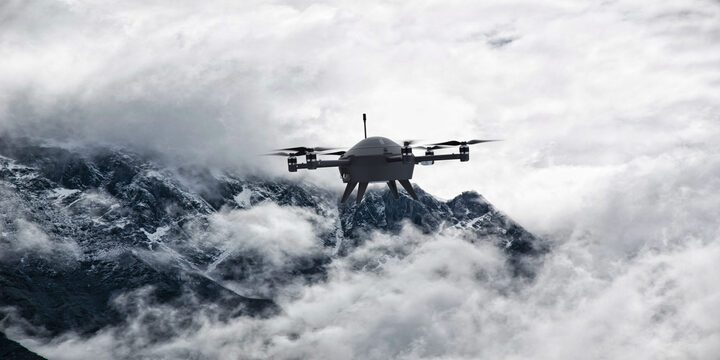
The company’s compact but powerful Meteodrones measure about two-and-a-half feet across and are capable of flying up to a maximum of 20,000 feet. They’re designed to accommodate the lower pressure and atmospheric conditions encountered at that altitude.
“They can handle winds of up to 50 knots, can fly in precipitation, and they also have a de-icing system, which allows them to fly in icy conditions and in frozen clouds,” said Guay. The company currently has a waiver from the FAA to fly its vehicles up to 10,000 feet, and is working to secure the necessary waivers to fly at even higher altitudes.
Designed, tested and manufactured in Switzerland, the UAVs are approved for use by U.S. government agencies. “We worked with the Department of Defense for a number of years, so the drones were of course designed with NDAA-compliance in mind,” he said.
NOAA’s Plans to Expand Data-Collection System
Curtis Marshall, director of the National Mesonet program for the National Weather Service (NWS), a specialized operational branch within NOAA, said NOAA’s arrangement with Meteomatics is one of a number of similar partnerships the agency has with third-party data providers.
“We purchase observational data from approximately 70 partners, and those span a wide variety of observing system types, drones being one of them,” Marshall said. “It’s a contractual relationship to purchase their data and integrate it into our forecast and warning mission and our systems that support that mission.”
Since the 1930s, the network of federally operated balloon launch sites has formed the backbone of NWS’s forecasting system. In addition, the NWS works with private companies that operate their own weather balloons, some of which, unlike the government’s balloons, can be used more than once.
“As we look to the future and growing out what we call the upper-air footprint there’s a range of technologies that we can use to gather effectively data that I call vertical-profile data. When a balloon ascends, every few seconds, it’s taking an observation of wind, temperature, humidity and pressure, and you string those points together in the vertical, and we have a vertical profile,” Marshall said.
Going forward, NOAA and the NWS hope to expand their collection of meteorological data through partnerships with third-party providers, such as the one with Meteomatics.
Global Need for Drone-Collected Weather Data
Guay said that beyond its contract with NOAA, Meteomatics hopes to market its drone-based weather data-collection systems to other countries.
“There’s a global need for this type of data, and there have been some studies done by the World Meteorological Organization that have shown that drone data is going to be highly valuable for improving global weather forecasting capabilities,” he said.
“There are a lot of places in the world right now that are not covered by weather balloons at all because it’s been too cost-prohibitive to get those systems installed. So, I think as this technology continues to mature that’s where we’ll see a lot of growth, in starting to fill in some of those data gaps around the world.”
On Thursday, July 30, Meteomatics, in conjunction with NOAA, will host an event at the Kessler Atmospheric and Ecological Field Station in Purcell, Oklahoma to demonstrate the advances that the company’s Meteodrones are bringing to modern weather forecasting. Meteomatics will conduct demo flights where the drones will be piloted into the low-level airspace.
Read More
-
U.S. Drone Manufacturing’s New Advantage Isn’t Just Factories. It’s Agility.
-
Drones vs. Bears? JUIDA Spotlights Six Solutions Across Japan

Jim Magill is a Houston-based writer with almost a quarter-century of experience covering technical and economic developments in the oil and gas industry. After retiring in December 2019 as a senior editor with S&P Global Platts, Jim began writing about emerging technologies, such as artificial intelligence, robots and drones, and the ways in which they’re contributing to our society. In addition to DroneLife, Jim is a contributor to Forbes.com and his work has appeared in the Houston Chronicle, U.S. News & World Report, and Unmanned Systems, a publication of the Association for Unmanned Vehicle Systems International






It’s interesting to hear that NOAA is moving beyond traditional methods like balloons to incorporate drones for weather data collection. The collaboration with Meteomatics could lead to more accurate predictions, especially in challenging conditions. Looking forward to seeing how this develops! relevant link
It’s fascinating to see NOAA exploring new technologies like drones to enhance weather forecasting. The use of Meteodrones could significantly improve data collection methods. see here