
New U.S. and Canadian holdings strengthen land surveying and service capabilities while supporting growth in key industry sectors ZenaTech, Inc. (Nasdaq: ZENA) (FSE: 49Q) (BMV: ZENA) has announced the completion of three new Drone as a Service acquisitions that expand its North American footprint and add new service capabilities across the U.S. and Canada. The company reported … [Read more...] about ZenaTech Expands North American Drone-as-a-Service Network With Three New Acquisitions
Surveying
From the Floor of Intergeo 2025: Trimble Announces Next-Generation Applanix Mobile Mapping Portfolios

Trimble unveiled two comprehensive positioning system portfolios at INTERGEO 2025, designed to meet evolving demands in the geospatial industry. The Applanix POS LVX+ and Applanix POS AVX RTX solutions deliver unparalleled accuracy and efficiency for land-based and airborne mobile mapping applications through next-generation technology. Both portfolios feature an all-in-one … [Read more...] about From the Floor of Intergeo 2025: Trimble Announces Next-Generation Applanix Mobile Mapping Portfolios
From the Floor Of Intergeo 2025: GeoCue Announces NDAA-Compliant TrueView 641 Aerial LiDAR Sensor

GeoCue unveiled the TrueView 641 at INTERGEO 2025, a new NDAA-compliant aerial LiDAR sensor designed to meet growing demand from surveying and engineering companies across the United States and worldwide. The engineering-grade sensor addresses the increasing number of Federal, State, Local, and Educational contracts requiring NDAA compliance while maintaining cost accessibility … [Read more...] about From the Floor Of Intergeo 2025: GeoCue Announces NDAA-Compliant TrueView 641 Aerial LiDAR Sensor
Skyfront Introduces Next-Generation Drone Magnetometer
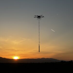
Skyfront MagniPhy Enhances Surveying, Mineral Prospecting, and UXO Detection Skyfront, a leader in high-endurance hybrid drones, has launched the Skyfront MagniPhy, its latest drone magnetometer solution. This new tool is designed for various applications, including surveying, mineral prospecting, detecting orphaned wellheads, and finding landmines and unexploded ordnance … [Read more...] about Skyfront Introduces Next-Generation Drone Magnetometer
Quantum Systems and Propeller Aero: Trinity F90+ Drone Compatible with 3D Mapping Software
Quantum-Systems Partners with Propeller Aero: Trinity F90+ Drone and Propeller Aero's 3D Mapping Software by DRONELIFE Staff Writer Ian M Crosby Trimble [NASDAQ:TRMB] is one of the holdings in the AdvisorShares Drone Technology ETF [NYSE ARCA:UAV], the only ETF dedicated to the drone economy. The AdvisorShares Drone Technology ETF is a thematic investment strategy seeking … [Read more...] about Quantum Systems and Propeller Aero: Trinity F90+ Drone Compatible with 3D Mapping Software


