
Is drone mapping surveying without a license? A First Amendment lawsuit in North Carolina says surveyors cannot stop drone operators from selling photos and making maps. Hiring a surveyor is an expensive buisness, but necessary if you want to establish legal property lines. What if you just want to see what your property looks like, or create a visual map of your property … [Read more...] about Surveyors Wanted to Shut this Drone Photographer Down. Now, He’s Fighting Back. [VIDEO]
Surveying
Photogrammetry is Evolving: Pix4D Announces Pix4Dmatic
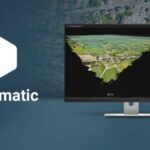
As mapping professionals are called on to map larger and larger areas around the world, photogrammetry software is evolving to meet their needs. Today, Pix4D announces PixDmatic: faster, accurate photogrammetry on a larger scale. "Projects that would have previously been mapped by aircraft are now being surveyed with drones," says a Pix4D press release. "With Pix4Dmatic, … [Read more...] about Photogrammetry is Evolving: Pix4D Announces Pix4Dmatic
DJI Expands Mapping & Surveying Solutions

DJI has announced a raft of product news at the INTERGEO conference in Stuttgart, Germany. The updates from the drone industry's leading manufacturer are aimed at improving the company's surveying tools. DJI Updates Mapping & Surveying Solutions The new products and updates include: Matrice 210 RTK V2 + Zenmuse X7 A new package that combines a rugged aerial platform … [Read more...] about DJI Expands Mapping & Surveying Solutions
Professional Viewpoint: How Drones Overcome Major Obstacles in Pipeline Surveys

Drones are significant tools in pipeline surveys - get an professional surveyor's insider look at why, and how to optimize the ROI. The following is a guest post by Dustin Price, a licensed land surveyor and the Operations Manager at Landpoint. For pipeline surveys, there's a lot that needs to be considered: speed, accuracy, budget, and safety. Pipeline surveys occur at … [Read more...] about Professional Viewpoint: How Drones Overcome Major Obstacles in Pipeline Surveys
Terra For Drone Software Vendors as DJI Launches Mapping & Modeling Tool

Not that many years ago, DJI was credited with forcing several competitors to pivot out of the drone hardware market and into commercial software. The Chinese company's drones were too good and too cheap for the likes of 3DR to compete with. Now the world's leading manufacturer has launched Terra, a new software tool that transforms drone data into 3D models and maps … [Read more...] about Terra For Drone Software Vendors as DJI Launches Mapping & Modeling Tool


