• Skip to main content
  • Skip to secondary menu
  • Skip to primary sidebar
  • Skip to secondary sidebar
  • Skip to footer
  • DroneRacingLife
  • DroneFlyers
  • Newsletter
DroneLife

DRONELIFE

Stay up to date on all the latest Drone News

  • News
  • Products
  • Industries
    • Agriculture
    • Construction
    • Delivery
    • Dual Use
    • Inspection
    • Public Safety
    • Surveying
  • Enthusiasts
  • Regulations
  • Business
  • Video
  • Podcasts

SenseFly to Unveil eBee Plus with Survey Grade Mapping

October 6, 2016 by Miriam McNabb 2 Comments

survey grade mappingParrot‘s commercial drone company senseFly has announced that they will unveil the eBee Plus system next week at the InterGEO conference in Hamburg, Germany.

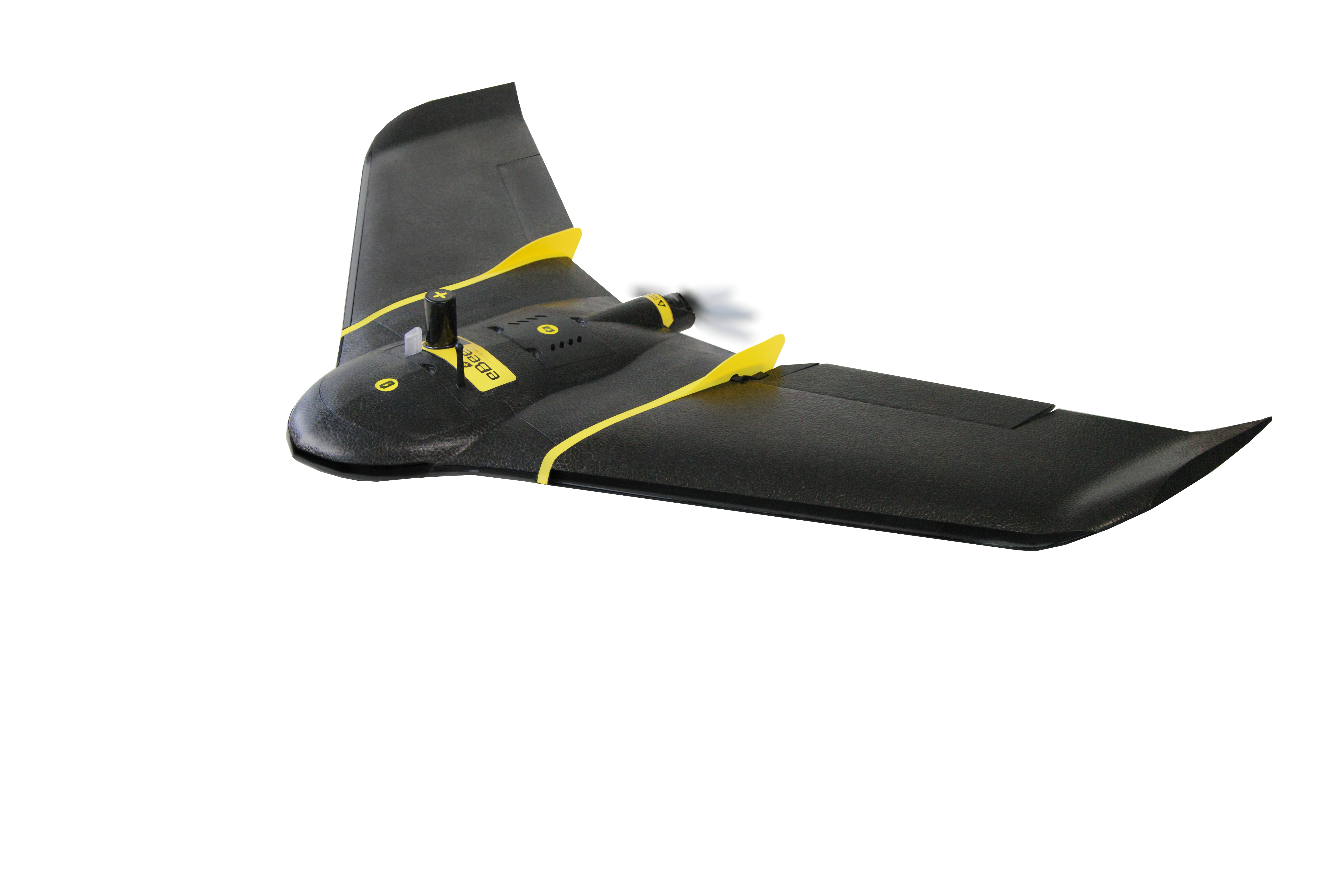
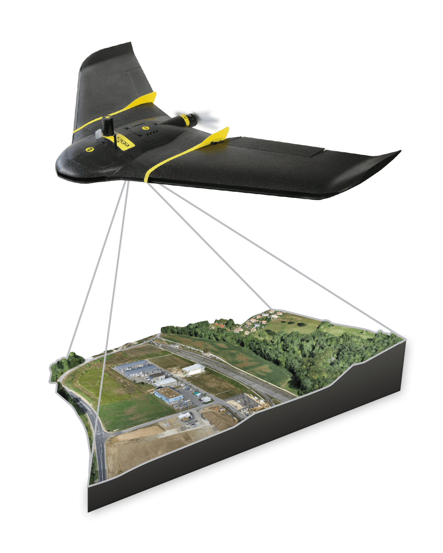
The new eBee Plus system enhances eBee’s existing fixed-wing commercial drones, industry leaders in many applications including agriculture.  The new system adds a photogrammetry-optimised RGB sensor and next-gen flight & data management software.  The additions will provide survey grade photogrammetric mapping capabilities to the eBee solution.

survey grade mapping“The eBee Plus system is the ultimate tool for geospatial organisations that demand photogrammetric-quality mapping,” said senseFly’s CEO, Jean-Christophe Zufferey. “With its unique upgradeable RTK/PPK functionality and flight time of almost an hour, this simple, largely automated solution is perfect for professionals working in fields such as surveying, construction and GIS who require a highly efficient method of data collection with survey-grade accuracy.”

The eBee Plus offers geospatial professionals 3 key benefits:

1. Large coverage for optimal efficiency: the eBee Plus can map more hectares per flight than any drone in its weight class.

2. High Precision on Demand (HPoD): the eBee Plus includes built-in RTK/PPK functionality, activated immediately or later on demand, for survey-grade accuracy that the operator controls.

3. Project-perfect payloads: a camera is available to suit every application, including the new senseFly S.O.D.A. (supplied)—the first sensor developed specifically for
drone photogrammetry work.

Survey grade-ready

One of the eBee Plus’ main features – which the company describes as a “breakthrough innovation”  is High Precision on Demand (HPoD). This is a paid enhancement which allows real-time and post-processing correction (RTK/PPK) functionality. “Once activated by the user, this paid enhancement boosts the system’s achievable horizontal/vertical absolute accuracy to 3 cm/5 cm without the need for ground control points—dramatically reducing expensive, time-consuming field work,” says a company statement.  eBee Plus customers can try RTK/PPK activation free for four weeks (activated on demand when the customer chooses.)

Payload flexibility

“The eBee Plus can carry the full line of senseFly fixed-wing RGB, thermal and multispectral sensors, including the recently introduced Parrot Sequoia for agricultural work and the thermoMAP for producing thermal maps,” says senseFly. “The drone’s camera bay also accepts existing eBee payloads, while the senseFly S.O.D.A. is itself backward-compatible with operators’ existing eBee and eBee RTK drones. eMotion 3, meanwhile, can also be used to manage the flights and data of all senseFly UASs2, both fixed-wing and rotary.”

The eBee Plus photogrammetric mapping system is available to order immediately via senseFly’s global network of distributors (www.senseFly.com/wheretobuy).


Miriam McNabb

Miriam McNabb is the Editor-in-Chief of DRONELIFE and CEO of JobForDrones, a professional drone services marketplace, and a fascinated observer of the emerging drone industry and the regulatory environment for drones. Miriam has penned over 3,000 articles focused on the commercial drone space and is an international speaker and recognized figure in the industry.  Miriam has a degree from the University of Chicago and over 20 years of experience in high tech sales and marketing for new technologies.
For drone industry consulting or writing, Email Miriam.

TWITTER:@spaldingbarker

Subscribe to DroneLife here.

Filed Under: Business and Finance, News Tagged With: commercial drone news, Commercial Drones, eBee Plus, mapping, Parrot, photogrammetry, senseFly, Surveying

Reader Interactions

Trackbacks

  1. SenseFly’s eBee Plus: More Features, Not More Weight - DFW FlyBy PhotograpghyDFW FlyBy Photograpghy | Drone Services & Aerial Cinematography – FAA Approved says:
    November 2, 2016 at 12:49 pm

    […] kicked off their new eBee Plus commercial solution in the US this week, demonstrating the drone at the Commercial UAV Expo in Las […]

    Reply
  2. SenseFly to Unveil eBee Plus with Survey Grade Mapping | Drone, UAV, Quadcopter a Multi Rotor News says:
    October 6, 2016 at 11:20 am

    […] post SenseFly to Unveil eBee Plus with Survey Grade Mapping appeared first on […]

    Reply

Leave a Reply Cancel reply

Your email address will not be published. Required fields are marked *

Primary Sidebar

LATEST

Conroe Police Launch DFR Program Funded by Criminal Asset Seizures

City’s DFR program financed by asset forfeiture funds By DRONELIFE Features Editor Jim Magill Images: Jim Magill When the city…

Continue Reading Conroe Police Launch DFR Program Funded by Criminal Asset Seizures

IACLEA Launches National Campus Drone Program with Draganfly

New initiative offers colleges a framework for building compliant drone programs focused on public safety, training, and governance The International…

Continue Reading IACLEA Launches National Campus Drone Program with Draganfly

Beyond the Numbers: What 300 World Cup Drone Seizures Really Tell Us

The headline is hard to miss: more than 300 drones have been seized near FIFA World Cup venues since the…

Continue Reading Beyond the Numbers: What 300 World Cup Drone Seizures Really Tell Us

Who Builds the Sky? How Regional Partnerships Are Creating the Infrastructure for Advanced Air Mobility

On this episode of the Drone Radio Show, Lavera Alexander of the Monterey Bay Economic Partnership discusses why the future…

Continue Reading Who Builds the Sky? How Regional Partnerships Are Creating the Infrastructure for Advanced Air Mobility

FAA Moves from Planning to Building for Advanced Air Mobility

New research facility signals shift from policy development to operational readiness The Federal Aviation Administration is taking another step toward…

Continue Reading FAA Moves from Planning to Building for Advanced Air Mobility

How Skyways Quietly Built a Global Heavy-Lift Drone Business

Texas-based company expands offshore cargo operations while preparing for the next phase of U.S. BVLOS regulations By DRONELIFE Features Editor…

Continue Reading How Skyways Quietly Built a Global Heavy-Lift Drone Business

National Resilience Strategy Connects the Dots Behind U.S. Drone Policy

New White House strategy frames commercial drones as part of a broader effort to strengthen U.S. manufacturing, infrastructure, and supply…

Continue Reading National Resilience Strategy Connects the Dots Behind U.S. Drone Policy

Beyond the Drone: Percepto’s New Platform Brings AI to Infrastructure Inspections

Percepto launches next-gen inspection software By DRONELIFE Features Editor Jim Magill For energy companies, producing actionable data is almost as…

Continue Reading Beyond the Drone: Percepto’s New Platform Brings AI to Infrastructure Inspections

Danish Investigation Finds No Proof Drones Caused Copenhagen Airport Shutdown

Nine-month investigation underscores the need for better airspace awareness, not just more speculation News and Commentary.  A nine-month investigation into…

Continue Reading Danish Investigation Finds No Proof Drones Caused Copenhagen Airport Shutdown

Flytrex and Wing Report Zero Airspace Conflicts for Multi-Operator Drone Delivery

Flytrex says automated UTM coordination with Wing has deconflicted 100% of operations in Dallas–Fort Worth shared airspace, with zero conflicts.…

Continue Reading Flytrex and Wing Report Zero Airspace Conflicts for Multi-Operator Drone Delivery

Secondary Sidebar

Footer

SPONSORED

Inspired Flight Gremsy IF800 VIO F1 drones geo week

What Will It Take to Strengthen U.S. Drone Manufacturing? A Conversation with Inspired Flight’s CEO

Global Mapper Mobile data collection

Collection Ground Control Points with Global Mapper Mobile

Military Drone Mapping Solutions

How SimActive’s Correlator3D™ is Revolutionizing Military Mapping: An Exclusive Interview with CEO Philippe Simard

Photogrammetry Accuracy Standards

SimActive Photogrammetry Software: Enabling Users to Meet Accuracy Standards for Over 20 Years

NACT Engineering Parrot ANAFI tether indoor shot

Smart Tether for Parrot ANAFI USA from NACT Engineering

Blue Marble, features global mapper, features Blue Marble

Check Out These New Features in Global Mapper v25 from Blue Marble

About Us | Contact Us | Advertise With Us | Write for Us | Privacy Policy | Terms of Service

The Trusted Source for the Business of Drones.

This website uses cookies and third party services. By clicking OK, you are agreeing to our privacy policy. ACCEPT

Manage consent

Privacy Overview

This website uses cookies to improve your experience while you navigate through the website. Out of these, the cookies that are categorized as necessary are stored on your browser as they are essential for the working of basic functionalities of the website. We also use third-party cookies that help us analyze and understand how you use this website. These cookies will be stored in your browser only with your consent. You also have the option to opt-out of these cookies. But opting out of some of these cookies may affect your browsing experience.
Necessary
Always Enabled
Necessary cookies are absolutely essential for the website to function properly. These cookies ensure basic functionalities and security features of the website, anonymously.
CookieDurationDescription
cookielawinfo-checkbox-analytics11 monthsThis cookie is set by GDPR Cookie Consent plugin. The cookie is used to store the user consent for the cookies in the category "Analytics".
cookielawinfo-checkbox-functional11 monthsThe cookie is set by GDPR cookie consent to record the user consent for the cookies in the category "Functional".
cookielawinfo-checkbox-necessary11 monthsThis cookie is set by GDPR Cookie Consent plugin. The cookies is used to store the user consent for the cookies in the category "Necessary".
cookielawinfo-checkbox-others11 monthsThis cookie is set by GDPR Cookie Consent plugin. The cookie is used to store the user consent for the cookies in the category "Other.
cookielawinfo-checkbox-performance11 monthsThis cookie is set by GDPR Cookie Consent plugin. The cookie is used to store the user consent for the cookies in the category "Performance".
viewed_cookie_policy11 monthsThe cookie is set by the GDPR Cookie Consent plugin and is used to store whether or not user has consented to the use of cookies. It does not store any personal data.
Functional
Functional cookies help to perform certain functionalities like sharing the content of the website on social media platforms, collect feedbacks, and other third-party features.
Performance
Performance cookies are used to understand and analyze the key performance indexes of the website which helps in delivering a better user experience for the visitors.
Analytics
Analytical cookies are used to understand how visitors interact with the website. These cookies help provide information on metrics the number of visitors, bounce rate, traffic source, etc.
Advertisement
Advertisement cookies are used to provide visitors with relevant ads and marketing campaigns. These cookies track visitors across websites and collect information to provide customized ads.
Others
Other uncategorized cookies are those that are being analyzed and have not been classified into a category as yet.
SAVE & ACCEPT