Skylogic Research, LLC, the leading research and advisory services firm for the commercial drone industry and owner of Drone Analyst®, just announced the launch of its third annual Drone Market Sector Research survey, which promises to be its most comprehensive study of drone market trends and usage to date. The online portion of this research seeks to get information about who … [Read more...] about 2018 Drone Industry Benchmark Survey: Who’s Buying Drones, Using Drone Software, and Why?
Trimble
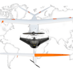
Trimble Inks Drone Data Deal with Propeller Aero

A leading drone firm is putting a new spin on aerial data by cementing a distribution deal with a growing cloud-based analytics company. Last week, California-based Trimble announced a new collaboration with Propeller Aero, an Australian company known for automated drone ground-control targets, cloud-based data visualization and analysis. The deal will see Propeller’s … [Read more...] about Trimble Inks Drone Data Deal with Propeller Aero
Trimble Sells Gatewing UAS Business to Delair-Tech
Delair-Tech sought to cement it’s position as an international leader in the commercial UAS market by acquiring Gatewing, Trimble’s Unmanned Aircraft Systems (UAS) business based in Belgium. In addition, the company signed an agreement to partner with Trimble as its preferred provider of UAS solutions. “Currently, the drone market is undergoing intense consolidation, and now … [Read more...] about Trimble Sells Gatewing UAS Business to Delair-Tech
Trimble Announces Connected Farm Bundles
(Source: precisionag.com) Trimble announced today that its Connected Farm solution will be available in Free or Standard subscription bundles to suit growers with varying farm management requirements. The Connected Farm entry level bundle is an easy-to-use free entry point for growers to organize and access their precision farming data from any desktop computer or mobile … [Read more...] about Trimble Announces Connected Farm Bundles
Faster Flight Planning and Greater Flight Performance for UAS with Trimble’s New Access Aerial ImagingSoftware
(Source: trimble.com) Trimble announced today the latest enhancements to its Trimble® Access™ Aerial Imaging 2.0 application—making it even more robust, intuitive and easier to use. Part of the Trimble Access field software suite of applications, the Aerial Imaging application is a software tool used with the Trimble Tablet Rugged PC for planning aerial missions, … [Read more...] about Faster Flight Planning and Greater Flight Performance for UAS with Trimble’s New Access Aerial ImagingSoftware


