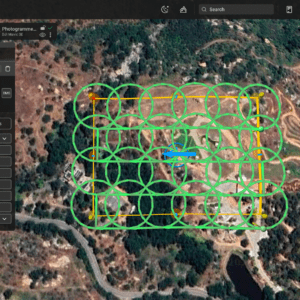
New tool promises faster, more accurate 3D models with shorter flight times SPH Engineering has introduced Circlegrammetry, a new photogrammetry tool that could change how drone operators capture data for 3D modeling and mapping. Designed in response to challenges faced by drone pilots, Circlegrammetry aims to improve the accuracy, speed, and efficiency of aerial mapping … [Read more...] about SPH Engineering Unveils Circlegrammetry: A New Approach to Drone Photogrammetry
3D modeling
Skyebrowse Introduces Affordable Photogrammetry Software Tier
New Lite Option Expands Access to Advanced Photogrammetry Features for Diverse Industries by DRONELIFE Staff Writer Ian J. McNabb Texas-based mapping software developer Skyebrowse recently announced a new “Lite” tier for their flagship affordable photogrammetry software, making access to high-quality mapping more accessible for organizations than ever. While missing … [Read more...] about Skyebrowse Introduces Affordable Photogrammetry Software Tier
The Newest Advance in 3D Modeling: Videogrammetry
The rise of videogrammetry is enabling 3D modeling for everyone: making the process easier and lowering barriers to adoption. The following is a guest post by Bobby Ouyang, CEO of SkyeBrowse. SkyeBrowse is an innovative software that enables 3D modeling through videogrammetry. DRONELIFE neither accepts nor offers payments for guest posts. The concept of aerial 3D … [Read more...] about The Newest Advance in 3D Modeling: Videogrammetry
Flyability and Pix4D: Drone Companies Partner to Bring Indoor Inspections to the Next Level
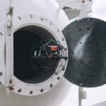
Flyability and Pix4D, two major names in the drone industry, have joined forces to bring indoor drone inspections to the next level. Flyability's Elios series offers a unique and sophisticated solution to the problem of using drones in small, dark, and difficult spaces. The innovative cage around the drone allows pilots to navigate narrow areas like the insides of mines, … [Read more...] about Flyability and Pix4D: Drone Companies Partner to Bring Indoor Inspections to the Next Level
3D Modeling with SimActive: Leveling Up Commercial Drone Data
SimActive's Correlator3D is one of the tools that enables commercial drone operators to level up and play at the enterprise level. SimActive has been a major player in the creation of photogrammetry solutions from aerial data since 2003. They started by utilizing data from satellites and manned aircraft, and their mature platform is a leader for government and enterprise … [Read more...] about 3D Modeling with SimActive: Leveling Up Commercial Drone Data


