
• Skip to main content
  • Skip to secondary menu
  • Skip to primary sidebar
  • Skip to secondary sidebar
  • Skip to footer
  • DroneRacingLife
  • DroneFlyers
  • Newsletter
DroneLife

DRONELIFE

Stay up to date on all the latest Drone News

  • News
  • Products
  • Industries
    • Agriculture
    • Construction
    • Delivery
    • Dual Use
    • Inspection
    • Public Safety
    • Surveying
  • Enthusiasts
  • Regulations
  • Business
  • Video
  • Podcasts

Flyability and Pix4D: Drone Companies Partner to Bring Indoor Inspections to the Next Level

January 10, 2020 by Miriam McNabb 4 Comments

Flyability and Pix4D, two major names in the drone industry, have joined forces to bring indoor drone inspections to the next level.
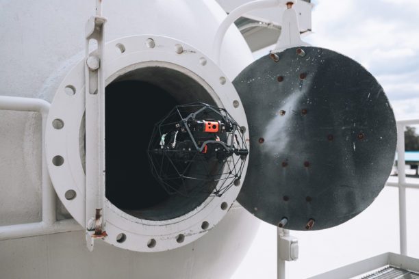
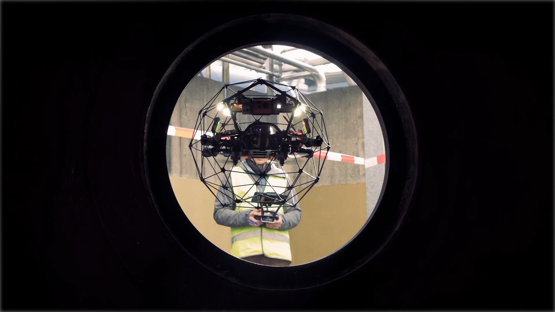
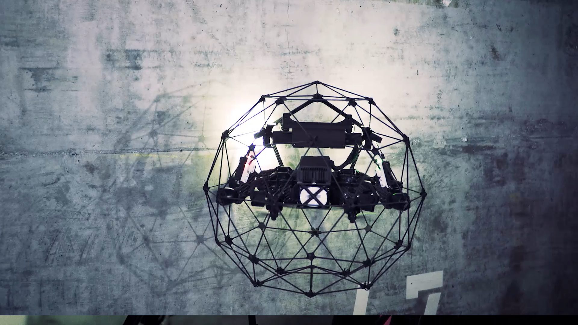
Flyability’s Elios series offers a unique and sophisticated solution to the problem of using drones in small, dark, and difficult spaces.  The innovative cage around the drone allows pilots to navigate narrow areas like the insides of mines, girders, ship hulls and more.  Swiss company Pix4D provides an elegant mapping and modeling solution for a wide variety of commercial and law enforcement uses.  The partnership will provide Elios customers with 3D modeling capabilities, allowing them a new level of data to assess problems during the inspection process.
“3D modeling brings tremendous value to inspection professionals on multiple fronts,” says Flyability’s Marc Gandillon.  “First of all, when looking at a defect using remote visual inspection technology, the information you get on the video stream is flat. You can easily spot cracks, corrosion, or other visually-featured defects. However, sometimes, this is not sufficient and depth perception (beyond the information you can get by using oblique lighting technics) is required to assess the severity of a defect. By building a local 3D (3D model focused on a point of interest inside an asset) you get this depth perception that often helps inspectors to make a decision,” says Gandillon.
“This is precisely what happened to our refinery customer that was assessing if the refractory inside the riser of one of its FCC unit had to be repaired immediately or if this could wait for the next shutdown. In this case, building the 3D model only took about 30 minutes, which is far less time consuming and dangerous than physically repelling someone down the riser.”
“The other aspect where 3D modeling is of precious help in asset maintenance has to do with streamlining the logistics and planning of repairs during shutdowns,” Gandillon points out. “By building a complete 3D model of an asset and combining it with flat 2-dimensional visual information, a turnaround manager and his team can make informed decisions on how to stage/prepare an asset for repair as they can physically localize defects within the asset. With a scaled 3D model you can measure how high you have to scaffold, you can figure out where you have to dig to access the broken part of a culvert, and you can simply measure if there is enough room around a worker to actually perform the work he’s got to perform.”

The following is a Flyability press release.

January 8, 2020 – Flyability and Pix4D are pleased to announce the recent signature of a partnership agreement to offer bundled Flyability and Pix4D products. ​The bundle will be sold in the form of a Photogrammetry Add-On that can be purchased on top of Elios 2 drone packages. This offer is meant to facilitate access to a coherent and complete product offering to those who want to tackle indoor 3D modeling using photogrammetry.

The design of the Elios 2 makes it a formidable tool to build 3D models of indoor spaces using photogrammetry. The photogrammetry processing engine of Pix4Dmapper is the industry-leading photogrammetry software solution. It delivers outstanding performances when it comes to processing non-georeferenced images ; a feature that is much needed when building 3D models of GPS-denied environments.

“Since the launch of Elios 2, we’ve seen a growing demand for a complete solution to deliver 3D models of confined spaces,” says Marc Gandillon, Marketing Manager with Flyability. “At first, it was not always obvious how building 3D models could bring value to our customers. Eight months after the launch of Elios 2, this is much more clear.”

To illustrate the value of 3D modeling in confined spaces, Flyability recently performed a demonstration for a customer who is running a refinery. The customer was wondering if they had to cut open the riser in one of their FCC units during a turnaround to remediate a defect. By looking at 2D pictures, it was challenging for them to determine the severity of the defect. By building a 3D model of the part of interest, they could immediately see that the defect did not threaten the functioning of the equipment, and remediation could wait for the next turnaround or proper planning. Using a 3D model literally saved them days of downtime.

“Drones and photogrammetry have proved their potential in many applications,” says Nikoleta Guetcheva, Head of Marketing at Pix4D, “but using the Elios 2 to create a 3D model now allows teams to make more informed decisions and provide a valuable record for the future in places that were once inaccessible to the human eye.”

The launch of the new Photogrammetry Add-On comes along with the launch of a new training course dedicated to Indoor Photogrammetry. This course will initially be available through Flyability directly and subsequently through its Authorized Training Centers, progressively throughout 2020.

 

Miriam McNabb

Miriam McNabb is the Editor-in-Chief of DRONELIFE and CEO of JobForDrones, a professional drone services marketplace, and a fascinated observer of the emerging drone industry and the regulatory environment for drones. Miriam has penned over 3,000 articles focused on the commercial drone space and is an international speaker and recognized figure in the industry.  Miriam has a degree from the University of Chicago and over 20 years of experience in high tech sales and marketing for new technologies.
For drone industry consulting or writing, Email Miriam.

TWITTER:@spaldingbarker

Subscribe to DroneLife here.

Filed Under: Drone News Feeds, News Tagged With: 3D modeling, Commercial drone industry, Flyability, indoor inspections, Pix4D

Reader Interactions

Trackbacks

  1. Swiss Drone Startup Flyability Snags $8.6 million in VC Funding Round - You Startups says:
    December 21, 2020 at 9:31 pm

    […] Flyability and Pix4D joined forces to deliver 3D modeling capabilities to Flyability customers, allowing them a new level of data to […]

    Reply
  2. Flyability and Pix4D: Drone Companies Partner to Bring Indoor Inspections to the Next Level says:
    January 10, 2020 at 4:24 pm

    […] The complete article is here […]

    Reply
  3. Flyability and Pix4D: Drone Companies Partner to Bring Indoor Inspections to the Next Level | Drone Magazine says:
    January 10, 2020 at 12:19 pm

    […] Source […]

    Reply
  4. Flyability and Pix4D: Drone Corporations Accomplice to Deliver Indoor Inspections to the Subsequent Degree - Drone Stuff Pro says:
    January 10, 2020 at 11:59 am

    […] Supply hyperlink […]

    Reply

Leave a Reply Cancel reply

Your email address will not be published. Required fields are marked *

Primary Sidebar

LATEST

Court Challenge Could Shape FCC Authority Over Previously Approved Drones

Hikvision challenge comes as FCC considers restrictions on previously authorized foreign-produced drones A case argued before the U.S. Court of…

Continue Reading Court Challenge Could Shape FCC Authority Over Previously Approved Drones

Satellite Applications Catapult Announces National Drone Testing Center at Westcott

The National Autonomy and Drone Innovation Centre, backed by £2.25 million (about $3 million) from Buckinghamshire Council, will give UK…

Continue Reading Satellite Applications Catapult Announces National Drone Testing Center at Westcott

SimActive Enables Online Sharing of Gaussian Splats From Correlator3D

A new Correlator3D capability publishes Gaussian splat models directly to a connected Cesium account, making photorealistic 3D results easier to…

Continue Reading SimActive Enables Online Sharing of Gaussian Splats From Correlator3D

LiveU and Airwise Solutions Partner On New Public Safety Drone Solution

The integrated stack pairs LiveU’s bonded, low-latency video transport with Airwise fleet management, airspace awareness and video distribution in one…

Continue Reading LiveU and Airwise Solutions Partner On New Public Safety Drone Solution

Smarter Drone Searches May Require Less Replanning, Not More

New research finds that autonomous vehicles can gain most of the benefits of adaptive route planning with only a few…

Continue Reading Smarter Drone Searches May Require Less Replanning, Not More

Teledyne FLIR Launches AI-Enabled Air-to-Ground Tracking Software for UAS

Prism A-ISR combines AI detection, multispectral imaging and edge processing for airborne surveillance and defense applications Teledyne FLIR OEM has…

Continue Reading Teledyne FLIR Launches AI-Enabled Air-to-Ground Tracking Software for UAS

Drone Industry Insights Launches ASTRA Intelligence Matchmaking Platform for Drones and Robots

The searchable platform now lists more than 1,500 companies and 6,500 products from 68 countries, with free base listings and…

Continue Reading Drone Industry Insights Launches ASTRA Intelligence Matchmaking Platform for Drones and Robots

Auterion Introduces Universal Nemyx Vertical Launch System

The modular launcher stacks drones in tubes on an electric elevator, fitting 30% more aircraft into the same volume while…

Continue Reading Auterion Introduces Universal Nemyx Vertical Launch System

Wing and Walmart Name Denver and Seattle for 2027 Drone Delivery Expansion

Denver announcement comes as Colorado communities consider local rules for drone delivery infrastructure Wing and Walmart have named the Denver…

Continue Reading Wing and Walmart Name Denver and Seattle for 2027 Drone Delivery Expansion

Michigan Medical Drone Delivery Pilot Expands to Multiple Aircraft and Sites

Second phase will test longer flights, multiple drones and sensor technology as partners explore rural healthcare logistics A medical drone…

Continue Reading Michigan Medical Drone Delivery Pilot Expands to Multiple Aircraft and Sites

Secondary Sidebar

Footer

SPONSORED

What Is the Best Commercial Cleaning Drone in 2026? Specs, Prices, and a Head-to-Head Comparison

Inspired Flight Gremsy IF800 VIO F1 drones geo week

What Will It Take to Strengthen U.S. Drone Manufacturing? A Conversation with Inspired Flight’s CEO

Global Mapper Mobile data collection

Collection Ground Control Points with Global Mapper Mobile

Military Drone Mapping Solutions

How SimActive’s Correlator3D™ is Revolutionizing Military Mapping: An Exclusive Interview with CEO Philippe Simard

Photogrammetry Accuracy Standards

SimActive Photogrammetry Software: Enabling Users to Meet Accuracy Standards for Over 20 Years

NACT Engineering Parrot ANAFI tether indoor shot

Smart Tether for Parrot ANAFI USA from NACT Engineering

About Us | Contact Us | Advertise With Us | Write for Us | Privacy Policy | Terms of Service

The Trusted Source for the Business of Drones.

This website uses cookies and third party services. By clicking OK, you are agreeing to our privacy policy. ACCEPT

Manage consent

Privacy Overview

This website uses cookies to improve your experience while you navigate through the website. Out of these, the cookies that are categorized as necessary are stored on your browser as they are essential for the working of basic functionalities of the website. We also use third-party cookies that help us analyze and understand how you use this website. These cookies will be stored in your browser only with your consent. You also have the option to opt-out of these cookies. But opting out of some of these cookies may affect your browsing experience.
Necessary
Always Enabled
Necessary cookies are absolutely essential for the website to function properly. These cookies ensure basic functionalities and security features of the website, anonymously.
CookieDurationDescription
cookielawinfo-checkbox-analytics11 monthsThis cookie is set by GDPR Cookie Consent plugin. The cookie is used to store the user consent for the cookies in the category "Analytics".
cookielawinfo-checkbox-functional11 monthsThe cookie is set by GDPR cookie consent to record the user consent for the cookies in the category "Functional".
cookielawinfo-checkbox-necessary11 monthsThis cookie is set by GDPR Cookie Consent plugin. The cookies is used to store the user consent for the cookies in the category "Necessary".
cookielawinfo-checkbox-others11 monthsThis cookie is set by GDPR Cookie Consent plugin. The cookie is used to store the user consent for the cookies in the category "Other.
cookielawinfo-checkbox-performance11 monthsThis cookie is set by GDPR Cookie Consent plugin. The cookie is used to store the user consent for the cookies in the category "Performance".
viewed_cookie_policy11 monthsThe cookie is set by the GDPR Cookie Consent plugin and is used to store whether or not user has consented to the use of cookies. It does not store any personal data.
Functional
Functional cookies help to perform certain functionalities like sharing the content of the website on social media platforms, collect feedbacks, and other third-party features.
Performance
Performance cookies are used to understand and analyze the key performance indexes of the website which helps in delivering a better user experience for the visitors.
Analytics
Analytical cookies are used to understand how visitors interact with the website. These cookies help provide information on metrics the number of visitors, bounce rate, traffic source, etc.
Advertisement
Advertisement cookies are used to provide visitors with relevant ads and marketing campaigns. These cookies track visitors across websites and collect information to provide customized ads.
Others
Other uncategorized cookies are those that are being analyzed and have not been classified into a category as yet.
SAVE & ACCEPT




