
• Skip to main content
  • Skip to secondary menu
  • Skip to primary sidebar
  • Skip to secondary sidebar
  • Skip to footer
  • DroneRacingLife
  • DroneFlyers
  • Newsletter
DroneLife

DRONELIFE

Stay up to date on all the latest Drone News

  • News
  • Products
  • Industries
    • Agriculture
    • Construction
    • Delivery
    • Dual Use
    • Inspection
    • Public Safety
    • Surveying
  • Enthusiasts
  • Regulations
  • Business
  • Video
  • Podcasts

How Rural Colorado Is Putting Drones to Work for Conservation

July 8, 2026 by staff Leave a Comment

In this guest post, Vanessa Trout, Executive Director of the White River Conservation District, describes how rural conservation districts in Colorado are using drone technology to support agriculture, watershed management, and land stewardship. Her article explores how practical drone applications can help small communities monitor and manage natural resources more efficiently.  DRONELIFE does not accept or make payment for guest posts.

All images courtesy of Vanessa Trout and Tristan McGee, used with permission.

How a Rural Colorado Conservation District Is Using Drones to Bridge Agriculture, Watersheds, and Wildlife

By Vanessa Trout, Executive Director, White River Conservation District

In northwest Colorado, drones are becoming more than just a technology trend, they are emerging as one of the most practical conservation tools available to rural communities managing vast landscapes with limited resources.

The White River and Douglas Creek Conservation Districts, based in Meeker, Colorado, are developing a Drone Services Program aimed at helping agricultural producers, watershed groups, and land managers make faster, safer, and more informed decisions across working lands and natural resource projects.
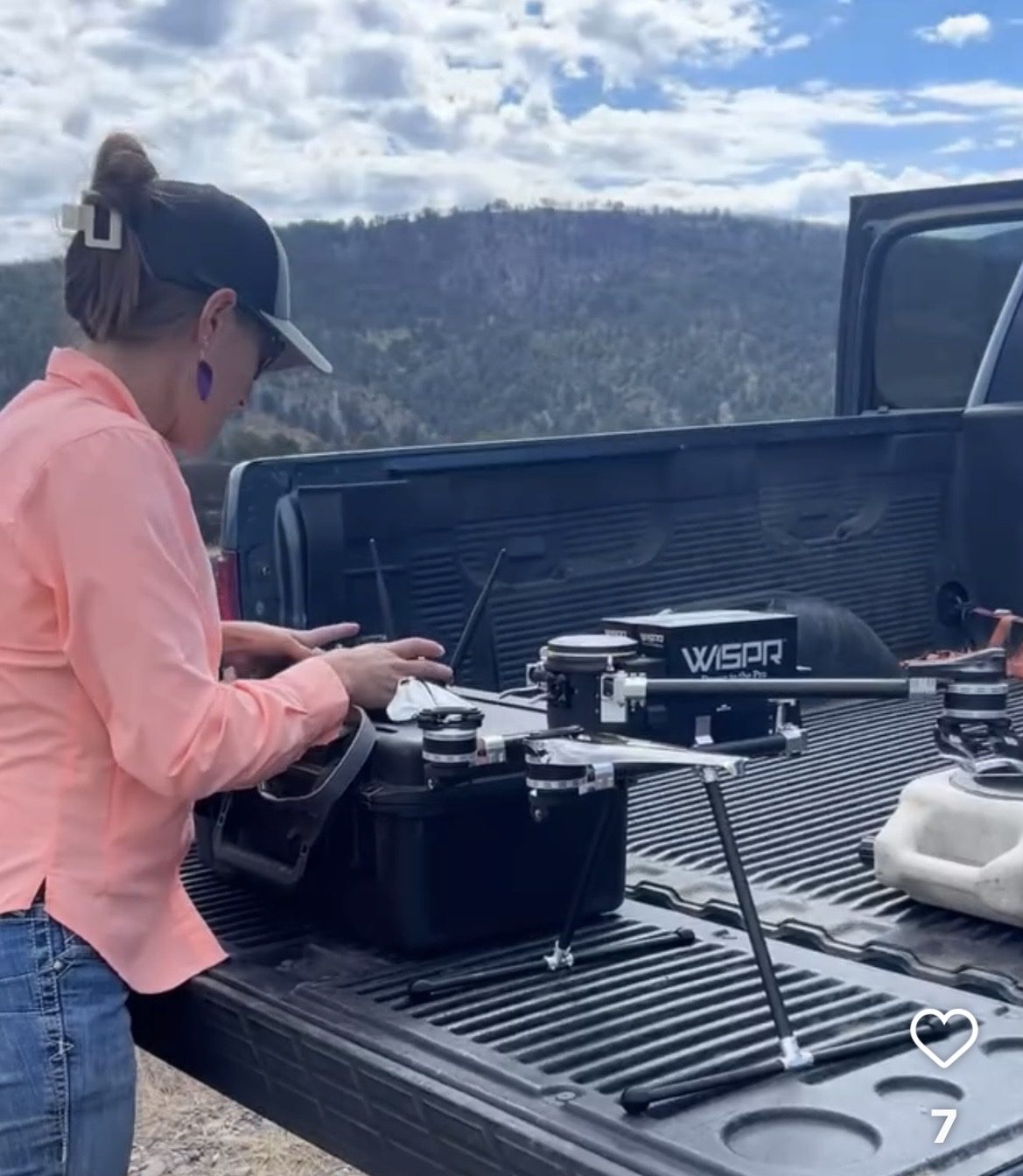
Drone mapping agricultural and conservation land in rural Colorado.
 

But unlike many commercial drone programs focused on media production or real estate photography, this e ort is taking a diferent approach by using drones as a tool for locally led conservation.

Drones for the “Unseen” Rural Infrastructure

In the arid West, some of the most important infrastructure is also the hardest to monitor like irrigation diversions, streambanks, remote water developments, erosion-prone roads, wildfire-impacted watersheds, and thousands of acres of rangeland.
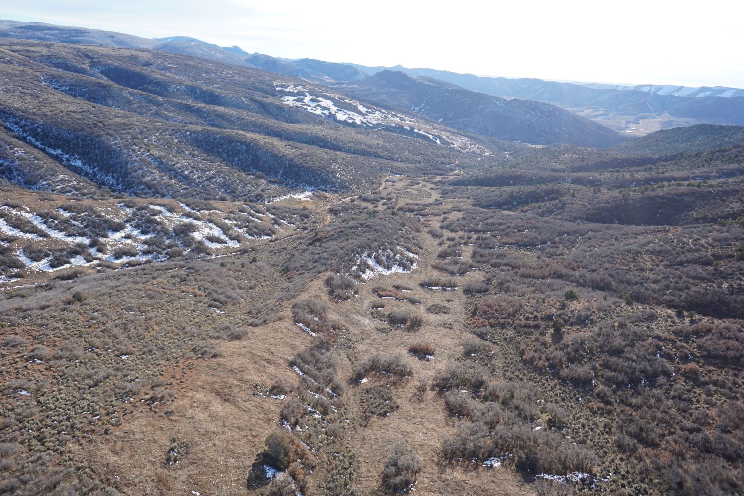
Drone mapping agricultural and conservation land in rural Colorado.

Many of these landscapes are difficult to access, expensive to survey, and constantly changing due to drought, floods, grazing pressure, wildfire, and invasive species. The Districts saw an opportunity to use drone technology to close that gap. Their program is designed to provide high-resolution aerial mapping, orthomosaics, terrain modeling, infrastructure inspections, and future multispectral analysis to support conservation planning and resource management.

The vision is not simply to “fly drones,” but to create affordable technical capacity for rural landowners who traditionally have limited access to these technologies.

Conservation Meets Practical Application

The Districts identified an immediate need for drone-based services in several areas: irrigation infrastructure assessments, riparian and watershed monitoring, noxious weed mapping, post-fire recovery, livestock water planning, vegetation health assessments, and restoration project monitoring.

According to Drone Industry Insights research, Agriculture rates as one of the current top three drone industries. For agricultural producers, this can mean identifying erosion before it becomes a major infrastructure problem or documenting pasture conditions over time.For watershed groups, it means being able to monitor stream restoration projects with repeatable aerial imagery and terrain data. For conservation planners, drones create a way to rapidly gather data across landscapes that would otherwise require extensive field time.

A Different Kind of Drone Program

One of the more interesting aspects of the effort is that the Districts intentionally do not want to compete with local photographers or media companies. Instead, they are positioning the program around technical conservation services: mapping, monitoring, GIS support and natural resource analysis.

That distinction matters. Private drone operators can produce stunning visuals.

Conservation districts bring something different: trusted relationships with landowners, technical understanding of soil and water conservation, experience with watershed planning, and the ability to connect aerial data directly to on-the-ground management decisions. The program is being built as a hybrid model: partially grant-funded, partially fee-for-service, and partially supported through partnerships with agencies and watershed initiatives.
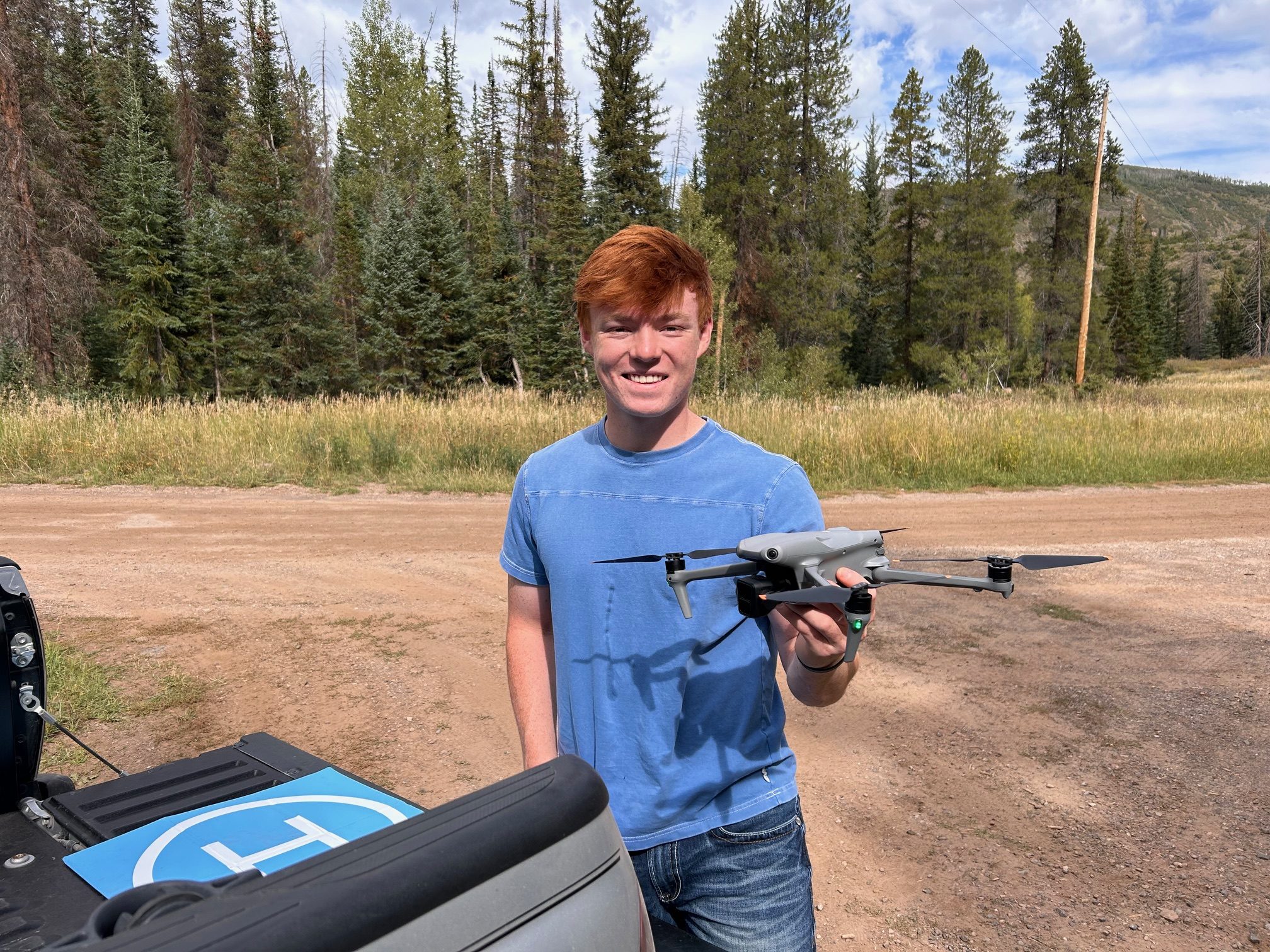
The long-term goal is sustainability, not as a standalone tech company, but as a self-supporting conservation tool embedded within existing district programs.

Why Rural Communities May Be the Next Frontier for Drone Innovation

While much of the drone industry conversation focuses on urban delivery systems, inspection markets, or AI-powered automation, rural conservation districts may quietly represent one of the most impactful applications of drone technology. Across the West, land managers are facing: increasing drought pressure, aging irrigation infrastructure, larger wildfires, invasive species expansion, and growing demands for watershed resilience.

At the same time, many local governments and conservation organizations operate with small staffs and limited technical capacity. Drones offer a rare combination of:affordability, scalability, speed, and actionable data. For organizations like the White River and Douglas Creek Conservation Districts, the technology is not replacing field knowledge, it is amplifying it.
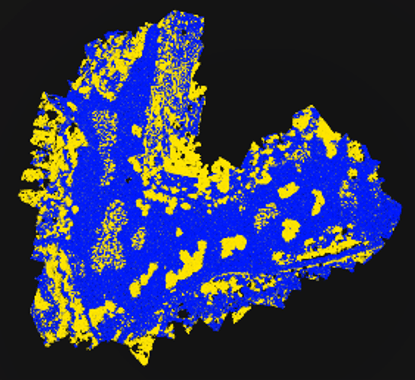
Figure 1 is a high-resolution drone orthomosaic of a mastication treatment area. The lighter gray areas are where brush was masticated, while the darker “islands” of vegetation were intentionally left standing.
Figure 2 shows the same area after drone data processing and analysis. The yellow and blue points represent classified data generated from the drone survey. Each point represents approximately one square foot, allowing us to calculate treatment acreage and vegetation retention with a high degree of accuracy.

Looking Ahead

The Districts are currently developing service packages focused on: orthomosaic mapping, Infrastructure inspections, conservation project monitoring, and future multispectral analysis for vegetation and watershed health. As the program evolves, the team sees opportunities to support larger regional efforts related to Integrated Stream Management Planning, watershed restoration, wildfire resilience, and agricultural sustainability.

In a rural county better known for cattle, hay fields, and river corridors than cutting-edge technology, drones are becoming an unexpected but powerful conservation tool. And in the process, they may offer a model for how small local organizations can use emerging technology to solve very practical land and water challenges.

Vanessa Trout is the Executive Director and Forestry Program Coordinator of the White River and Douglas Creek Conservation Districts leading conservation initiatives, grant administration, partnership development, strategic planning, and natural resource programs. She brings over 25 years of prior experience in business operations, viticulture, management, and international agricultural experience.

Read more:

  • Drones Saving Island Ecosystems: An Interview with Island Conservation
  • World-First Drone Mouse Eradication Passes Six-Month Check on Browse Island
  • Windracers ULTRA Autonomous Drone Begins Tests in the Antarctic: Drones for Environmental Research in Challenging Environments


Filed Under: Agriculture, Applications, Conservation, DL Exclusive, Drone News, Drone News Feeds, Environmental Research, Feature 1, Mapping, News Tagged With: agricultural drones, Colorado, Commercial Drones, conservation district, conservation drones, drone mapping, Dronelife, Environmental monitoring, GIS, land management, natural resource management, orthomosaic mapping, Precision Agriculture, watershed management, White River Conservation District

Reader Interactions

Leave a Reply Cancel reply

Your email address will not be published. Required fields are marked *

Primary Sidebar

LATEST

What Ordering Walmart by Drone Looks Like as Houston Service Expands

Wing and Walmart Launch Expanded Houston Drone Delivery Network Eight new drone hubs more than double Wing’s Houston footprint as…

Continue Reading What Ordering Walmart by Drone Looks Like as Houston Service Expands

Aerial Triangulation Gets Major Overhaul in SimActive’s Correlator3D Version 11.1

Montreal photogrammetry developer overhauls tie point extraction, bundle adjustment and multi-camera workflows in the latest Correlator3D release. SimActive has released…

Continue Reading Aerial Triangulation Gets Major Overhaul in SimActive’s Correlator3D Version 11.1

GeoCue’s TrueView 641 Certified for Real-Time Robotics HERA Drone

The companies say the integration gives customers a secure aerial mapping option that combines heavy-lift American-made drones with engineering-grade LiDAR.…

Continue Reading GeoCue’s TrueView 641 Certified for Real-Time Robotics HERA Drone

Guest Post: America’s Drone Future Depends on Battery Independence

In this guest post, Micantis co-founder and CEO Howard Alt argues that batteries, not aircraft, may be the defining factor…

Continue Reading Guest Post: America’s Drone Future Depends on Battery Independence

Ukraine Looks to Export Drone Expertise as It Pursues New NATO Partnerships

Kyiv’s proposed agreements reflect a broader shift from wartime recipient to provider of drone technology and operational knowledge For much…

Continue Reading Ukraine Looks to Export Drone Expertise as It Pursues New NATO Partnerships

Federal Agencies Move Quickly to Turn SAFER SKIES Act Into Operational Reality

New DOJ/DHS rule and coordinated FCC actions establish the legal, technical, and spectrum framework for trained state and local agencies…

Continue Reading Federal Agencies Move Quickly to Turn SAFER SKIES Act Into Operational Reality

Carbonix and CASA Certify First SAIL III Drone in Australia

Carbonix says it is the first company in Australia to receive SAIL III certification for a drone, clearing a path…

Continue Reading Carbonix and CASA Certify First SAIL III Drone in Australia

Ondas Acquires DZYNE Technologies for $875.8M

The Ondas DZYNE acquisition combines long-endurance ISR, counter-UAS, and autonomous effects under a new operating division for U.S. defense customers.…

Continue Reading Ondas Acquires DZYNE Technologies for $875.8M

FAA Data Shows Drone Sightings Near Airports Nearly Doubled in Second Quarter

After incidents, FAA warns against drones at airports By DRONELIFE Features Editor Jim Magill The number of reported close encounters…

Continue Reading FAA Data Shows Drone Sightings Near Airports Nearly Doubled in Second Quarter

University of Tokyo and Kubota Develop Drone Potato Yield Prediction Method

This article published in collaboration with JUIDA, the Japan UAS Industrial Development Association.     Researchers at the University of Tokyo…

Continue Reading University of Tokyo and Kubota Develop Drone Potato Yield Prediction Method

Secondary Sidebar

Footer

SPONSORED

Inspired Flight Gremsy IF800 VIO F1 drones geo week

What Will It Take to Strengthen U.S. Drone Manufacturing? A Conversation with Inspired Flight’s CEO

Global Mapper Mobile data collection

Collection Ground Control Points with Global Mapper Mobile

Military Drone Mapping Solutions

How SimActive’s Correlator3D™ is Revolutionizing Military Mapping: An Exclusive Interview with CEO Philippe Simard

Photogrammetry Accuracy Standards

SimActive Photogrammetry Software: Enabling Users to Meet Accuracy Standards for Over 20 Years

NACT Engineering Parrot ANAFI tether indoor shot

Smart Tether for Parrot ANAFI USA from NACT Engineering

Blue Marble, features global mapper, features Blue Marble

Check Out These New Features in Global Mapper v25 from Blue Marble

About Us | Contact Us | Advertise With Us | Write for Us | Privacy Policy | Terms of Service

The Trusted Source for the Business of Drones.

This website uses cookies and third party services. By clicking OK, you are agreeing to our privacy policy. ACCEPT

Manage consent

Privacy Overview

This website uses cookies to improve your experience while you navigate through the website. Out of these, the cookies that are categorized as necessary are stored on your browser as they are essential for the working of basic functionalities of the website. We also use third-party cookies that help us analyze and understand how you use this website. These cookies will be stored in your browser only with your consent. You also have the option to opt-out of these cookies. But opting out of some of these cookies may affect your browsing experience.
Necessary
Always Enabled
Necessary cookies are absolutely essential for the website to function properly. These cookies ensure basic functionalities and security features of the website, anonymously.
CookieDurationDescription
cookielawinfo-checkbox-analytics11 monthsThis cookie is set by GDPR Cookie Consent plugin. The cookie is used to store the user consent for the cookies in the category "Analytics".
cookielawinfo-checkbox-functional11 monthsThe cookie is set by GDPR cookie consent to record the user consent for the cookies in the category "Functional".
cookielawinfo-checkbox-necessary11 monthsThis cookie is set by GDPR Cookie Consent plugin. The cookies is used to store the user consent for the cookies in the category "Necessary".
cookielawinfo-checkbox-others11 monthsThis cookie is set by GDPR Cookie Consent plugin. The cookie is used to store the user consent for the cookies in the category "Other.
cookielawinfo-checkbox-performance11 monthsThis cookie is set by GDPR Cookie Consent plugin. The cookie is used to store the user consent for the cookies in the category "Performance".
viewed_cookie_policy11 monthsThe cookie is set by the GDPR Cookie Consent plugin and is used to store whether or not user has consented to the use of cookies. It does not store any personal data.
Functional
Functional cookies help to perform certain functionalities like sharing the content of the website on social media platforms, collect feedbacks, and other third-party features.
Performance
Performance cookies are used to understand and analyze the key performance indexes of the website which helps in delivering a better user experience for the visitors.
Analytics
Analytical cookies are used to understand how visitors interact with the website. These cookies help provide information on metrics the number of visitors, bounce rate, traffic source, etc.
Advertisement
Advertisement cookies are used to provide visitors with relevant ads and marketing campaigns. These cookies track visitors across websites and collect information to provide customized ads.
Others
Other uncategorized cookies are those that are being analyzed and have not been classified into a category as yet.
SAVE & ACCEPT



