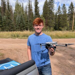
In this guest post, Vanessa Trout, Executive Director of the White River Conservation District, describes how rural conservation districts in Colorado are using drone technology to support agriculture, watershed management, and land stewardship. Her article explores how practical drone applications can help small communities monitor and manage natural resources more … [Read more...] about How Rural Colorado Is Putting Drones to Work for Conservation
GIS
Aerial Triangulation Gets Major Overhaul in SimActive’s Correlator3D Version 11.1

Montreal photogrammetry developer overhauls tie point extraction, bundle adjustment and multi-camera workflows in the latest Correlator3D release. SimActive has released Correlator3D Version 11.1, a photogrammetry update centered on a rebuilt aerial triangulation engine. The company says the release improves tie point extraction, accelerates bundle adjustment and adds tools to … [Read more...] about Aerial Triangulation Gets Major Overhaul in SimActive’s Correlator3D Version 11.1
Landair Surveys Uses SimActive Correlator3D for Planned Burns Mapping in Australia

The Australian geospatial firm is using Correlator3D to generate orthomosaics from aerial imagery captured for wildfire prevention and land management projects. SimActive has announced that Landair Surveys is using its Correlator3D software to produce orthomosaics for planned burns mapping projects in Australia. The Montreal-based developer said the workflow is intended to … [Read more...] about Landair Surveys Uses SimActive Correlator3D for Planned Burns Mapping in Australia
Gaussian Splatting Meets Photogrammetry: SimActive Integrates New Capability in Correlator3D
From Industry Buzz to Practical Workflow Gaussian splatting has quickly become one of the most talked-about developments in 3D reconstruction. Known for its ability to create highly realistic, smooth-rendered scenes, the technique has sparked a central question across the geospatial industry: can it move beyond visualization and support real-world mapping workflows? With the … [Read more...] about Gaussian Splatting Meets Photogrammetry: SimActive Integrates New Capability in Correlator3D
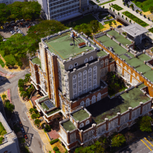
A Smarter City Model: Harrow’s Digital Twin Delivers Real-World Results

New approach reduces maintenance costs and improves planning, engagement, and public services The London Borough of Harrow has launched an expanded digital twin of the city, using drone data to improve maintenance, planning, and public engagement. The project combines high-resolution drone imagery with existing lower-resolution data to create a more detailed and cost-effective … [Read more...] about A Smarter City Model: Harrow’s Digital Twin Delivers Real-World Results


