• Skip to main content
  • Skip to secondary menu
  • Skip to primary sidebar
  • Skip to secondary sidebar
  • Skip to footer
  • DroneRacingLife
  • DroneFlyers
  • Newsletter
DroneLife

DRONELIFE

Stay up to date on all the latest Drone News

  • News
  • Products
  • Industries
    • Agriculture
    • Construction
    • Delivery
    • Dual Use
    • Inspection
    • Public Safety
    • Surveying
  • Enthusiasts
  • Regulations
  • Business
  • Video
  • Podcasts

Phase One Unveils iXM-FS130 Camera for Sub-Centimeter Aerial Mapping

February 3, 2026 by staff Leave a Comment

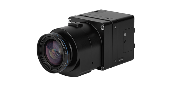
Phase One has announced the iXM-FS130, a next-generation aerial mapping camera designed to capture sub-centimeter ground sample distance imagery from fixed-wing aircraft at speeds exceeding 120 knots. The camera introduces Phase One’s patented Fusion Shutter technology to the commercial aerial mapping market. This enables operators to maintain image quality while increasing mission efficiency.

Fusion Shutter Technology Enables High-Speed Capture

The iXM-FS130 features Fusion Shutter technology at its core. This system combines an electronic global shutter sensor with a mechanical leaf shutter. The dual-shutter approach eliminates parasitic light sensitivity effects that typically occur at extreme shutter speeds. The result is artifact-free images even in high-contrast lighting conditions.

The technology enables reliable 1 cm ground sample distance image capture at airspeeds exceeding 120 knots. Operators can now cover larger areas per flight while reducing motion blur and re-flight risk.

“With iXM-FS130, we are removing long-standing tradeoffs between speed, resolution, and image integrity,” said Thomas Allin, Chief Technical Officer at Phase One. “By introducing Fusion Shutter technology and enabling sub-centimeter GSD at high aircraft speeds, we are opening the door to new aerial imaging capabilities while ensuring our customers can build on the investments they have already made.”

Efficient Data Management for Sub-Centimeter Aerial Mapping

The iXM-FS130 supports Phase One’s IIQ-X image compression format. This format reduces file sizes while preserving radiometric and geometric image quality. The compression is optimized for high-volume operations, which accelerates data transfer and processing without compromising precision. This enables faster turnaround from flight to final deliverables, particularly important for sub-centimeter aerial mapping missions that generate substantial data volumes.

Platform Compatibility and Field Deployment

The iXM-FS130 is built on the established iXM platform. It maintains compatibility with Phase One’s RS and RSM lens ecosystem, offering focal lengths from 35 mm to 300 mm. This provides existing Phase One customers a seamless upgrade path. Applications include large-area mapping, urban 3D modeling, corridor inspection, and defense-grade imaging operations.

The camera is currently operational as part of the IGI CM-1 aerial mapping system. It integrates with IGI’s CCNS-5 Flight Management system, AEROcontrol GNSS/IMU, and stabilized mount technology.

“With CM-1, we have a fully operational system that proves what iXM-FS130 enables in practice,” said Philip Grimm, Managing Director at IGI. “The combination of Fusion Shutter technology, high-speed image capture, and tight system integration allows operators to fly fast, maintain image integrity, and execute complex missions with confidence. This is not a concept — it is a production-ready solution.”

Phase One will showcase the iXM-FS130 at GeoWeek 2026, with global availability commencing shortly after. More information is available from their website.

Read More
  • The Companies and Technologies Capturing the Counter-Drone Funding Surge
  • February Public Safety Drone Review: Gemma Alcock of SkyBound Joins the Conversation
  • News Media Coalition Letter Challenges FAA’s Expansive NOTAM

Filed Under: Cameras, Drone News, Drone News Feeds, Fixed wing, Imaging, Mapping, News, sensors, Survey, Surveying Tagged With: aerial mapping, aerial survey, fixed-wing aircraft, Fusion Shutter, geospatial imaging, GeoWeek 2026, IGI CM-1, iXM-FS130, mapping camera, Phase One, photogrammetry, sub-centimeter GSD

Reader Interactions

Leave a Reply Cancel reply

Your email address will not be published. Required fields are marked *

Primary Sidebar

LATEST

Gather AI Raises $40 Million for Warehousing Tech

Gather AI’s latest funding round underscores growing demand for drone-based inventory intelligence in large, complex warehouses. The Pittsburgh-based company has raised $40…

Continue Reading Gather AI Raises $40 Million for Warehousing Tech

Corvus Robotics Unveils Drone System for Cold Chain Operations

Corvus Robotics has introduced Corvus One for Cold Chain, an autonomous aerial inventory system designed to operate in freezer environments…

Continue Reading Corvus Robotics Unveils Drone System for Cold Chain Operations

Ohio Identifies First Participants in Nation’s Only Statewide Drone First Responder Pilot

Nine public safety agencies selected to test rapid, drone-based emergency response across the state Ohio has taken a major step…

Continue Reading Ohio Identifies First Participants in Nation’s Only Statewide Drone First Responder Pilot

Teledyne FLIR OEM Introduces Its Longest-Range Thermal ISR Camera to Date

New infrared module targets extended-range surveillance and counter-UAS missions while addressing U.S. compliance needs Teledyne FLIR OEM has announced the…

Continue Reading Teledyne FLIR OEM Introduces Its Longest-Range Thermal ISR Camera to Date

Paladin Unveils New First Responder Drone: Knighthawk 2.0

Paladin has introduced Knighthawk 2.0, an autonomous NDAA-compliant drone designed as public safety infrastructure for Drone as a First Responder (DFR) programs…

Continue Reading Paladin Unveils New First Responder Drone: Knighthawk 2.0

Windracers Expands Scottish Highlands Cargo Drone Project

British heavy-lift drone manufacturer Windracers has signed a Memorandum of Understanding (MoU) with the Highlands and Islands Transport Partnership (HITRANS) to accelerate the deployment…

Continue Reading Windracers Expands Scottish Highlands Cargo Drone Project

Two Days Left: FAA Reopens BVLOS Comments on Some of the Hardest Airspace Questions

Agency narrows focus to electronic conspicuity and right-of-way as February 11 deadline approaches Just two days remaining to comment, as…

Continue Reading Two Days Left: FAA Reopens BVLOS Comments on Some of the Hardest Airspace Questions

Titan Protection Receives FAA Approval for One-to-Many Drone Operations

Titan Protection has secured FAA approval to conduct one-to-many drone operations, enabling a single remote pilot to oversee up to…

Continue Reading Titan Protection Receives FAA Approval for One-to-Many Drone Operations

DroneOD Joins Space Park Leicester to Advance Cross-Platform Drone Technologies

DroneOD, a UK start-up developing universal connectivity solutions for unmanned aerial systems, has joined Space Park Leicester at its £100…

Continue Reading DroneOD Joins Space Park Leicester to Advance Cross-Platform Drone Technologies

Autoflight Unveils First 5-Ton Heavy Lift eVTOL Aircraft

AutoFlight has introduced Matrix, the world’s first 5-ton eVTOL aircraft, successfully completing a public full transition flight demonstration at its…

Continue Reading Autoflight Unveils First 5-Ton Heavy Lift eVTOL Aircraft

Secondary Sidebar

Footer

SPONSORED

Inspired Flight Gremsy IF800 VIO F1 drones geo week

What Will It Take to Strengthen U.S. Drone Manufacturing? A Conversation with Inspired Flight’s CEO

Global Mapper Mobile data collection

Collection Ground Control Points with Global Mapper Mobile

Military Drone Mapping Solutions

How SimActive’s Correlator3Dâ„¢ is Revolutionizing Military Mapping: An Exclusive Interview with CEO Philippe Simard

Photogrammetry Accuracy Standards

SimActive Photogrammetry Software: Enabling Users to Meet Accuracy Standards for Over 20 Years

NACT Engineering Parrot ANAFI tether indoor shot

Smart Tether for Parrot ANAFI USA from NACT Engineering

Blue Marble, features global mapper, features Blue Marble

Check Out These New Features in Global Mapper v25 from Blue Marble

About Us | Contact Us | Advertise With Us | Write for Us | Privacy Policy | Terms of Service

The Trusted Source for the Business of Drones.

This website uses cookies and third party services. By clicking OK, you are agreeing to our privacy policy. ACCEPT

Manage consent

Privacy Overview

This website uses cookies to improve your experience while you navigate through the website. Out of these, the cookies that are categorized as necessary are stored on your browser as they are essential for the working of basic functionalities of the website. We also use third-party cookies that help us analyze and understand how you use this website. These cookies will be stored in your browser only with your consent. You also have the option to opt-out of these cookies. But opting out of some of these cookies may affect your browsing experience.
Necessary
Always Enabled
Necessary cookies are absolutely essential for the website to function properly. These cookies ensure basic functionalities and security features of the website, anonymously.
CookieDurationDescription
cookielawinfo-checkbox-analytics11 monthsThis cookie is set by GDPR Cookie Consent plugin. The cookie is used to store the user consent for the cookies in the category "Analytics".
cookielawinfo-checkbox-functional11 monthsThe cookie is set by GDPR cookie consent to record the user consent for the cookies in the category "Functional".
cookielawinfo-checkbox-necessary11 monthsThis cookie is set by GDPR Cookie Consent plugin. The cookies is used to store the user consent for the cookies in the category "Necessary".
cookielawinfo-checkbox-others11 monthsThis cookie is set by GDPR Cookie Consent plugin. The cookie is used to store the user consent for the cookies in the category "Other.
cookielawinfo-checkbox-performance11 monthsThis cookie is set by GDPR Cookie Consent plugin. The cookie is used to store the user consent for the cookies in the category "Performance".
viewed_cookie_policy11 monthsThe cookie is set by the GDPR Cookie Consent plugin and is used to store whether or not user has consented to the use of cookies. It does not store any personal data.
Functional
Functional cookies help to perform certain functionalities like sharing the content of the website on social media platforms, collect feedbacks, and other third-party features.
Performance
Performance cookies are used to understand and analyze the key performance indexes of the website which helps in delivering a better user experience for the visitors.
Analytics
Analytical cookies are used to understand how visitors interact with the website. These cookies help provide information on metrics the number of visitors, bounce rate, traffic source, etc.
Advertisement
Advertisement cookies are used to provide visitors with relevant ads and marketing campaigns. These cookies track visitors across websites and collect information to provide customized ads.
Others
Other uncategorized cookies are those that are being analyzed and have not been classified into a category as yet.
SAVE & ACCEPT