
Pilot program combines aerial LiDAR and construction scheduling to provide more accurate progress tracking and improve safety on major transportation infrastructure As construction continues on the final phase of North Carolina's Complete 540 project, the North Carolina Turnpike Authority (NCTA) is using drone-based LiDAR to gain a more detailed view of construction progress … [Read more...] about North Carolina Turnpike Authority Uses Drone LiDAR to Improve Oversight on Complete 540 Project
sensors
Danish Startup Launches 10K Drone Sensor for Wide-Area Search, Surveillance, and Mine Detection
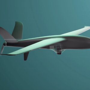
Danish start-up promotes innovative sensor system By DRONELIFE Features Editor Jim Magill Marine rescue teams using drones to search for capsized boats or people clinging to wreckage have a big job. They have to use images sent back from the drone to search wide expanses of water to find the few pixels that capture the vital evidence of what they’re looking for – and they … [Read more...] about Danish Startup Launches 10K Drone Sensor for Wide-Area Search, Surveillance, and Mine Detection
Elsight’s Halo Makes the Blue UAS List: What That Means for Allied Suppliers
New designation highlights growing focus on secure communications as a critical component in U.S. drone policy Elsight’s Halo connectivity platform has been added to the U.S. Department of War’s Defense Contract Management Agency (DCMA) Blue UAS List, marking a notable development in how the U.S. government evaluates and procures drone technologies. The Blue UAS List serves … [Read more...] about Elsight’s Halo Makes the Blue UAS List: What That Means for Allied Suppliers
Spexi Orthomosaic Drone Imagery Now Available on SkyWatch Platform

SkyWatch has announced the addition of Spexi orthomosaic drone imagery to its platform, expanding access to standardized aerial data for mapping and analysis. The integration allows users to source ultra-high-resolution drone imagery directly through SkyWatch’s EXPLORE and HUB applications. With the launch, SkyWatch customers can access Spexi’s stitched, orthorectified imagery … [Read more...] about Spexi Orthomosaic Drone Imagery Now Available on SkyWatch Platform
Phase One Unveils iXM-FS130 Camera for Sub-Centimeter Aerial Mapping
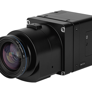
Phase One has announced the iXM-FS130, a next-generation aerial mapping camera designed to capture sub-centimeter ground sample distance imagery from fixed-wing aircraft at speeds exceeding 120 knots. The camera introduces Phase One's patented Fusion Shutter technology to the commercial aerial mapping market. This enables operators to maintain image quality while increasing … [Read more...] about Phase One Unveils iXM-FS130 Camera for Sub-Centimeter Aerial Mapping


