
• Skip to main content
  • Skip to secondary menu
  • Skip to primary sidebar
  • Skip to secondary sidebar
  • Skip to footer
  • DroneRacingLife
  • DroneFlyers
  • Newsletter
DroneLife

DRONELIFE

Stay up to date on all the latest Drone News

  • News
  • Products
  • Industries
    • Agriculture
    • Construction
    • Delivery
    • Dual Use
    • Inspection
    • Public Safety
    • Surveying
  • Enthusiasts
  • Regulations
  • Business
  • Video
  • Podcasts

5 Reasons Your Drone Needs RTK: DRONELIFE Exclusive from Point One

February 14, 2024 by Miriam McNabb 8 Comments

DRONELIFE presents this guest post by Mark Wilkerson, Product Manager at Point One Navigation, providing a centimeter-accurate positioning system. In this piece, Mark lays out the reasons that RTK might be right for your commercial drone application.  DRONELIFE neither accepts nor makes payment for guest posts.  

The Five Reasons Your Drone Needs RTK

By Mark Wilkerson, Point One Navigation Product Manager

 There are more drones in the sky than ever, and that makes precise location services more important than ever. And even if you’re not flying multiple drones at the same time, precise positioning can let you do things you never thought possible. Real-time kinematic (RTK) positioning gives your drone centimeter location accuracy without the need for ground control points (GCPs) or time-consuming post-flight post processing.

What is RTK?

Typically, drones rely on global navigation satellite system (GNSS) data to determine their locations. But GNSS can be inaccurate due to atmospheric interference, signal multipath, and satellite orbit and clock errors. Usually drones need ground control points (GCPs)—known points on the ground used to calibrate and correct their data. If there are no GCPs, then location accuracy can severely suffer. Post-processed kinematic (PPK) is another method for improving location accuracy, but only works after the fact. Data is collected during the flight, but needs to be processed later to achieve better accuracy.

RTK does what it says in the name: Provides real-time positioning data. Drones with RTK communicate with a network of installed base stations that correct GNSS data. How does RTK work? The RTK network can compensate for things like atmospheric disturbances, satellite clock inaccuracies, and orbital errors. With RTK, you can instantly achieve 1-3 cm positioning accuracy. If your drones work in construction planning, agriculture mapping, or infrastructure inspection, that level of accuracy is crucial.

Here are five reasons why your drone needs RTK, and some of the amazing things you can do when you have centimeter-level positioning accuracy.

1. No More Ground Control Points

Many drone operators set up GCPs or base stations for more accurate positioning. RTK networks make those GCPs unnecessary. Just arrive at a site, launch your drone, and fly. The RTK network will give your drone all the data it needs to calculate precise location instantly in real time. That means you can spend more time collecting the data you need, and less time setting up GCPs.


Figure 1 – Caption: Ground control points require setup at every site vs. RTK Networks that cover large areas.

2. Reduce Post Processing

If you’re using PPK, it could take hours to process all the data you gathered from photogrammetry, LIDAR frame matching, or mapping. With an RTK network, post extensive processing isn’t needed—you get high-precision positioning data from the start. On average, RTK–enabled drones reduce post-processing time by about 90%.

3. Avoid Collisions

If you’re operating an entire drone fleet, or just flying in a crowded area, avoiding collisions is paramount. One slipup can cost thousands and set your project back. RTK gives you the real-time positioning you need to avoid collisions and to protect your investment. Good RTK data coupled with path planning can prevent collisions before they happen.
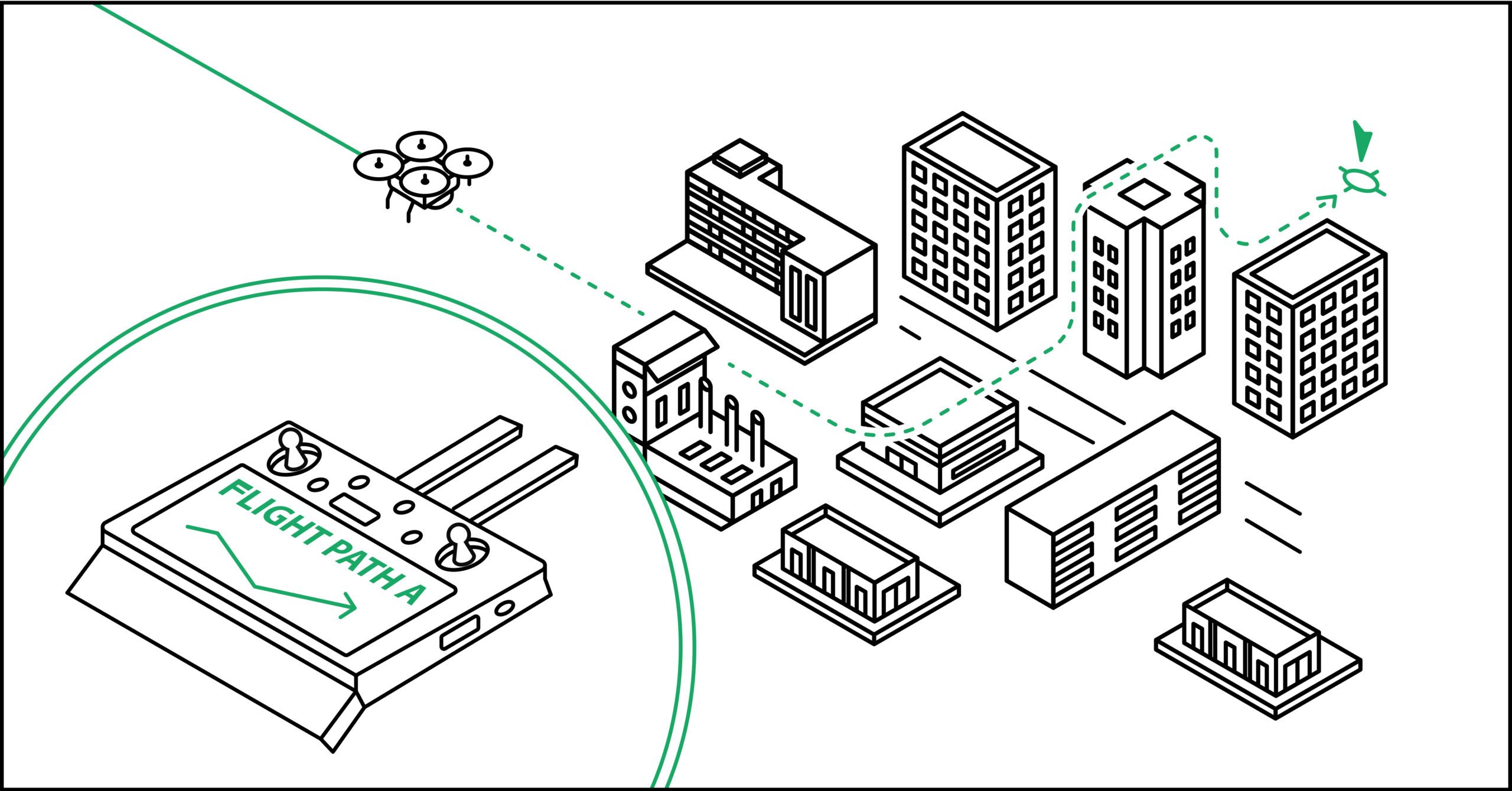
Figure 2: RTK simplifies path planning.

4. Get Detailed Flight History

RTK can give you detailed flight history, including timestamped locations, so you can determine if there are any remaining location inaccuracies and where they may be coming from. With Point One RTL, you can send a single HTTPS request and receive plain, well-informed JSON data in return for any RTK-enabled drones.

5. Do More With Your UAV

With super-precise real-time location data, you can do more with your drone than ever before. Precision agriculture, volumetric measurement, inspection, and a host of other location-based use cases all benefit from RTK technology.

Agriculture – Drones with RTK can deliver more accurate soil health analysis, crop monitoring, and field mapping data. That means farmers can practice site-specific crop management, yield more crops, use resources more efficiently, and reduce environmental impacts.

Mapping & Surveying – RTK makes rapid data collection with high accuracy simile, making drones ideal for topographic surveys, GIS data collection, and environmental monitoring.

Inspections & Public Safety – RTK-enabled drones can be an efficient and safe way to assess infrastructure like dams, bridges, buildings, and power lines. They can also play an important role in emergency response, search and rescue, and disaster management.

Construction – You can use RTK drones for site planning, monitoring progress, and making sure that projects follow their blueprints. They can deliver precise data that helps reduce costly errors, ensures compliance with regulations, and enhances overall efficiency.

Mining – With RTK, you can use your drone for surveying mine sites, monitoring stockpiles, and calculating the volume of extracted materials. They provide safer and more cost-effective alternatives to traditional survey methods, especially in hazardous environments.

Caption: Currently, Point One Navigation provides over 1,400 base stations worldwide, with more being established every day. This includes most of North America, Europe and now South Korea

RTK networks can give your drone the precision it truly needs to be useful for tomorrow’s businesses. Point One has over 1,400 base stations across the globe–providing centimeter-accurate positioning in many countries, including most of Europe, the US, parts of Canada as well as South Korea. Our network continues to expand every day, delivering super-accurate real-time positioning data that will help make drones even more useful in our everyday lives.

Mark Wilkerson is Point One’s Product Manager. He’s a veteran engineer & technical leader with more than 30 years’ experience in large, distributed, and embedded applications.


Read more:

  • RTK and Drone Mapping: Do You Need It? Is It Worth It?
  • DJI Matrice M30, Matrice M350 RTK Earn EU Certifications
  • Sony Announces Airpeak Upgrades, Including RTK Kit

Miriam McNabb

Miriam McNabb is the Editor-in-Chief of DRONELIFE and CEO of JobForDrones, a professional drone services marketplace, and a fascinated observer of the emerging drone industry and the regulatory environment for drones. Miriam has penned over 3,000 articles focused on the commercial drone space and is an international speaker and recognized figure in the industry.  Miriam has a degree from the University of Chicago and over 20 years of experience in high tech sales and marketing for new technologies.
For drone industry consulting or writing, Email Miriam.

TWITTER:@spaldingbarker

Subscribe to DroneLife here.

Filed Under: DL Exclusive, Drone News, Drone News Feeds, Drones in the News, News Tagged With: DJI RTK, drone base positioning system, GNSS positioning, PointOne Navigation, rtk, RTK for drones

Reader Interactions

Comments

  1. Michael Lambert says

    January 11, 2025 at 2:42 am

    This article should be revisited and edited by someone who actually does this work. There are at least three “facts” that would never pass the test of an experienced mapping Pilot.

    Reply

Trackbacks

  1. Sky-High Marketing: How Businesses Are Winning with Aerial Media Campaigns – Overwatch Aviation says:
    August 13, 2025 at 3:56 pm

    […] inquiries by 403% compared to video-free listings. In construction, expertise in photogrammetry and RTK/PPK mapping can reduce survey times by up to 90%, delivering actionable data for BIM […]

    Reply
  2. What to Look for When Choosing Your Aerial Drone Company – Overwatch Aviation says:
    August 6, 2025 at 12:47 pm

    […] inquiries by 403% compared to video-free listings. In construction, expertise in photogrammetry and RTK/PPK mapping can reduce survey times by up to 90%, delivering actionable data for BIM […]

    Reply
  3. 5 Causes Your Drone Wants RTK - Enjbs says:
    February 14, 2024 at 10:35 pm

    […] Miriam McNabb is the Editor-in-Chief of DRONELIFE and CEO of JobForDrones, an expert drone companies market, and a fascinated observer of the rising drone trade and the regulatory setting for drones. Miriam has penned over 3,000 articles targeted on the industrial drone house and is a global speaker and acknowledged determine within the trade.  Miriam has a level from the College of Chicago and over 20 years of expertise in excessive tech gross sales and advertising for brand spanking new applied sciences.For drone trade consulting or writing, Electronic mail Miriam. […]

    Reply
  4. 5 Causes Your Drone Wants RTK - TC Technology News says:
    February 14, 2024 at 1:47 pm

    […] Supply hyperlink […]

    Reply
  5. 5 Causes Your Drone Wants RTK - Hello says:
    February 14, 2024 at 1:09 pm

    […] Miriam McNabb is the Editor-in-Chief of DRONELIFE and CEO of JobForDrones, knowledgeable drone companies market, and a fascinated observer of the rising drone trade and the regulatory setting for drones. Miriam has penned over 3,000 articles targeted on the business drone house and is a global speaker and acknowledged determine within the trade.  Miriam has a level from the College of Chicago and over 20 years of expertise in excessive tech gross sales and advertising and marketing for brand new applied sciences.For drone trade consulting or writing, E mail Miriam. […]

    Reply
  6. 5 Reasons Your Drone Needs RTK: DRONELIFE Exclusive from Point One - Worldnews4 says:
    February 14, 2024 at 12:53 pm

    […] Miriam McNabb is the Editor-in-Chief of DRONELIFE and CEO of JobForDrones, a professional drone services marketplace, and a fascinated observer of the emerging drone industry and the regulatory environment for drones. Miriam has penned over 3,000 articles focused on the commercial drone space and is an international speaker and recognized figure in the industry.  Miriam has a degree from the University of Chicago and over 20 years of experience in high tech sales and marketing for new technologies.For drone industry consulting or writing, Email Miriam. […]

    Reply
  7. 5 Reasons Your Drone Needs RTK: DRONELIFE Exclusive from Point One – Independent Drone Exchange says:
    February 14, 2024 at 12:18 pm

    […] post 5 Reasons Your Drone Needs RTK: DRONELIFE Exclusive from Point One appeared first on […]

    Reply

Leave a Reply Cancel reply

Your email address will not be published. Required fields are marked *

Primary Sidebar

LATEST

BayCare Selects Zipline to Build Drone Delivery Network Across Tampa Bay

BayCare hospital system to partner with Zipline By DRONELIFE Features Editor Jim Magill Zipline, which operates the world’s largest autonomous…

Continue Reading BayCare Selects Zipline to Build Drone Delivery Network Across Tampa Bay

DRONERESPONDERS And Commercial UAV Expo Bring FIFA Insight to Event

Commercial UAV Expo debuts a two-day DRONERESPONDERS Program Management Course and unveils the 2026 Summit agenda, headlined by World Cup…

Continue Reading DRONERESPONDERS And Commercial UAV Expo Bring FIFA Insight to Event

Japan Biz Aviation to Support SkyDrive eVTOL Launch by 2028

Toyota-based eVTOL manufacturer partners with HondaJet and Bell 429 operator JBZ to build a commercial framework for its 2028 launch.…

Continue Reading Japan Biz Aviation to Support SkyDrive eVTOL Launch by 2028

FAA Clears MONTIS Drone for U.S. Avalanche Control Operations

Nebraska-based drone maker secures a legal framework for U.S. commercial deployment of its remote avalanche mitigation system. Drone Amplified announced…

Continue Reading FAA Clears MONTIS Drone for U.S. Avalanche Control Operations

Echodyne Expands U.S. Radar Manufacturing to Meet Global C-UAS Demand

Kirkland-based radar maker opens an 86,350-square-foot plant capable of producing more than 30,000 MESA radars a year to meet counter-UAS…

Continue Reading Echodyne Expands U.S. Radar Manufacturing to Meet Global C-UAS Demand

Manna Launches First U.S. Metro Drone Delivery Hub in Tulsa

Irish drone delivery company plans U.S. manufacturing, commercial operations, and more than 1,000 jobs as it begins American expansion Irish…

Continue Reading Manna Launches First U.S. Metro Drone Delivery Hub in Tulsa

Startup Aims to Make Drone Attacks Too Expensive to Wage

Small US start-up hopes to have big impact on defense By DRONELIFE Features Editor Jim Magill A tiny California-based start-up…

Continue Reading Startup Aims to Make Drone Attacks Too Expensive to Wage

As Drone Demand Grows, Protolabs Scales On-Demand Manufacturing

New CNC machining and 3D printing capabilities aim to help drone manufacturers move from prototype to production faster As commercial…

Continue Reading As Drone Demand Grows, Protolabs Scales On-Demand Manufacturing

What Ordering Walmart by Drone Looks Like as Houston Service Expands

Wing and Walmart Launch Expanded Houston Drone Delivery Network Eight new drone hubs more than double Wing’s Houston footprint as…

Continue Reading What Ordering Walmart by Drone Looks Like as Houston Service Expands

How Rural Colorado Is Putting Drones to Work for Conservation

In this guest post, Vanessa Trout, Executive Director of the White River Conservation District, describes how rural conservation districts in…

Continue Reading How Rural Colorado Is Putting Drones to Work for Conservation

Secondary Sidebar

Footer

SPONSORED

Inspired Flight Gremsy IF800 VIO F1 drones geo week

What Will It Take to Strengthen U.S. Drone Manufacturing? A Conversation with Inspired Flight’s CEO

Global Mapper Mobile data collection

Collection Ground Control Points with Global Mapper Mobile

Military Drone Mapping Solutions

How SimActive’s Correlator3D™ is Revolutionizing Military Mapping: An Exclusive Interview with CEO Philippe Simard

Photogrammetry Accuracy Standards

SimActive Photogrammetry Software: Enabling Users to Meet Accuracy Standards for Over 20 Years

NACT Engineering Parrot ANAFI tether indoor shot

Smart Tether for Parrot ANAFI USA from NACT Engineering

Blue Marble, features global mapper, features Blue Marble

Check Out These New Features in Global Mapper v25 from Blue Marble

About Us | Contact Us | Advertise With Us | Write for Us | Privacy Policy | Terms of Service

The Trusted Source for the Business of Drones.

This website uses cookies and third party services. By clicking OK, you are agreeing to our privacy policy. ACCEPT

Manage consent

Privacy Overview

This website uses cookies to improve your experience while you navigate through the website. Out of these, the cookies that are categorized as necessary are stored on your browser as they are essential for the working of basic functionalities of the website. We also use third-party cookies that help us analyze and understand how you use this website. These cookies will be stored in your browser only with your consent. You also have the option to opt-out of these cookies. But opting out of some of these cookies may affect your browsing experience.
Necessary
Always Enabled
Necessary cookies are absolutely essential for the website to function properly. These cookies ensure basic functionalities and security features of the website, anonymously.
CookieDurationDescription
cookielawinfo-checkbox-analytics11 monthsThis cookie is set by GDPR Cookie Consent plugin. The cookie is used to store the user consent for the cookies in the category "Analytics".
cookielawinfo-checkbox-functional11 monthsThe cookie is set by GDPR cookie consent to record the user consent for the cookies in the category "Functional".
cookielawinfo-checkbox-necessary11 monthsThis cookie is set by GDPR Cookie Consent plugin. The cookies is used to store the user consent for the cookies in the category "Necessary".
cookielawinfo-checkbox-others11 monthsThis cookie is set by GDPR Cookie Consent plugin. The cookie is used to store the user consent for the cookies in the category "Other.
cookielawinfo-checkbox-performance11 monthsThis cookie is set by GDPR Cookie Consent plugin. The cookie is used to store the user consent for the cookies in the category "Performance".
viewed_cookie_policy11 monthsThe cookie is set by the GDPR Cookie Consent plugin and is used to store whether or not user has consented to the use of cookies. It does not store any personal data.
Functional
Functional cookies help to perform certain functionalities like sharing the content of the website on social media platforms, collect feedbacks, and other third-party features.
Performance
Performance cookies are used to understand and analyze the key performance indexes of the website which helps in delivering a better user experience for the visitors.
Analytics
Analytical cookies are used to understand how visitors interact with the website. These cookies help provide information on metrics the number of visitors, bounce rate, traffic source, etc.
Advertisement
Advertisement cookies are used to provide visitors with relevant ads and marketing campaigns. These cookies track visitors across websites and collect information to provide customized ads.
Others
Other uncategorized cookies are those that are being analyzed and have not been classified into a category as yet.
SAVE & ACCEPT




