• Skip to main content
  • Skip to secondary menu
  • Skip to primary sidebar
  • Skip to secondary sidebar
  • Skip to footer
  • DroneRacingLife
  • DroneFlyers
  • Newsletter
DroneLife

DRONELIFE

Stay up to date on all the latest Drone News

  • News
  • Products
  • Industries
    • Agriculture
    • Construction
    • Delivery
    • Dual Use
    • Inspection
    • Public Safety
    • Surveying
  • Enthusiasts
  • Regulations
  • Business
  • Video
  • Podcasts

New Infographic Highlights Rise of Firefighting Drones

December 18, 2017 by Jason Reagan 4 Comments

As drone solutions continue to grow within public-safety sectors – police and firefighting – many in the UAV industry are tracking new and better ways for these agencies to save lives from above.

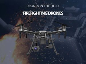
One such company, California-based Dronefly recently launched another informative infographic that paints a fascinating canvas of the future of drone firefighting tactics. Dronefly, an authorized enterprise dealer for DJI drones and FLIR thermal cameras, published  a similar graphic about police drone uses in October.

For the uninitiated, an infographic is “a visual image such as a chart or diagram used to represent information or data.” Many major drone players like DJI are making infographics a standard tool in explaining drone data.

Dronefly’s latest offering shows how drones can provide firefighting agencies with a “quickly deployable aerial overview, a lower cost compared to manned aircraft, payload drop systems, and thermal camera payload options.”

The infographic identifies four key uses:

  • “Scene Monitoring – Rapid aerial assessment of burning structures. See through smoke with thermal imaging cameras and identify hotspots;
  • Search & Rescue – Search over large areas of hard-to-reach land and identify missing people with thermal drone cameras;
  • Wildland Firefighting – Understand current fire conditions and reduce risk through better ground crew monitoring;
  • Post Fire or Disaster Assessment – Survey and map the scene to assess damage or to search for missing people.”

“The application of drones to work alongside public safety agencies is the future as they have the ability to reach and see places where humans cannot. With cameras, payload drop systems and flood lights, drones can be configured to assist ground crews in any situation,” Dronefly Vice President of Business Development Robert Scott said in a recent press release.

“Why wouldn’t a public safety agency want to use this technology especially if it could keep fire crew safe, making sure they get home at the end of their shift?”

A 2017 market report predicts government drone investment will leap from $100 million to $250 million by 2025 with federal spending alone accounting for $170 million – much of which could land across various public-safety agencies.

Jason Reagan
Jason Reagan

Jason is a longstanding contributor to DroneLife with an avid interest in all things tech. He focuses on anti-drone technologies and the public safety sector; police, fire, and search and rescue.

Beginning his career as a journalist in 1996, Jason has since written and edited thousands of engaging news articles, blog posts, press releases and online content.

Email Jason
TWITTER:@JasonPReagan

LinkedIn 

Subscribe to DroneLife here.

Filed Under: Drone News, Drone News Feeds, Fire and Police, News Tagged With: Dronefly, firefighting drones

Reader Interactions

Trackbacks

  1. New Infographic Highlights Rise of Firefighting Drones | News and Reviews about Drones, Quadcopter, Camera says:
    December 19, 2017 at 3:14 am

    […] Source link […]

    Reply
  2. New Infographic Highlights Rise of Firefighting Drones | Drone Magazine says:
    December 18, 2017 at 10:51 pm

    […] Source […]

    Reply
  3. New Infographic Highlights Rise of Firefighting Drones - Drone Services Company | Aerial Photo and Video | Miami Florida says:
    December 18, 2017 at 8:15 pm

    […] post New Infographic Highlights Rise of Firefighting Drones appeared first on […]

    Reply
  4. New Infographic Highlights Rise of Firefighting Drones – Dronegram says:
    December 18, 2017 at 3:45 pm

    […] post New Infographic Highlights Rise of Firefighting Drones appeared first on […]

    Reply

Leave a Reply Cancel reply

Your email address will not be published. Required fields are marked *

Primary Sidebar

LATEST

University of Tokyo and Kubota Develop Drone Potato Yield Prediction Method

This article published in collaboration with JUIDA, the Japan UAS Industrial Development Association.     Researchers at the University of Tokyo…

Continue Reading University of Tokyo and Kubota Develop Drone Potato Yield Prediction Method

Department of War Creates Central Office to Oversee U.S. Military Unmanned Systems

New Direct Reporting Portfolio Manager will consolidate acquisition, standards, budgeting, and industry engagement for drone and autonomous programs The U.S.…

Continue Reading Department of War Creates Central Office to Oversee U.S. Military Unmanned Systems

FAA Investigating Reported Drone Encounter on JetBlue Flight Approaching JFK

The Federal Aviation Administration (FAA) is investigating after the crew of a JetBlue flight reported striking what they believed was…

Continue Reading FAA Investigating Reported Drone Encounter on JetBlue Flight Approaching JFK

Versaterm on the Drone Radio Show! Next Level Integration of Drones into Public Safety

Versaterm on the Drone Radio Show! In this episode, Ryan Bracken explains how Versaterm’s acquisition of DroneSense is helping agencies…

Continue Reading Versaterm on the Drone Radio Show! Next Level Integration of Drones into Public Safety

ANRA Technologies Surpasses 55,000 Commercial Drone Operations Per Month

ANRA says its Mission Manager X platform now supports more than 1,800 BVLOS commercial drone operations per day across delivery,…

Continue Reading ANRA Technologies Surpasses 55,000 Commercial Drone Operations Per Month

Nearly One Million Comments Underscore Stakes of FAA’s Section 2209 Rule

Experts weigh in on extension of 2209 comment period By DRONELIFE Features Editor Jim Magill With almost 1 million comments…

Continue Reading Nearly One Million Comments Underscore Stakes of FAA’s Section 2209 Rule

ND UAS Council Adds Grand Forks DDA to Strengthen Drone Ecosystem

The North Dakota UAS Council has added the Grand Forks Downtown Development Association as its newest member, linking the state’s…

Continue Reading ND UAS Council Adds Grand Forks DDA to Strengthen Drone Ecosystem

World-First Drone Mouse Eradication Passes Six-Month Check on Browse Island

Parks and Wildlife Service staff have returned to Browse Island Nature Reserve for a follow-up survey and found no signs…

Continue Reading World-First Drone Mouse Eradication Passes Six-Month Check on Browse Island

House FY27 NDAA Signals Drones Have Become Core Military Infrastructure

Rather than focusing primarily on buying new drones, the House Armed Services Committee is proposing the standards, training, doctrine, and…

Continue Reading House FY27 NDAA Signals Drones Have Become Core Military Infrastructure

Don’t Miss AirWise Solutions on the Public Safety Drone Review, July 7!

Join us Tuesday, July 7 at 3pm EST for the next edition of the Public Safety Drone Review, presented by…

Continue Reading Don’t Miss AirWise Solutions on the Public Safety Drone Review, July 7!

Secondary Sidebar

Footer

SPONSORED

Inspired Flight Gremsy IF800 VIO F1 drones geo week

What Will It Take to Strengthen U.S. Drone Manufacturing? A Conversation with Inspired Flight’s CEO

Global Mapper Mobile data collection

Collection Ground Control Points with Global Mapper Mobile

Military Drone Mapping Solutions

How SimActive’s Correlator3D™ is Revolutionizing Military Mapping: An Exclusive Interview with CEO Philippe Simard

Photogrammetry Accuracy Standards

SimActive Photogrammetry Software: Enabling Users to Meet Accuracy Standards for Over 20 Years

NACT Engineering Parrot ANAFI tether indoor shot

Smart Tether for Parrot ANAFI USA from NACT Engineering

Blue Marble, features global mapper, features Blue Marble

Check Out These New Features in Global Mapper v25 from Blue Marble

About Us | Contact Us | Advertise With Us | Write for Us | Privacy Policy | Terms of Service

The Trusted Source for the Business of Drones.

This website uses cookies and third party services. By clicking OK, you are agreeing to our privacy policy. ACCEPT

Manage consent

Privacy Overview

This website uses cookies to improve your experience while you navigate through the website. Out of these, the cookies that are categorized as necessary are stored on your browser as they are essential for the working of basic functionalities of the website. We also use third-party cookies that help us analyze and understand how you use this website. These cookies will be stored in your browser only with your consent. You also have the option to opt-out of these cookies. But opting out of some of these cookies may affect your browsing experience.
Necessary
Always Enabled
Necessary cookies are absolutely essential for the website to function properly. These cookies ensure basic functionalities and security features of the website, anonymously.
CookieDurationDescription
cookielawinfo-checkbox-analytics11 monthsThis cookie is set by GDPR Cookie Consent plugin. The cookie is used to store the user consent for the cookies in the category "Analytics".
cookielawinfo-checkbox-functional11 monthsThe cookie is set by GDPR cookie consent to record the user consent for the cookies in the category "Functional".
cookielawinfo-checkbox-necessary11 monthsThis cookie is set by GDPR Cookie Consent plugin. The cookies is used to store the user consent for the cookies in the category "Necessary".
cookielawinfo-checkbox-others11 monthsThis cookie is set by GDPR Cookie Consent plugin. The cookie is used to store the user consent for the cookies in the category "Other.
cookielawinfo-checkbox-performance11 monthsThis cookie is set by GDPR Cookie Consent plugin. The cookie is used to store the user consent for the cookies in the category "Performance".
viewed_cookie_policy11 monthsThe cookie is set by the GDPR Cookie Consent plugin and is used to store whether or not user has consented to the use of cookies. It does not store any personal data.
Functional
Functional cookies help to perform certain functionalities like sharing the content of the website on social media platforms, collect feedbacks, and other third-party features.
Performance
Performance cookies are used to understand and analyze the key performance indexes of the website which helps in delivering a better user experience for the visitors.
Analytics
Analytical cookies are used to understand how visitors interact with the website. These cookies help provide information on metrics the number of visitors, bounce rate, traffic source, etc.
Advertisement
Advertisement cookies are used to provide visitors with relevant ads and marketing campaigns. These cookies track visitors across websites and collect information to provide customized ads.
Others
Other uncategorized cookies are those that are being analyzed and have not been classified into a category as yet.
SAVE & ACCEPT