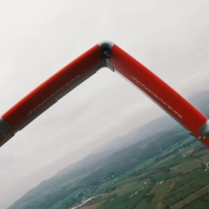
A New Chapter for Autonomous Middle-Mile Logistics Windracers has unveiled its latest self-flying cargo aircraft, the ULTRA MK2, at a launch event in London. Designed to enhance middle-mile logistics, the ULTRA MK2 offers double the power output, a 50% increase in payload capacity, and a significant reduction in fuel costs compared to its predecessor. “The launch of ULTRA … [Read more...] about Windracers Introduces ULTRA MK2 Cargo UAV: More Power, Payload, and Efficiency
Environmental monitoring
Spexi Secures $11.5M Series A to Expand Ultra-High-Resolution Drone Imagery Network
Transforming Earth Imagery for Emergency Response, AI, and Emerging Technologies Spexi, a Vancouver-based technology company, has announced the completion of its $11.5 million USD Series A funding round, led by Blockchange Ventures. This milestone will support Spexi’s goal of building a scalable global network of drone pilots to deliver standardized, ultra-high-resolution … [Read more...] about Spexi Secures $11.5M Series A to Expand Ultra-High-Resolution Drone Imagery Network
Expand Your Impact with DroneDeploy’s Resilient Futures Grant Program
DroneDeploy launches new grant initiative to support nonprofit organizations using reality capture technology. DroneDeploy.org has announced the Resilient Futures Technology Grant Program, offering up to $75,000 in grants to eligible nonprofit organizations in 2024. This initiative seeks to foster inclusion and enhance outcomes for underresourced communities by utilizing … [Read more...] about Expand Your Impact with DroneDeploy’s Resilient Futures Grant Program
Groundbreaking Drone Inspection Conducted on General Sherman Tree
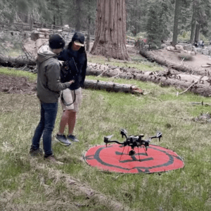
Pioneering Use of Industrial-Grade Drone Provides Comprehensive Health Assessment of World's Largest Known Living Tree In May, a collaborative effort by the US National Park Service, Giant Sequoia Lands Coalition, and other groups led to a pioneering health check-up for the General Sherman tree in Sequoia National Park. This monumental project marked the first time an … [Read more...] about Groundbreaking Drone Inspection Conducted on General Sherman Tree
Revolutionising Flood and Drought Management: Radar Drones Could Redefine Soil Moisture Monitoring
Radar Drones Transform Soil Moisture Monitoring: Cranfield University Leads Innovation for Flood and Drought Management Cranfield University is spearheading a groundbreaking two-year project aimed at revolutionizing soil moisture monitoring through the fusion of Synthetic Aperture Radar (SAR) and unmanned aerial vehicles (UAVs). Synthetic Aperture Radar utilizes radio … [Read more...] about Revolutionising Flood and Drought Management: Radar Drones Could Redefine Soil Moisture Monitoring


