
From May 11-14, the annual AUVSI Xponential conference will bring the global autonomous systems industry to Detroit. This year’s conference arrives at a moment when uncrewed systems, AI, advanced manufacturing, and resilient supply chains are becoming increasingly tied to both commercial and defense priorities. XPONENTIAL has steadily evolved into one of the leading showcases … [Read more...] about Headed to XPONENTIAL 2026? Don’t Miss These Partners, Panels, and Dual-Use Innovations in Detroit
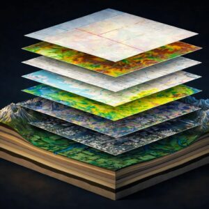
Blue Marble Geographics
Blue Marble Geographics and Avenza Systems Combine to Create Unified Geospatial Platform
Merger connects office-based analysis with field operations for end-to-end spatial workflows Blue Marble Geographics and Avenza Systems, Inc. have announced a combined organization that will operate under the Blue Marble Geographics name. The move brings together complementary geospatial technologies designed to connect office-based spatial analysis with field data collection … [Read more...] about Blue Marble Geographics and Avenza Systems Combine to Create Unified Geospatial Platform
Designing Resilient Roads on Java’s Southern Coast: A Blue Marble Geographics Case Study
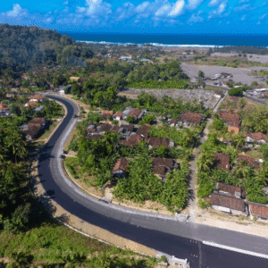
As governments invest in infrastructure to unlock tourism and regional growth, the challenge is no longer just building roads. It is building roads that can endure terrain, climate, and time. A recent case study from Blue Marble Geographics demonstrates how drone-based photogrammetry and watershed modeling are helping engineers design a more resilient transportation corridor … [Read more...] about Designing Resilient Roads on Java’s Southern Coast: A Blue Marble Geographics Case Study
Blue Marble Geographics Unveils Global Mapper® v26.2 at Intergeo 2025

New update delivers user-driven interface improvements, expanded visualization tools, and enhanced file format support. Blue Marble Geographics has announced the release of Global Mapper® v26.2, the latest version of its all-in-one GIS software. The update was introduced this week at Intergeo 2025, the international mapping conference taking place in Frankfurt, Germany this … [Read more...] about Blue Marble Geographics Unveils Global Mapper® v26.2 at Intergeo 2025
Leveraging Point Clouds for Vegetation Encroachment Assessment: A Drone-Enabled Approach

This article from Blue Marble Geographics highlights how advanced point cloud analysis can support vegetation fire risk assessment. Blue Marble is known for its geospatial software, including Global Mapper and Global Mapper Pro, which provide powerful tools for working with LiDAR, photogrammetry, and other complex datasets. These solutions enable users across industries—from … [Read more...] about Leveraging Point Clouds for Vegetation Encroachment Assessment: A Drone-Enabled Approach


