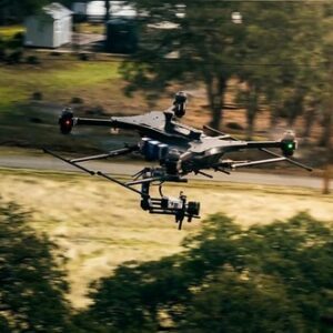
Aureus Greenway Holdings Inc. (Nasdaq: AGH) and Autonomous Power Corporation, doing business as Powerus, announced a definitive merger agreement on March 9, 2026. The combined company will operate as Powerus Corporation and trade on Nasdaq under the ticker "PUSA" upon deal close, expected in summer 2026. Autonomous Drone Systems Built for High-Risk Environments Powerus … [Read more...] about Powerus and Aureus Greenway Holdings Announce Merger to Advance Autonomous Drone Systems
Aerospace
EagleNXT Expands Defense Technology Portfolio with Investment in Autonomous Loitering Munition Developer
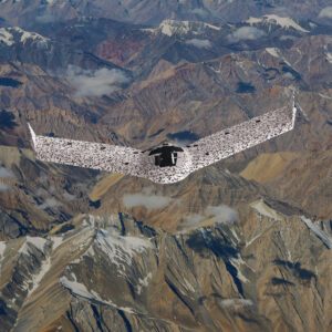
Strategic investment expands autonomous defense capabilities and opens path for potential U.S. collaboration EagleNXT has announced a strategic investment in Aerodrome Group Ltd., an Israel-based developer of precision loitering munitions. The investment expands EagleNXT’s capabilities in autonomy and precision strike technology. EagleNXT, formerly known as AgEagle Aerial … [Read more...] about EagleNXT Expands Defense Technology Portfolio with Investment in Autonomous Loitering Munition Developer
DHS Offers Counter-UAV Siting Advice For World Cup Communities

By Dronelife Features Editor Jim Magill (Editor’s note: This following story is part of an ongoing series of stories on efforts to establish new counter-UAS protocols in the U.S. to protect high-profile sporting events and critical infrastructure from the potential threats posed by drones flown by careless or hostile actors.) As U.S. cities get ready to host FIFA World … [Read more...] about DHS Offers Counter-UAV Siting Advice For World Cup Communities
Proposed Bill Calls For FAA To Study Drone Incursions During Wildfires
The Wildfire Aerial Response Safety Act (H.R. 6618) would require the Federal Aviation Administration to conduct a comprehensive study examining how unauthorized drone operations interfere with wildfire firefighting operations. Introduced in the House on December 11, 2025, by Representative Janelle Bynum with bipartisan cosponsorship from Representatives Eli Crane, Joe Neguse, … [Read more...] about Proposed Bill Calls For FAA To Study Drone Incursions During Wildfires
AIR Delivers First Production-Ready eVTOL Cargo Aircraft

Company begins commercial rollout after two years of operational deployment AIR has delivered its first production-ready electric vertical takeoff and landing aircraft, marking a key step from development into commercial manufacturing. The aircraft is AIR’s production cargo model and follows nearly two years of operational use by the company’s launch customer with … [Read more...] about AIR Delivers First Production-Ready eVTOL Cargo Aircraft


