By Dronelife Features Editor Jim Magill
An international team of researchers plans to deploy Windracers’ dual-use heavy-lift drone technology to study the interactions of ice and ocean water in the frigid Arctic region of northwestern Greenland.
The study, which is expected to get under way this summer, will be a critical part of the so-called GIANT (Greenland Ice sheet to AtlaNtic Tipping points from ice loss) program , an international research mission to understand how melting glaciers are pushing the Atlantic Ocean towards a critical climate tipping point.
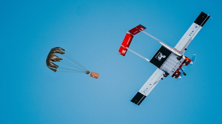
Researchers will deploy the British drone company’s ULTRA system, a fixed-wing heavy-duty cargo drone, which has previously been deployed in the harsh climate of Antarctica.
“This is a very big overarching science project looking at Greenland’s ice sheet and how it’s interacting with the oceans around it. It’s led by the British Antarctic Survey (BAS),” Tom Jordan, a BAS geophysicist who is leading the airborne UAV survey component of the GIANT Project, told DroneLife.
In addition to using the ULTRA, the researchers will deploy a wide range of sophisticated technologies, including unmanned marine vehicles as well as satellites and sensors to better understand how ice interacts with ocean waters.
The ULTRA, capable of carrying payloads of over 150 kg (about 330 pounds) and flying distances of up to 2,000 km (about 1,240 miles), will use a new ice-penetrating radar system to map the base of the floating ice shelf and the valleys hidden beneath the ice further inland.
Plans call for the researchers to first travel to one of the most northerly communities in Greenland, which will serve as a base for the expedition. “We’ll go there, we’ll test the platform and then we’ll go even further north out into a remote field site. And that’s where we’ll fly the actual survey of one of the glaciers and ice tongues,” Jordan said.
The researchers will focus their drone-based studies on the Petermann Glacier, a large field in far northwest Greenland, which covers wide expanse of land, and which extend into the sea in a formation known as the tongue.
“The glacier comes down to the ocean, but then instead of breaking off into icebergs, immediately it goes into this floating ice tongue. And that helps support the glacier and prevent lots of ice from flying into the ocean all at once,” Jordan said.
Located at around 81 degrees North latitude, the Petermann Glacier is the longest floating glacier in the Northern Hemisphere. Covering about 500 square miles, its floating ice tongue is six to eight miles wide and 27 miles long
Jordan said the researchers hope to learn more about the process in which chunks of ice break off from the tongue to become icebergs, as the ice is heated up by warm waters underneath while at the same time the glacial ice is being warmed by the sun above.
“We don’t really understand very much about the processes by which it gets melted from underneath,” Jordan said. “We’ll be effectively flying a grid survey with one-kilometer line spacing, heading 50 kilometers upstream from the grounding line, at a hundred kilometers downstream, and mapping out the whole thickness of this ice sheet.”
Windracers to Fly Next-Generation ULTRA
The Windracers ULTRA MK2, which will perform the survey, is a twin-engine unmanned aircraft with a 10-meter (about 33-foot) wingspan. The vehicle is powered by two gas-fueled 50-hp Hirth F23 engines, which gives it double the power output of the previous generation of ULTRA aircraft.
Nikolay Jelev, Windracers’ product marketing manager, said the aircraft’ power train is designed to operate in bitterly cold temperatures, like those found in northwestern Greenland. “We’ve just finished testing this propulsion system in Finland down to minus-28 degrees (Celsius). And it’s being tested on the ground at much lower temperatures than that as well,” he said. “We ran engines on an earlier version of the aircraft at minus-40 degrees C up in Alaska.”
The ULTRA’s main payload will be a 300-megahertz ice-penetrating radar, which will be able to “see” through the ice to the rock or water underneath, and which can measure the thickness of the glacier at different points.
“It’s a multi-antenna system, so it has three antennas mounted in the belly, the cargo bay of the aircraft, and then it’s got four antennas mounted on the wings, on the structure, and at the wing tip,” Jordan said. This array of antennas will allow the radar system to not just sound a single ping from a point directly beneath the UAV, but also to look off to one side and the other to create a full 3D picture of what’s under the surface.
“It’s an experimental system, so we’ve not yet deployed it. So, it’s really exciting to be getting it integrated onto the platform, up to Greenland and over some ice to actually fly it and see how capable it really is,” he said.
Alongside the radar, the ULTRA will deploy a downward-looking camera that will allow researchers to pick out surface features and create a 3D model of the ice surface. In addition, if the UAV conducts repeat flights over the same area, researchers will be able to use the data from the earlier flight to track how the surface of the ice has moved. This will allow them to determine the speed of the ice’s movement.
Plans call for the glacier survey project to include 19 two- to four-hour flights, a process that researchers hope to complete within three weeks, contingent on the weather.
The glacier survey will serve as the basis for the next phase of the GIANT program to take place next summer, Jordan said. The second team of researchers will use the drone-collected data to guide where to drill a hole through the ice in order to place measuring instruments in the ocean waters beneath the ice.
“They’ll have like really detailed measurements in one tiny location, but our big survey with the drone is going to help put that in proper context,” Jordan said.
Once the glacier survey project is completed, the GIANT team will deploy the Windracers drone in a subsidiary project, on behalf of the program’s Greenlandic hosts. “The local community and other Greenland researchers are really interested in the population of narwhales in that region,” Jordan said.
The team will remove the radar equipment from the ULTRA and replace it with higher-resolution cameras and a hyperspectral camera system. The system array is similar to one that Windracers had deployed in a previous BAS study to spot seals in Antarctica.
“We’ll be flying over the open ocean to see if we can map out the abundance and distribution of narwhales,” Jordan said. He added that if the technology could be used to identify seals on a beach, it should be able to easily find narwhales swimming in the ocean. “We know that we’re looking for animals of about the same size, so we should be able to see them.”
More information about the ULTRA platform is available from Windracer’s website.
Read More
- Ukraine’s Drone Industry Is Breaking Its Dependence on Chinese Parts
- Africa Pavilion to Debut at XPONENTIAL Europe 2026
- Everdrone Raises SEK 36 Million to Expand Drone-Based Emergency Healthcare Services
 Jim Magill is a Houston-based writer with almost a quarter-century of experience covering technical and economic developments in the oil and gas industry. After retiring in December 2019 as a senior editor with S&P Global Platts, Jim began writing about emerging technologies, such as artificial intelligence, robots and drones, and the ways in which they’re contributing to our society. In addition to DroneLife, Jim is a contributor to Forbes.com and his work has appeared in the Houston Chronicle, U.S. News & World Report, and Unmanned Systems, a publication of the Association for Unmanned Vehicle Systems International.


Leave a Reply