


Continue reading below, or listen:
Blue Marble Geographic’s flagship software, Global Mapper Pro, is an all-in-one GIS package for analyzing and processing vector, terrain, image, and point cloud data. A comprehensive and easy-to-use GIS application that provides an extensive collection of tools, Global Mapper Pro is suited for any GIS user, from novice to expert. Compatible with over 380 different file formats, Global Mapper can be seamlessly brought into your existing workflow. New updates to the software include the ability to calculate and model an optimal flattened site plan in the terrain and plot the least cost path across a landscape. A notable update is the Pixels to Points improvements, including refining the wizard to streamline setup and processing speed improvements of up to 50% for some projects.
The Automatic Point Cloud Analysis tool is the new hub of point cloud classification and extraction in Global Mapper Pro. This integrated tool allows users to manage automatic classifications, segmentation, and feature extraction from one window, providing the ability to share settings and run multiple processes simultaneously. Also included are new segmentation processes for ground and noise classifications, such as the segmentation-based “Max Likelihood” methods, which were previously only available for non-ground points but are better tailored for modern point cloud generation and collection approaches.
A new Custom Feature Classification tool (Beta) lets users define additional custom classifications based on unique attributes and spatial patterns. Users can create their automatic point cloud classifications and train Global Mapper to find specific objects in their point clouds. These settings can also be applied to further train existing classification methods to tailor the tool for particular datasets and workflows.
The newly added Least Cost Path tool provides a terrain analysis method for finding the shortest and most efficient path between locations. By iterating through all possible options, it identifies the best route between specified point features across a terrain layer based on minimized terrain slope angle and avoiding unwanted areas. This simple yet powerful analysis can connect two locations, map multiple locations into a single path, or discover the most accessible site.
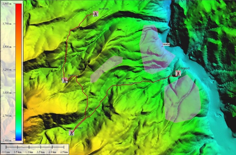

Least Cost Path can find the most optimal route across the terrain, avoiding steep slopes, vector features, and more.
Other updates to version 25 of Global Mapper include the ability to compare kriging outputs to control data as cross-validation and improvements to the creation of estimated tree footprints extracted from point clouds. A few of the new tools are expansions of existing popular ones, such as Raster Painting, which allows for editing image and raster layers, and Elevation QC for applying vertical adjustments based on ground control points.
To check out the exciting new functionality in Global Mapper standard and Pro v25, download a free 14-day trial today!
Read more:
- From the Floor of Intergeo: Blue Marble Global Mapper V24, More Resolution, More Speed
- Global Mapper Mobile: Streamlining Data Collection and Processing
- Global Mapper Mobile: New GNSS Device Support
- Drone Mapping: Global Mapper Mobile New Features Mean Higher Accuracy Data Collection


Miriam McNabb is the Editor-in-Chief of DRONELIFE and CEO of JobForDrones, a professional drone services marketplace, and a fascinated observer of the emerging drone industry and the regulatory environment for drones. Miriam has penned over 3,000 articles focused on the commercial drone space and is an international speaker and recognized figure in the industry. Miriam has a degree from the University of Chicago and over 20 years of experience in high tech sales and marketing for new technologies.
For drone industry consulting or writing, Email Miriam.
TWITTER:@spaldingbarker
Subscribe to DroneLife here.