• Skip to main content
  • Skip to secondary menu
  • Skip to primary sidebar
  • Skip to secondary sidebar
  • Skip to footer
  • DroneRacingLife
  • DroneFlyers
  • Newsletter
DroneLife

DRONELIFE

Stay up to date on all the latest Drone News

  • News
  • Products
  • Industries
    • Agriculture
    • Construction
    • Delivery
    • Dual Use
    • Inspection
    • Public Safety
    • Surveying
  • Enthusiasts
  • Regulations
  • Business
  • Video
  • Podcasts

Drone Pilots Wanted: Why Drone Mapping is the Skill You Need

March 24, 2017 by Alan Phillips 2 Comments

Since Part 107 was enacted last year, more than 30,000 drone pilots have received their certification and joined the marketplace of commercial operators.  For some, getting the license was the easy part: but finding steady work can be more challenging.  Adding mapping skills to your portfolio can be a game changer – drone mapping pilots are in demand.

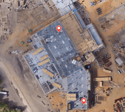
Part of the reason for this is that drone mapping covers so many different industries: agriculture, inspection, construction, and mining all use the data provided with aerial maps.  These industries are among the first to adopt drone technology on a large scale, mostly because the tech offers so much concrete value to their bottom line. The FAA’s recently published Aerospace Forecast for 2017 demonstrates that over 70% of commercial drone applications are in these verticals.

“Businesses are always looking to innovate, improving and sometimes eliminating inefficient processes — and drones are making it possible to do old tasks in completely new ways,” says Mike Winn, CEO of Drone Deploy, the leading drone mapping data platform.  “In general, our customers tell us drone mapping is 3X faster and cheaper than land-based methods. There is a large appetite for improvements at this high ROI, and this is driving demand for a generation of drone pilots and services who will reap the benefits.”

The good news is that adding drone mapping to your portfolio doesn’t have to be expensive or difficult.  While terms like orthomosaics, terrain modeling and NDVI analysis sound intimidating, drone pilots take heart: there’s an app for that.  Orthomosaic images are simply aerial photographs that have been geometrically corrected so that the scale is uniform – and offer the same precision as a map.  Terrain modelling provides elevation information, allowing for 3D representations of an area.  And NDVI stands for Normalized Difference Vegetation Index – a standardized index that allows agronomists to generate an image displaying greenness (relative biomass).

Drone operators need to know what the terms mean so that they can communicate well with their clients; but then they simply need to gather the data accurately and use the right tools.  Platforms like Drone Deploy do all the rest of it for you: they provide the flight planning app, they process the data, and they allow you to share the finished product with your clients under your own brand.   Learn one app and package to deliver a polished product to clients across a number of different sectors; more flying, less data manipulation.

Mapping services are in such demand that Drone Deploy keeps a list of providers on their site for the benefit of industries looking for drone data.    When you’ve honed your drone mapping skills, register your company – and start meeting paying customers.

Alan Phillips
Alan Phillips

Alan is serial entrepreneur, active angel investor, and a drone enthusiast. He co-founded DRONELIFE.com to address the emerging commercial market for drones and drone technology. Prior to DRONELIFE.com, Alan co-founded Where.com, ThinkingScreen Media, and Nurse.com. Recently, Alan has co-founded Crowditz.com,  a leader in Equity Crowdfunding Data, Analytics, and Insights.  Alan can be reached at alan(at)dronelife.com

Filed Under: News Tagged With: Agriculture Drones, Construction drones, drone mapping, drone mapping applications, DroneDeploy

Reader Interactions

Comments

  1. Phil Barker says

    April 6, 2017 at 7:31 am

    Hey there, I have a question for the author of this post about a follow up location and mapping article. Could you email me so I can explain? Thanks a lot for your time.

    Reply
  2. Steve Miller says

    March 24, 2017 at 2:38 pm

    Another great write-up.

    Reply

Leave a Reply Cancel reply

Your email address will not be published. Required fields are marked *

Primary Sidebar

LATEST

UK Firm Unveils New High Speed Drone Interceptor

Drone Defence, a UK-based technology firm, has introduced AeroStrike, a high-speed drone interceptor designed to physically counter hostile or unauthorized unmanned…

Continue Reading UK Firm Unveils New High Speed Drone Interceptor

FAA and FBI Establish Comprehensive Drone Restrictions for Super Bowl LX

The Federal Aviation Administration (FAA), in coordination with the Federal Bureau of Investigation (FBI), has established extensive drone restrictions for…

Continue Reading FAA and FBI Establish Comprehensive Drone Restrictions for Super Bowl LX

Draganfly FPV Drones Selected for U.S. Air Force Special Operations Training

Draganfly Inc. has been awarded a contract to supply Flex FPV drones and comprehensive training to U.S. Air Force Special…

Continue Reading Draganfly FPV Drones Selected for U.S. Air Force Special Operations Training

The Companies and Technologies Capturing the Counter-Drone Funding Surge

Governments around the world are no longer debating whether counter-drone systems are necessary. They are deciding which technologies, architectures, and…

Continue Reading The Companies and Technologies Capturing the Counter-Drone Funding Surge

February Public Safety Drone Review: Gemma Alcock of SkyBound Joins the Conversation

Register here to join the live broadcast on Tuesday, February 3 at 3 p.m. EST. The next edition of the…

Continue Reading February Public Safety Drone Review: Gemma Alcock of SkyBound Joins the Conversation

News Media Coalition Letter Challenges FAA’s Expansive NOTAM

By Dronelife Features Editor Jim Magill A coalition of news media associations has sent a letter to the FAA, raising…

Continue Reading News Media Coalition Letter Challenges FAA’s Expansive NOTAM

Ondas Unveils Integrated C-UAS System at Singapore Airshow

Ondas Holdings Inc. (Nasdaq: ONDS) has launched its unified Defence and Security portfolio at the Singapore Airshow 2026, featuring an…

Continue Reading Ondas Unveils Integrated C-UAS System at Singapore Airshow

UAVOS Tests Stratospheric Drone Payload for Earth Observation

UAVOS has announced successful flight testing of an advanced optoelectronic payload system integrated aboard the ApusNeo 18, a solar-powered high-altitude…

Continue Reading UAVOS Tests Stratospheric Drone Payload for Earth Observation

The Drone Industry’s Next Bottleneck Isn’t the Aircraft

Why Networks, Chips, and Trusted Infrastructure Will Decide Who Scales (News and commentary.) Commercial drones are increasingly shaped by forces…

Continue Reading The Drone Industry’s Next Bottleneck Isn’t the Aircraft

UK MOD Selects Seven Partners for Project NYX Apache Wingman Drone Project

The UK Ministry of Defence has invited seven industry partners to advance designs for autonomous drones designed to operate alongside…

Continue Reading UK MOD Selects Seven Partners for Project NYX Apache Wingman Drone Project

Secondary Sidebar

Footer

SPONSORED

Inspired Flight Gremsy IF800 VIO F1 drones geo week

What Will It Take to Strengthen U.S. Drone Manufacturing? A Conversation with Inspired Flight’s CEO

Global Mapper Mobile data collection

Collection Ground Control Points with Global Mapper Mobile

Military Drone Mapping Solutions

How SimActive’s Correlator3D™ is Revolutionizing Military Mapping: An Exclusive Interview with CEO Philippe Simard

Photogrammetry Accuracy Standards

SimActive Photogrammetry Software: Enabling Users to Meet Accuracy Standards for Over 20 Years

NACT Engineering Parrot ANAFI tether indoor shot

Smart Tether for Parrot ANAFI USA from NACT Engineering

Blue Marble, features global mapper, features Blue Marble

Check Out These New Features in Global Mapper v25 from Blue Marble

About Us | Contact Us | Advertise With Us | Write for Us | Privacy Policy | Terms of Service

The Trusted Source for the Business of Drones.

This website uses cookies and third party services. By clicking OK, you are agreeing to our privacy policy. ACCEPT

Manage consent

Privacy Overview

This website uses cookies to improve your experience while you navigate through the website. Out of these, the cookies that are categorized as necessary are stored on your browser as they are essential for the working of basic functionalities of the website. We also use third-party cookies that help us analyze and understand how you use this website. These cookies will be stored in your browser only with your consent. You also have the option to opt-out of these cookies. But opting out of some of these cookies may affect your browsing experience.
Necessary
Always Enabled
Necessary cookies are absolutely essential for the website to function properly. These cookies ensure basic functionalities and security features of the website, anonymously.
CookieDurationDescription
cookielawinfo-checkbox-analytics11 monthsThis cookie is set by GDPR Cookie Consent plugin. The cookie is used to store the user consent for the cookies in the category "Analytics".
cookielawinfo-checkbox-functional11 monthsThe cookie is set by GDPR cookie consent to record the user consent for the cookies in the category "Functional".
cookielawinfo-checkbox-necessary11 monthsThis cookie is set by GDPR Cookie Consent plugin. The cookies is used to store the user consent for the cookies in the category "Necessary".
cookielawinfo-checkbox-others11 monthsThis cookie is set by GDPR Cookie Consent plugin. The cookie is used to store the user consent for the cookies in the category "Other.
cookielawinfo-checkbox-performance11 monthsThis cookie is set by GDPR Cookie Consent plugin. The cookie is used to store the user consent for the cookies in the category "Performance".
viewed_cookie_policy11 monthsThe cookie is set by the GDPR Cookie Consent plugin and is used to store whether or not user has consented to the use of cookies. It does not store any personal data.
Functional
Functional cookies help to perform certain functionalities like sharing the content of the website on social media platforms, collect feedbacks, and other third-party features.
Performance
Performance cookies are used to understand and analyze the key performance indexes of the website which helps in delivering a better user experience for the visitors.
Analytics
Analytical cookies are used to understand how visitors interact with the website. These cookies help provide information on metrics the number of visitors, bounce rate, traffic source, etc.
Advertisement
Advertisement cookies are used to provide visitors with relevant ads and marketing campaigns. These cookies track visitors across websites and collect information to provide customized ads.
Others
Other uncategorized cookies are those that are being analyzed and have not been classified into a category as yet.
SAVE & ACCEPT