• Skip to main content
  • Skip to secondary menu
  • Skip to primary sidebar
  • Skip to secondary sidebar
  • Skip to footer
  • DroneRacingLife
  • DroneFlyers
  • Newsletter
DroneLife

DRONELIFE

Stay up to date on all the latest Drone News

  • News
  • Products
  • Industries
    • Agriculture
    • Construction
    • Delivery
    • Dual Use
    • Inspection
    • Public Safety
    • Surveying
  • Enthusiasts
  • Regulations
  • Business
  • Video
  • Podcasts

Citizen Science and Crowdsourced Maps to Save CA Coastline

January 15, 2016 by Miriam McNabb 2 Comments

CA Coastal floodingCA drone technology firm DroneDeploy has announced the largest citizen science project to date, a partnership with the Nature Conservancy to help save the CA coastline during this year’s record-breaking El Niño.

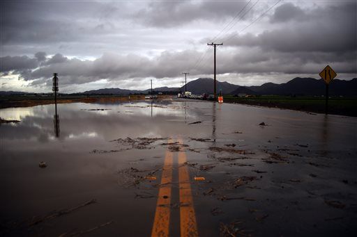
The “Phones and Drones” project aims to bring together drone images from citizens throughout the state to create a crowd-sourced map of the California coast, accurately recording the effects of El Niño to inform future conservancy efforts.

“Citizen scientists have the potential to capture far more images and at a more local scale than researchers could obtain on their own or through satellite data alone,” the Nature Conservancy statement explains.

“It’s incredible! You can take a picture and your phone automatically captures time, date, and a precise location. Geolocation features on phones are so good that you can map to within a meter or two of where you are,” says Sarah Newkirk, Senior Coastal Project Director for the Nature Conservancy in California. “We’ll be able to tell from time and date stamps on the pictures where they fall within the tidal cycle.”

DroneDeploy is a leading provider of cloud-based image processing software.  They will allow all of the citizen scientists in the project to process their geotagged imagery for free, creating “high-resolution orthomosaic maps, digital surface models, and 3D models of California’s coast.”

The Nature Conservancy scientists will use the crowd-sourced data to adjust their climate models to get an accurate, statewide picture of how sea level rise, flooding and erosion are affecting the California coastline.
The data and analysis will result in a map of the coastline available to everyone to view.

“We are pushing the boundaries of modeling sea level rise and storms by combining information on sea level rise with river floods, and looking at how coastal habitats like wetlands will change. The models are good and the results of different models mostly agree with one another, but they would benefit from ground-truthing,” says Newkirk.  “El Niño is a great opportunity to validate the models. It’s like looking through a crystal ball into a future of higher water levels and more frequent and severe storm events.”

Anyone with a phone and a drone can be part of this effort.  To participate in the Phones and Drones project, read the full DroneDeploy brief here.

Miriam McNabb

Miriam McNabb is the Editor-in-Chief of DRONELIFE and CEO of JobForDrones, a professional drone services marketplace, and a fascinated observer of the emerging drone industry and the regulatory environment for drones. Miriam has penned over 3,000 articles focused on the commercial drone space and is an international speaker and recognized figure in the industry.  Miriam has a degree from the University of Chicago and over 20 years of experience in high tech sales and marketing for new technologies.
For drone industry consulting or writing, Email Miriam.

TWITTER:@spaldingbarker

Subscribe to DroneLife here.

Filed Under: News Tagged With: CA, citizen science, Drone Deploy, el nino, flooding, nature conservancy, phones and drones

Reader Interactions

Trackbacks

  1. Citizen Science and Crowdsourced Maps to Save CA Coastline – The Drone Buzz .Com says:
    February 10, 2016 at 11:28 am

    […] Original Story: DroneLife […]

    Reply
  2. Citizen Science and Crowdsourced Maps to Save CA Coastline - FreeSkies - Drone Center says:
    January 20, 2016 at 9:18 pm

    […] Original Story: DroneLife […]

    Reply

Leave a Reply Cancel reply

Your email address will not be published. Required fields are marked *

Primary Sidebar

LATEST

Can Drones Replace High-Speed Police Pursuits? BRINC’s Guardian Points to a New Model

At the recent Motorola Solutions [NYSE: MSI], BRINC CEO Blake Resnick outlined a vision that challenges one of policing’s most…

Continue Reading Can Drones Replace High-Speed Police Pursuits? BRINC’s Guardian Points to a New Model

Can America Build a Fully Domestic Drone? Lithium Discovery Moves the Needle

New USGS findings highlight potential for domestic lithium supply, but key gaps remain in the battery chain A new study…

Continue Reading Can America Build a Fully Domestic Drone? Lithium Discovery Moves the Needle

Public Safety Drone Review: May 5, 2026 with BRINC CEO Blake Resnick

Join the Live Discussion on May 5 Register here for the May Public Safety Drone Review. The next Public Safety…

Continue Reading Public Safety Drone Review: May 5, 2026 with BRINC CEO Blake Resnick

Lawmakers Urge Expanded National Guard Role for Drone Security at 2026 FIFA World Cup

Letter calls for unified federal approach to counter-UAS operations across U.S. host cities U.S. lawmakers are calling on the federal…

Continue Reading Lawmakers Urge Expanded National Guard Role for Drone Security at 2026 FIFA World Cup

Skydio Raises $110M Series F, Signals Strong Revenue and U.S. Manufacturing Push

CEO Adam Bry highlights reduced capital needs as company expands production and commits billions to domestic manufacturing Skydio has raised…

Continue Reading Skydio Raises $110M Series F, Signals Strong Revenue and U.S. Manufacturing Push

Teledyne FLIR Defense Expands Payload Program with Emesent Hovermap for GPS-Denied Operations

New integration brings LiDAR mapping and radiation detection together across air and ground platforms Teledyne FLIR Defense has expanded its…

Continue Reading Teledyne FLIR Defense Expands Payload Program with Emesent Hovermap for GPS-Denied Operations

ideaForge Signs MoU with Japan’s DMP to Develop AI Drones

India’s largest UAV maker partners with Tokyo-based Digital Media Professionals to integrate edge AI silicon and enter the Japanese defense…

Continue Reading ideaForge Signs MoU with Japan’s DMP to Develop AI Drones

WISPR Systems’ SkyScout 2+ Earns Blue UAS Cleared List Approval

WISPR Systems’ SkyScout 2+ receives Blue UAS Cleared List designation from DCMA, validating the platform for federal, public safety, and…

Continue Reading WISPR Systems’ SkyScout 2+ Earns Blue UAS Cleared List Approval

SkyfireAI Raises $11M to Advance Autonomous Multi-Drone Operations for Public Safety

New platform aims to reduce operator workload while enabling coordinated drone response at scale SkyfireAI has announced an $11 million…

Continue Reading SkyfireAI Raises $11M to Advance Autonomous Multi-Drone Operations for Public Safety

What Starlink Actually Changes for Police Drones: A Look at BRINC’s Guardian

BRINC Guardian with Starlink: A New Standard for Drone as First Responder?Satellite connectivity, redundancy, and real-world range could reshape police…

Continue Reading What Starlink Actually Changes for Police Drones: A Look at BRINC’s Guardian

Secondary Sidebar

Footer

SPONSORED

Inspired Flight Gremsy IF800 VIO F1 drones geo week

What Will It Take to Strengthen U.S. Drone Manufacturing? A Conversation with Inspired Flight’s CEO

Global Mapper Mobile data collection

Collection Ground Control Points with Global Mapper Mobile

Military Drone Mapping Solutions

How SimActive’s Correlator3D™ is Revolutionizing Military Mapping: An Exclusive Interview with CEO Philippe Simard

Photogrammetry Accuracy Standards

SimActive Photogrammetry Software: Enabling Users to Meet Accuracy Standards for Over 20 Years

NACT Engineering Parrot ANAFI tether indoor shot

Smart Tether for Parrot ANAFI USA from NACT Engineering

Blue Marble, features global mapper, features Blue Marble

Check Out These New Features in Global Mapper v25 from Blue Marble

About Us | Contact Us | Advertise With Us | Write for Us | Privacy Policy | Terms of Service

The Trusted Source for the Business of Drones.

This website uses cookies and third party services. By clicking OK, you are agreeing to our privacy policy. ACCEPT

Manage consent

Privacy Overview

This website uses cookies to improve your experience while you navigate through the website. Out of these, the cookies that are categorized as necessary are stored on your browser as they are essential for the working of basic functionalities of the website. We also use third-party cookies that help us analyze and understand how you use this website. These cookies will be stored in your browser only with your consent. You also have the option to opt-out of these cookies. But opting out of some of these cookies may affect your browsing experience.
Necessary
Always Enabled
Necessary cookies are absolutely essential for the website to function properly. These cookies ensure basic functionalities and security features of the website, anonymously.
CookieDurationDescription
cookielawinfo-checkbox-analytics11 monthsThis cookie is set by GDPR Cookie Consent plugin. The cookie is used to store the user consent for the cookies in the category "Analytics".
cookielawinfo-checkbox-functional11 monthsThe cookie is set by GDPR cookie consent to record the user consent for the cookies in the category "Functional".
cookielawinfo-checkbox-necessary11 monthsThis cookie is set by GDPR Cookie Consent plugin. The cookies is used to store the user consent for the cookies in the category "Necessary".
cookielawinfo-checkbox-others11 monthsThis cookie is set by GDPR Cookie Consent plugin. The cookie is used to store the user consent for the cookies in the category "Other.
cookielawinfo-checkbox-performance11 monthsThis cookie is set by GDPR Cookie Consent plugin. The cookie is used to store the user consent for the cookies in the category "Performance".
viewed_cookie_policy11 monthsThe cookie is set by the GDPR Cookie Consent plugin and is used to store whether or not user has consented to the use of cookies. It does not store any personal data.
Functional
Functional cookies help to perform certain functionalities like sharing the content of the website on social media platforms, collect feedbacks, and other third-party features.
Performance
Performance cookies are used to understand and analyze the key performance indexes of the website which helps in delivering a better user experience for the visitors.
Analytics
Analytical cookies are used to understand how visitors interact with the website. These cookies help provide information on metrics the number of visitors, bounce rate, traffic source, etc.
Advertisement
Advertisement cookies are used to provide visitors with relevant ads and marketing campaigns. These cookies track visitors across websites and collect information to provide customized ads.
Others
Other uncategorized cookies are those that are being analyzed and have not been classified into a category as yet.
SAVE & ACCEPT