
Wingcopter’s long-range Wingcopter 198 drone will be deployed for aerial surveying in Japan under a new collaboration between ITOCHU Corporation, PASCO Corporation, and YellowScan Japan Co., Ltd. The partners have signed an MOU to apply the platform to disaster management, terrain mapping, and post-event restoration tasks. The Wingcopter 198 combines vertical takeoff and … [Read more...] about Wingcopter 198 Drones to Support Aerial Surveying in Japan
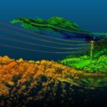
Yellowscan
Orkid Unveils All-in-One Drone Combining LiDAR, Photogrammetry, GNSS, and Starlink

Orkid has announced a new variant of its ORKID 260 vertical take-off and landing (VTOL) drone, bringing together four of the most advanced aerial data capture technologies into one integrated, NDAA-compliant system. The ORKID 260VTOL integrated drone combines LiDAR, photogrammetry, GNSS, and Starlink satellite connectivity onboard, allowing all systems to operate … [Read more...] about Orkid Unveils All-in-One Drone Combining LiDAR, Photogrammetry, GNSS, and Starlink
Headed to INTERGEO 2025? Unmanned Systems Take Center Stage in Frankfurt

Exhibitors, product launches, and presentations highlight drones’ expanding role in mapping, monitoring, and emergency response. The world’s largest geospatial event, INTERGEO 2025, returns to Frankfurt from October 7–9, 2025. This year, drones and unmanned systems are in the spotlight across the exhibition floor and conference stages. From new product launches to in-depth … [Read more...] about Headed to INTERGEO 2025? Unmanned Systems Take Center Stage in Frankfurt
Velodyne LiDAR and YellowScan Partner for Integrated LiDAR for UAVs
Velodyne LiDAR Inc., a developer of 3D vision systems for autonomous vehicles, announced that it is partnering with YellowScan to integrate its VLP-16 Puck and VLP-16 Puck LITE LiDAR sensors into YellowScan’s Surveyor for a turn-key and reliable LiDAR system for UAV applications. “YellowScan is known for its commitment to providing reliable and easy to use … [Read more...] about Velodyne LiDAR and YellowScan Partner for Integrated LiDAR for UAVs


