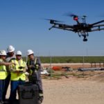
Tonight's the night for Episode 2 of the History Channel's fascinating adventure: Lost Gold of World War II. This episode has an added interest for the drone industry, as a drone pilot and two data scientists from leading drone firm PrecisionHawk used LiDAR-equipped drones to help find a real life treasure. "Lost Gold of World War II uncovers the quest to … [Read more...] about DRONELIFE Exclusive: Flying Drones in the Phillipines to Find Lost Gold – An Interview with PrecionHawk’s Intrepid Team
PrecisionHawk
Evaluating the Economics of BVLOS Drone Operations
Skylogic Research, the leading commercial drone industry research and advisory services firm, just announced the release of their latest research on commercial drone operations. The Economics of Using Drones for BVLOS Inspections is a white paper sponsored by PrecisionHawk, the leading provider of drone technology for the enterprise, which provides a foundation for businesses … [Read more...] about Evaluating the Economics of BVLOS Drone Operations
PrecisionHawk Acquires Drone Inspection Firm Uplift
Drone tech provider PrecisionHawk, has purchased inspection service Uplift Data Partners. Uplift provides turn-key inspection services for construction and building information management (BIM) as well as for real-estate. The company’s nationwide network of commercially trained drone pilots will join PrecisionHawk’s Droners.io network which consists of more than 15,000 … [Read more...] about PrecisionHawk Acquires Drone Inspection Firm Uplift
DJI Refines Geofencing and Ditches AirMap for PrecisionHawk
DJI has announced improvements to its geofencing technology. The move will refine airspace limitations for drone flights near airports to provide better protection to airplanes in sensitive areas. The GEO update will be backed by geospatial data from PrecisionHawk, replacing Airmap, the Santa Monica-based company DJI had been working with since 2015. GEO 2.0 will be … [Read more...] about DJI Refines Geofencing and Ditches AirMap for PrecisionHawk
PrecisionHawk Announces DJI Partnership
The following is press release from PrecisionHawk. PrecisionHawk’s Low Altitude Traffic and Airspace Safety (LATAS) platform to replace AirMap PrecisionHawk, Inc. today announced a partnership with DJI, the world’s leader in civilian drones and aerial imaging technology, to improve its geofencing technology. Leveraging PrecisionHawk’s Low Altitude Traffic and Airspace … [Read more...] about PrecisionHawk Announces DJI Partnership


