
New update delivers user-driven interface improvements, expanded visualization tools, and enhanced file format support. Blue Marble Geographics has announced the release of Global Mapper® v26.2, the latest version of its all-in-one GIS software. The update was introduced this week at Intergeo 2025, the international mapping conference taking place in Frankfurt, Germany this … [Read more...] about Blue Marble Geographics Unveils Global Mapper® v26.2 at Intergeo 2025
mapping software
SimActive Releases Correlator3D Version 10.4 with Enhanced 3D Model Controls
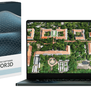
New Update Offers Greater Flexibility for Photogrammetry and LiDAR Workflows SimActive Inc., a leading developer of photogrammetry software, has released Version 10.4 of its Correlator3D platform. This new version gives users more control over 3D model creation, with advanced tools for both photogrammetry and LiDAR data. Full Control for Diverse Workflows Correlator3D … [Read more...] about SimActive Releases Correlator3D Version 10.4 with Enhanced 3D Model Controls
SimActive’s Correlator3D™ 10.3: Revolutionizing Large-Scale Mapping with Enhanced Speed and Flexibility
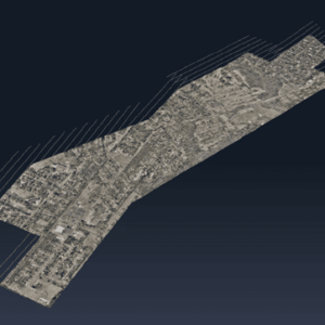
The latest update tackles big data challenges with optimized workflows and multi-platform integration, delivering powerful solutions for commercial and military applications. by DRONELIFE Staff Writer Ian J. McNabb Quebec-based software developer SimActive Inc. recently announced the release of the new Correlator3D™ Version 10.3, updating their popular mapping solution to … [Read more...] about SimActive’s Correlator3D™ 10.3: Revolutionizing Large-Scale Mapping with Enhanced Speed and Flexibility
SimActive Releases Correlator3D Version 10.2 With Enhanced Editing Tools
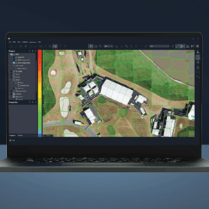
New Features Aim to Streamline Military and Commercial Mapping Operations SimActive Inc. has announced the release of Correlator3D™ Version 10.2, introducing significant upgrades designed to improve productivity and reduce editing time for both military and commercial users. The latest version of Correlator3D™ offers a comprehensive overhaul of mosaic and point cloud editing … [Read more...] about SimActive Releases Correlator3D Version 10.2 With Enhanced Editing Tools
Skyebrowse Introduces Affordable Photogrammetry Software Tier

New Lite Option Expands Access to Advanced Photogrammetry Features for Diverse Industries by DRONELIFE Staff Writer Ian J. McNabb Texas-based mapping software developer Skyebrowse recently announced a new “Lite” tier for their flagship affordable photogrammetry software, making access to high-quality mapping more accessible for organizations than ever. While missing … [Read more...] about Skyebrowse Introduces Affordable Photogrammetry Software Tier


