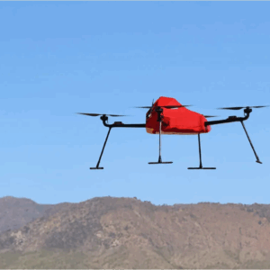
ZenaTech Launches ZenaDrone IQ Quad for Survey and Mapping Markets New autonomous quadcopter targets land surveying, construction, urban planning, and public works ZenaTech has announced the launch of the ZenaDrone IQ Quad, a new autonomous quadcopter designed for survey and mapping work. The drone will support land surveying, construction, urban planning, real estate … [Read more...] about Another New Drone from ZenaTech
drone surveying
The Engineering Behind UgCS: Insights from Kristaps Brass on the Future of Drone Flight Planning
Drone technology is evolving at a rapid pace, and with it comes the need for more advanced, reliable, and user-friendly flight planning software. At the forefront of this innovation is UgCS, developed by SPH Engineering. To gain a deeper understanding of the engineering challenges and breakthroughs behind UgCS, we interviewed Kristaps Brass, the company’s Product Owner and an … [Read more...] about The Engineering Behind UgCS: Insights from Kristaps Brass on the Future of Drone Flight Planning
SimActive’s Correlator3D Speeds Up Processing of Large Drone Datasets for SurvTech

Advanced photogrammetry software supports rapid delivery of high-quality geospatial products SimActive Inc., a global developer of photogrammetry software, has announced that SurvTech Solutions is using its Correlator3D product to process large-scale image datasets from drones and large-format cameras. The software enables SurvTech to deliver digital surface models and … [Read more...] about SimActive’s Correlator3D Speeds Up Processing of Large Drone Datasets for SurvTech
Wingcopter Secures New Funding and Strengthens Leadership Team

Fresh capital and new executives set to boost global drone operations Wingcopter, a leading German drone technology company, secures new funding from Copenhagen-based Nordic Secondary Fund, as well as existing shareholders and the European Investment Bank. The latest investment will support Wingcopter’s growth, including progress toward type certification for delivery drones … [Read more...] about Wingcopter Secures New Funding and Strengthens Leadership Team
Photogrammetry vs. LiDAR: Choosing the Right Tool for the Job, with Dr. Philippe Simard

SimActive Inc. has played a pivotal role in the evolution of geospatial data processing since its founding in 2003. Leading the company is Dr. Philippe Simard, a pioneer in the industry with a doctorate in electrical engineering from McGill University, specializing in computer vision. Under Dr. Simard’s leadership, SimActive’s flagship software, Correlator3D™, has become a … [Read more...] about Photogrammetry vs. LiDAR: Choosing the Right Tool for the Job, with Dr. Philippe Simard


