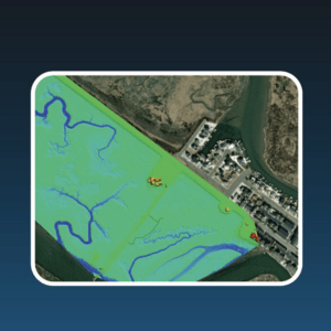
Correlator3D streamlines image processing for the Joint Airborne Lidar Bathymetry Technical Center of Expertise, enhancing topo-bathy lidar mapping efficiency. by DRONELIFE Staff Writer Ian J. McNabb SimActive Inc. recently announced that their Correlator3D product was deployed by the US Army Corps of Engineers for corridor mapping. The software is used to … [Read more...] about US Army Corps of Engineers Deploys SimActive’s Correlator3D for Coastal Corridor Mapping
coastal mapping
Drones Take Science to New Heights: UAF Research at AGU24
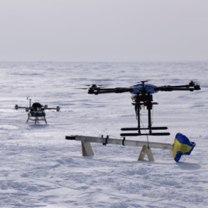
Exploring Snow, Sea Ice, and Remote Education with UAV Technology Scientists from the University of Alaska Fairbanks (UAF) Geophysical Institute are leveraging drone technology to push the boundaries of research in challenging environments. At the 2024 American Geophysical Union (AGU) Fall Meeting, UAF researchers will present innovative projects showcasing drones’ … [Read more...] about Drones Take Science to New Heights: UAF Research at AGU24


