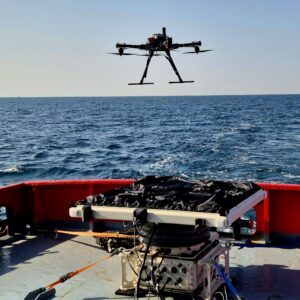
As offshore energy assets move farther from shore, operators face growing challenges in inspection, maintenance, and emergency response. This week, maritime autonomous infrastructure developer WaiV Robotics announced its official entry into the U.S. market, bringing its autonomous drone launch and recovery technology to offshore operators across the country. The London-based … [Read more...] about WaiV Robotics Brings Autonomous Drone Recovery at Sea to U.S. Offshore Operators
ocean
Saildrone Deploys 16 Voyager USVs for Coast Guard Great Lakes Mission
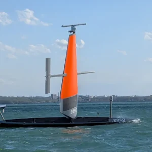
The Bay Area autonomous maritime company brings persistent surveillance to the Great Lakes and Northeast under a $15.5 million Coast Guard contract. Saildrone is deploying 16 Voyager unmanned surface vehicles in support of US Coast Guard missions across the Great Lakes and the Northeast. The Alameda, California-based company announced the deployment on May 11, 2026. The deal … [Read more...] about Saildrone Deploys 16 Voyager USVs for Coast Guard Great Lakes Mission
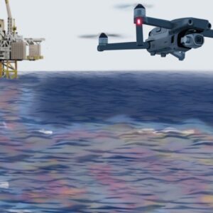
WaiV Robotics Debuts Maritime VTOL Landing Pad with $7.5M Seed Round

The London-based maritime startup unveils a gyro-stabilized landing pad that recovers VTOL drones on vessels as small as 10 meters in high sea states. WaiV Robotics has launched the first fully automatic landing and takeoff platform for VTOL drones operating at sea. The London-based company introduced the system on May 5, 2026, backed by $7.5 million in seed funding. The … [Read more...] about WaiV Robotics Debuts Maritime VTOL Landing Pad with $7.5M Seed Round
Texas A&M Team Uses Drones to Map Ocean Currents
By Dronelife Features Editor Jim Magill When an offshore platform experiences a massive blowout resulting in an oil spill covering a vast expanse of ocean waters, recovery teams require accurate data on ocean currents to quickly initiate the cleanup. In past years, it was often difficult and expensive to collect such data, but over the last decade or so, a team of … [Read more...] about Texas A&M Team Uses Drones to Map Ocean Currents
Drone Blow Sampling Helps Researchers Track Sick Whales

Researchers have demonstrated the effectiveness of consumer drone technology for non-invasive pathogen surveillance in free-ranging whales across the North Atlantic, marking a significant advancement in marine mammal health monitoring. A study published in BMC Veterinary Research documented the use of a DJI Mavic 2 Pro equipped with specialized sampling apparatus to detect … [Read more...] about Drone Blow Sampling Helps Researchers Track Sick Whales


