
By Dronelife Features Editor Jim Magill
When an offshore platform experiences a massive blowout resulting in an oil spill covering a vast expanse of ocean waters, recovery teams require accurate data on ocean currents to quickly initiate the cleanup. In past years, it was often difficult and expensive to collect such data, but over the last decade or so, a team of researchers at Texas A&M University has studied ways to use drones to collect ocean current data rapidly and inexpensively.
For example, using low-cost, commercially available hand-held drones that are launched from boats, the team is able to collect images of ocean waves, which are then analyzed in a laboratory to accurately measure the currents in a particular stretch of ocean, Scott Socolofsky, the research team’s leader said in an interview.
“We hover at one location for about 30 seconds for each measurement, said Socolofsky, an affiliate professor in the university’s Department of Ocean Engineering and Department of Oceanography. “We take those videos and then for each 30 seconds of video, we break the image down into smaller sub-images where we want to get a velocity measurement.”
Flying at an altitude of 400 feet, the maximum height allowed under FAA regulations, the drone can capture images of an area of ocean about 90 meters (295 feet)-by-120 meters (about 395 feet). Using a radar gun, of the type deployed by traffic cops to catch speeders, and the drone-captured images, researchers are able to utilize the Doppler effect — a change in wave frequency caused by underlying water movement — to accurately calculate surface current velocity.
“In this case, our signal is the sunlight reflections off of the ocean surface that give you the visual impression of all the waves — the big, long waves, the short waves, the choppy wind waves — everything contributes to that signal,” Socolofsky said.
The researchers also use the Fourier transform, a mathematical tool that breaks down a complex time-based signal into its constituent frequencies, to determine the relationship between the length of the waves and the frequency of the waves.
Vivek Bheeroo, a graduate student working on the ocean-currents project, said the team is able to create large maps of different current features by just hovering the drone sequentially over a series of measurement points.
“Often it isn’t necessary, but it’s easier in the field if you want to do a specific survey to have waypoints preloaded into the drone flight plan so that you can launch the drone by hand, get on station, and then let it work through a series of way points and come back,” Bheeroo said. Once the UAV has completed its reporting mission, it returns to the boat where the operators can bring it in by hand.
Researchers Were Early Drone Adopters
The Texas A&M scientists have a long history of deploying UAVs in their research. They began the practice about a decade ago, using a drone to measure the hydrodynamic actions of breaking waves, observing the bubbles they formed to track their velocity.
One of the team’s early purchases was a DJI Phantom, a consumer quadcopter, which featured GPS-stabilized flight and a mount for a GoPro camera, which gave the researchers the eye in the sky they needed for their maritime studies, Socolofsky said.
Over the next several years, the team assembled a fleet of UAVs, including about a dozen DJI drones. For a time, they relied on the Mavic 2 Pro as the workhorse of their research projects. However, as concerns over data security began to rise, the use of Chinese-made drones and associated products began to fall out of favor in the Lone Star State and in 2022 Texas Governor Greg Abbott issued a directive, banning the use of DJI products by state agencies—including public universities.
Bheeroo said the team currently flies ban-compliant drones such as the Specta Air, which offers similar features and performance to the Mavic 2 Pro.
“They offer high-resolution output and 4K images. We typically have them record at 24 frames per second because that’s sufficient for our applications. But we can record at higher frame rates if we would like to for more cinematic shots,” he said.
The UAVs also perform well in windy conditions such as those frequently encountered in the offshore environment. Bheeroo said the team’s drones have been flown in wind speeds of 20 mph, and up 25 mph.
For tasks requiring a more heavy-lift UAV, the team flies an Aurelia X6 MAX, a hexacopter capable of carrying up to 13 pounds (6 kg) of payload with a maximum flight time of 70 minutes.
Graduate student Mu-Jung Lee said the five-foot diameter drone is equipped with a multi-camera array, including an infrared camera for nighttime surveys. The camera system allows the researchers to capture a large-field view, of up to about 100 meters (330 feet)-by-500 meters (1,640 feet).
Unlike the small quadcopters, which can be launched from boats, because of its large size, the X6 MAX must take off and land from the shore, Lee said.
Early Funding Opportunity a Result of Oilfield Disaster
Part of the funding for Texas A&M’s UAS-based maritime research is from the National Oceanic and Atmospheric Administration (NOAA) RESTORE Science program, the largest environmental restoration effort in U.S. history, which was established to address the impacts of the 2010 Deepwater Horizon oil spill. A large part of the grant money comes from a $20.8 billion settlement with Deepwater Horizon owner BP.
The research program has also received grant moneys from the Texas General Land Office through that agency’s oil-spill science program, Socolofsky said.
“The application that we have been focused on mostly so far is related to trajectory modeling. Where does oil go after you spill it in the ocean?” he said. But the research is also providing useful information for all fields of study relating to coastal oceanography and coastal engineering “where you want to know what the near surface current fields are.”
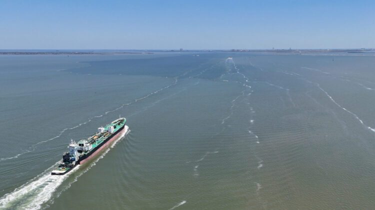
Through field studies in and around the barrier islands of Galveston Bay, the researchers are seeking to answer questions about the complex current system of the bay, such as the mechanics that guide the mixing of bay water with the waters of the open Gulf of Mexico.
“One of the unique features of Texas bays is that they’re very relatively large in surface area, 20 to 40 miles across and about three meters deep on average, but then they’re cut by these shipping channels that are 16-and-a-half meters deep,” Socolofsky said. “And those shipping channels obviously are important for shipping, but they pose a lot of challenges to numerical models that we would use to predict the currents in the bay.”
Read More
- FCC Updates Covered List, Introduces First Conditional Approvals for Drone Systems
- Volatus Aerospace Graduates to Toronto Stock Exchange
- Windracers ULTRA to Map Greenland’s Petermann Glacier
 Jim Magill is a Houston-based writer with almost a quarter-century of experience covering technical and economic developments in the oil and gas industry. After retiring in December 2019 as a senior editor with S&P Global Platts, Jim began writing about emerging technologies, such as artificial intelligence, robots and drones, and the ways in which they’re contributing to our society. In addition to DroneLife, Jim is a contributor to Forbes.com and his work has appeared in the Houston Chronicle, U.S. News & World Report, and Unmanned Systems, a publication of the Association for Unmanned Vehicle Systems International.






Leave a Reply