It really interesting to make note of the different approaches that are used to solve problems. In this case university research seeks to learn how to teach a drone how to travel though a confined space by emulating the flight patterns of birds and bees. There are different approaches to solve the problem of flying in a confined space and this one uses an approach called … [Read more...] about Teaching Drones to Travel in Small spaces by Watching the Birds and the Bees
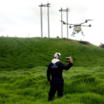
Agriculture
DroneDeploy: Jono Millin Talks About Current and Future Directions for the Industry

It's been another big year for DroneDeploy. Another $25 million funding round and a steady stream of new product announcements has kept them in the headlines. With over 30,000 users of its drone data mapping platform, and the largest app marketplace in the business, DroneDeploy is a major player in the drone industry. As the company's co-founder, Jono Millin has a front row … [Read more...] about DroneDeploy: Jono Millin Talks About Current and Future Directions for the Industry
Making Sense of Big Drone Data with Optelos

Commercial drone adoption is currently at an all-time high. But we’re still far from where drones are fully integrated into the processes that make businesses grow. Maybe we are not quite as the level of the pioneers of aviation like the Wright brothers were but let's agree that we are early in the process. As builders, growers, engineers, and the like continue to scale … [Read more...] about Making Sense of Big Drone Data with Optelos
Drones are Being Enlisted to Tackle Colombia’s Cocaine Farms
We're not quite at the stage at which drones are taking an active role in day to day agriculture. Despite hardware releases from DJI and other manufacturers with a view to autonomously sowing seeds and dispensing pesticides, most drone applications on the farm are more passive in nature: field mapping, crop health checks, that sort of thing. However, the Colombian government … [Read more...] about Drones are Being Enlisted to Tackle Colombia’s Cocaine Farms
FOXTECH: Providing Cost-Effective Solutions for Enterprise Drone Mapping Missions

Foxtech is one of China's largest online sources for industrial multicopters, fixed -wing and VTOL products. These commercial-grade drones are suitable for surveying, mapping, power line inspection and a wide variety of other commercial applications. The NIMBUS VTOL Mapping Version is one of their newest offerings: a best-selling and cost-effective drone for mapping and … [Read more...] about FOXTECH: Providing Cost-Effective Solutions for Enterprise Drone Mapping Missions


