• Skip to main content
  • Skip to secondary menu
  • Skip to primary sidebar
  • Skip to secondary sidebar
  • Skip to footer
  • DroneRacingLife
  • DroneFlyers
  • Newsletter
DroneLife

DRONELIFE

Stay up to date on all the latest Drone News

  • News
  • Products
  • Industries
    • Agriculture
    • Construction
    • Delivery
    • Dual Use
    • Inspection
    • Public Safety
    • Surveying
  • Enthusiasts
  • Regulations
  • Business
  • Video
  • Podcasts

Elk Grove Police Receive First FAA Waiver for Citywide 400-Foot Drone as First Responder Operations

February 5, 2025 by Miriam McNabb 1 Comment

New FAA Waiver Enhances Drone as First Responder Capabilities

The Federal Aviation Administration (FAA) has granted the Elk Grove Police Department (EGPD) a waiver to operate its Drone as First Responder (DFR) program up to 400 feet across the city without requiring human observers. This waiver, secured with the support of Flock Safety, allows the department to deploy its radar-based Flock Aerodome system, significantly expanding its operational capabilities.

Flock Aerodome

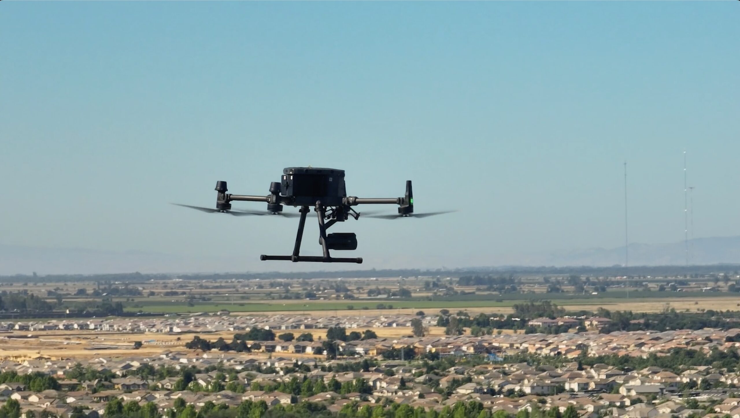
The waiver enables beyond visual line of sight (BVLOS) operations at higher altitudes than previous jurisdiction-wide approvals. The Flock Aerodome system, which consists of multiple drone docks, supports remote piloting and uses radar-based detect-and-avoid (DAA) technology to autonomously mitigate collision risks.

Advantages of 400-Foot Drone Operations

Operating drones at 400 feet provides several benefits for first responders:

  • Expanded Field of View: A drone at 400 feet has four times the coverage area compared to one at 200 feet, allowing faster searches for suspects and missing persons.
  • Improved Response Times: By covering larger areas more quickly, the system reduces the time required to gain situational awareness during emergency calls.
  • Enhanced Safety and Stealth: Higher altitudes make drones quieter and less visible, reducing the likelihood of alerting suspects and lowering community noise complaints.

Flock Safety’s Vice President of Aviation, Rahul Sidhu, emphasized the importance of optimizing altitude for public safety operations. “Many of us are first responders ourselves, and our vision has always been to provide our customers with technology to support their BVLOS operations at whatever altitude they feel is best for their mission,” said Sidhu. “We are honored to have worked with the FAA to ensure that the Elk Grove Police Department becomes the first of many agencies to operate a truly next-generation Drone as First Responder program.”

Elk Grove Police Achieves a Milestone in Public Safety Technology

EGPD Chief Bobby Davis highlighted the significance of this achievement for law enforcement agencies nationwide. “We are incredibly proud to lead the way as the first law enforcement agency in the nation to secure a BVLOS waiver, with the assistance of Flock Safety,” Davis said. “This milestone exemplifies our commitment to leveraging cutting-edge solutions to enhance public safety and better serve our Elk Grove community.”

The department recently surpassed 1,000 drone flights, demonstrating the impact of DFR technology in real-world applications. The ability to fly at 400 feet expands the range and effectiveness of drone deployments, helping officers respond to incidents more efficiently while reducing risks associated with traditional policing methods.

Industry Insights on 400-Foot Drone Operations

Rahul Sidhu shared additional perspective on the operational advantages of flying at 400 feet, drawing from his experience launching one of the first DFR programs in Redondo Beach, California. “The higher we fly, the better vantage we have. We can be virtually on-scene faster with less obstructions,” said Elk Grove Police Lt. Nate Lange.

Sidhu also noted that noise complaints from the community decreased significantly when drones operated at higher altitudes. Former Redondo Beach Police Chief Keith Kauffman confirmed this, stating, “We used to fly at around 200 feet and we got too many complaints. We switched to 400 feet and the amount of complaints plummeted.”

Additionally, flying at 400 feet allows drones to maintain tactical effectiveness by reducing their visibility and noise signature. “We don’t always want to be seen. If we did, we can always lower our drone to 200 feet. It’s better to have the option for stealth than be seen all the time,” said Lt. Lange.

Looking Ahead

The FAA’s approval of Elk Grove Police Department’s BVLOS waiver marks a significant step forward for DFR programs nationwide. By demonstrating the benefits of higher-altitude drone operations, EGPD and Flock Safety are setting a precedent for other law enforcement agencies looking to enhance their public safety efforts.

For more information about Flock Aerodome, visit Flock Safety.

Want DRONELIFE news delivered to your inbox every weekday?  Sign up here.

Read more:

  • DRONELIFE Exclusive Interview: Flock Safety’s Vision for High-Tech Crimefighting with DFR
  • Aerodome and Flock Safety Partner to Expand Drone-As-First-Responder Technology
  • Palm Springs Police Department Aims to Revolutionize Drone Response with DFR 2.0


Miriam McNabb

Miriam McNabb is the Editor-in-Chief of DRONELIFE and CEO of JobForDrones, a professional drone services marketplace, and a fascinated observer of the emerging drone industry and the regulatory environment for drones. Miriam has penned over 3,000 articles focused on the commercial drone space and is an international speaker and recognized figure in the industry.  Miriam has a degree from the University of Chicago and over 20 years of experience in high tech sales and marketing for new technologies.
For drone industry consulting or writing, Email Miriam.

TWITTER:@spaldingbarker

Subscribe to DroneLife here.

Filed Under: Drone News, Drone News Feeds, Drones in the News, Featured – Safety and Security, News, Selected – Safety and Security Tagged With: BVLOS waiver, detect-and-avoid system, drone as first responder, drone response times, Elk Grove Police, FAA drone approval, Flock Aerodome, law enforcement technology, police drone operations, Public Safety Drones

Reader Interactions

Comments

  1. Iamuprise says

    February 7, 2025 at 1:47 pm

    This is too much. How much power/freedoms are we to give up. Using a drone to find or get a better viewpoint of a situation is one thing. But allowing law and police these abilities is problematic. If the general public is allowed the same use of this technology then that’s fair. Personally I have regrets to allowing someone to fly without keeping an eye on it at all times. What happens if there’s an accident? Do they get fined or does the pilot get jail time? I can see in the future drones being flown overhead issuing tickets or worse. Some level of control on what they can actually do needs to be in place before we allow police to fly in such a way. This is a case of technology moving to fast vs. society’s way of life.

    Reply

Leave a Reply Cancel reply

Your email address will not be published. Required fields are marked *

Primary Sidebar

LATEST

Volocopter Unveils VoloXPro and Expands into Pilot Training Market, Air Sports

New ultralight multicopter targets private pilots, training organizations, and future air taxi operators Volocopter has introduced the VoloXPro, a new…

Continue Reading Volocopter Unveils VoloXPro and Expands into Pilot Training Market, Air Sports

Matternet Launches NHS Drone Deliveries in Central London

New service connects major hospital campuses to move critical medical items in minutes Matternet has launched drone delivery operations for…

Continue Reading Matternet Launches NHS Drone Deliveries in Central London

As Drone Delivery Expands, Communities Remain Uncertain

County denies Walmart bid to start drone deliveries By DRONELIFE Features Editor Jim Magill A board of Georgia county officials…

Continue Reading As Drone Delivery Expands, Communities Remain Uncertain

Rogue Drone Detected. Now What?

SkySafe and Motorola Solutions integration highlights the next step in managing low-altitude airspace At the Motorola Solutions Summit 2026 this…

Continue Reading Rogue Drone Detected. Now What?

New DJI Drones Launch Globally, But Not in the U.S.

Court filing highlights FCC restrictions as new products debut without U.S. availability Drone giant DJI has introduced new consumer drones,…

Continue Reading New DJI Drones Launch Globally, But Not in the U.S.

NYC Tests Cargo Drones to Cut Traffic and Speed Medical Deliveries

Port Authority Launches Yearlong Cargo Drone Trial Over East River. Skyports partnership aims to test middle-mile delivery, reduce congestion, and…

Continue Reading NYC Tests Cargo Drones to Cut Traffic and Speed Medical Deliveries

AirData and BRINC Integration Brings Automated Flight Records to Public Safety Drone Programs

New integration captures flight data automatically, supporting scalable and auditable drone operations AirData has announced a new integration with BRINC,…

Continue Reading AirData and BRINC Integration Brings Automated Flight Records to Public Safety Drone Programs

Sentrycs Lands Major Counter-Drone Contracts Across World Cup Cities

Sentrycs systems to protect skies in U.S., Mexico, Canada By DRONELIFE Features Editor Jim Magill (Editor’s note: This is part…

Continue Reading Sentrycs Lands Major Counter-Drone Contracts Across World Cup Cities

Kraus Hamdani Aerospace Demonstrates Wireless Power Beaming to K1000ULE at Shaw AFB

Kraus Hamdani Aerospace and PowerLight Technologies sustain the K1000ULE in flight using laser-based wireless power beaming, maintaining continuous ISR operations…

Continue Reading Kraus Hamdani Aerospace Demonstrates Wireless Power Beaming to K1000ULE at Shaw AFB

Sion Power Launches Two High Energy Density Batteries for Military Drones

Sion Power’s Licerion Strike and Echo cells exceed 500 Wh/kg, enabling combat drones to fly two to three times longer…

Continue Reading Sion Power Launches Two High Energy Density Batteries for Military Drones

Secondary Sidebar

Footer

SPONSORED

Inspired Flight Gremsy IF800 VIO F1 drones geo week

What Will It Take to Strengthen U.S. Drone Manufacturing? A Conversation with Inspired Flight’s CEO

Global Mapper Mobile data collection

Collection Ground Control Points with Global Mapper Mobile

Military Drone Mapping Solutions

How SimActive’s Correlator3D™ is Revolutionizing Military Mapping: An Exclusive Interview with CEO Philippe Simard

Photogrammetry Accuracy Standards

SimActive Photogrammetry Software: Enabling Users to Meet Accuracy Standards for Over 20 Years

NACT Engineering Parrot ANAFI tether indoor shot

Smart Tether for Parrot ANAFI USA from NACT Engineering

Blue Marble, features global mapper, features Blue Marble

Check Out These New Features in Global Mapper v25 from Blue Marble

About Us | Contact Us | Advertise With Us | Write for Us | Privacy Policy | Terms of Service

The Trusted Source for the Business of Drones.

This website uses cookies and third party services. By clicking OK, you are agreeing to our privacy policy. ACCEPT

Manage consent

Privacy Overview

This website uses cookies to improve your experience while you navigate through the website. Out of these, the cookies that are categorized as necessary are stored on your browser as they are essential for the working of basic functionalities of the website. We also use third-party cookies that help us analyze and understand how you use this website. These cookies will be stored in your browser only with your consent. You also have the option to opt-out of these cookies. But opting out of some of these cookies may affect your browsing experience.
Necessary
Always Enabled
Necessary cookies are absolutely essential for the website to function properly. These cookies ensure basic functionalities and security features of the website, anonymously.
CookieDurationDescription
cookielawinfo-checkbox-analytics11 monthsThis cookie is set by GDPR Cookie Consent plugin. The cookie is used to store the user consent for the cookies in the category "Analytics".
cookielawinfo-checkbox-functional11 monthsThe cookie is set by GDPR cookie consent to record the user consent for the cookies in the category "Functional".
cookielawinfo-checkbox-necessary11 monthsThis cookie is set by GDPR Cookie Consent plugin. The cookies is used to store the user consent for the cookies in the category "Necessary".
cookielawinfo-checkbox-others11 monthsThis cookie is set by GDPR Cookie Consent plugin. The cookie is used to store the user consent for the cookies in the category "Other.
cookielawinfo-checkbox-performance11 monthsThis cookie is set by GDPR Cookie Consent plugin. The cookie is used to store the user consent for the cookies in the category "Performance".
viewed_cookie_policy11 monthsThe cookie is set by the GDPR Cookie Consent plugin and is used to store whether or not user has consented to the use of cookies. It does not store any personal data.
Functional
Functional cookies help to perform certain functionalities like sharing the content of the website on social media platforms, collect feedbacks, and other third-party features.
Performance
Performance cookies are used to understand and analyze the key performance indexes of the website which helps in delivering a better user experience for the visitors.
Analytics
Analytical cookies are used to understand how visitors interact with the website. These cookies help provide information on metrics the number of visitors, bounce rate, traffic source, etc.
Advertisement
Advertisement cookies are used to provide visitors with relevant ads and marketing campaigns. These cookies track visitors across websites and collect information to provide customized ads.
Others
Other uncategorized cookies are those that are being analyzed and have not been classified into a category as yet.
SAVE & ACCEPT