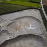
Drones equipped with high resolution lenses are a powerful tool in the fight to protect wildlife around the world. Here, Yasuo Baba of Sony Digital Imaging gives us the specifics of the project between Quantum-Systems and Wilderness International. The following is a guest post by Yasuo Baba, Director, Digital Imaging and European Product Marketing, Sony Digital Imaging … [Read more...] about Drones and High Resolution Lenses Protect Wildlife Around the World: Quantum Systems and Wilderness International in Peru
Imaging
CHEESEHEAD Drone Project May Improve Climate Models
What do the Green Bay Packers and forest-scanning drones have in common? Cheeseheads. While Packer fans proudly identify with the dairy-infused moniker, a research project at the University of Wisconsin-Madison has adapted the name for a ground-breaking UAV project to improve weather forecasting by understanding how vegetation and forests influence the … [Read more...] about CHEESEHEAD Drone Project May Improve Climate Models
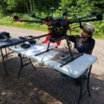
Auterion Partners with Workswell to Optimize Drone Thermal Cameras

Drone software provider Auterion is teaming up with European thermal-imaging company Workswell to produce precision, bispectral UAV cameras. The aerial marriage will make it easier for drone manufacturers to use Auterion’s open-standards software platform to integrate with Workswell’s WIRIS Pro and WIRIS Security thermal imaging cameras. The companies expect the announced … [Read more...] about Auterion Partners with Workswell to Optimize Drone Thermal Cameras
Orthophoto Survey Drones Help Predict Flash Flooding
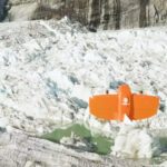
Orthophoto survey drones are providing new insights to scientists tracking ice and water levels in Alaska. A research team led by Gabriel Wolken of the University of Alaska Fairbank's Climate Adaptation Science Center has been measuring rising and falling ice and water levels in Suicide Basin glacial lake just outside Juneau. By working to visualize and predict the … [Read more...] about Orthophoto Survey Drones Help Predict Flash Flooding
An Insider Look at an Edinburgh University Researcher’s Drone Project in the Andes – the Drones, the Sensors, and the Software
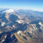
Researchers from Edinburgh University are using drones to study and demarcate global warming, and to determine how it is affecting glaciers in the Andes, a recent BBC article reports. DRONELIFE reached out to the makers of the drones to learn more about the project - but first, the research. Researches from a variety of sources have estimated that the glaciers have … [Read more...] about An Insider Look at an Edinburgh University Researcher’s Drone Project in the Andes – the Drones, the Sensors, and the Software


