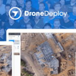
It's been another big year for DroneDeploy. Another $25 million funding round and a steady stream of new product announcements has kept them in the headlines. With over 30,000 users of its drone data mapping platform, and the largest app marketplace in the business, DroneDeploy is a major player in the drone industry. As the company's co-founder, Jono Millin has a front row … [Read more...] about DroneDeploy: Jono Millin Talks About Current and Future Directions for the Industry
Mining and Aggregates
Making Sense of Big Drone Data with Optelos

Commercial drone adoption is currently at an all-time high. But we’re still far from where drones are fully integrated into the processes that make businesses grow. Maybe we are not quite as the level of the pioneers of aviation like the Wright brothers were but let's agree that we are early in the process. As builders, growers, engineers, and the like continue to scale … [Read more...] about Making Sense of Big Drone Data with Optelos
Insitu’s Photogrammetry Payload Pushes Theoretical Limits of Accuracy

Boeing subsidiary Insitu has revealed that its latest advancements in High Accuracy Photogrammetry (HAP) are pushing the theoretical limits of aerial photography at altitude. Last month Insitu’s latest prototype carried a HAP payload that can capture images accurate to within five centimeters (cm) horizontally and 10cm vertically. Insitu describes this new capability as … [Read more...] about Insitu’s Photogrammetry Payload Pushes Theoretical Limits of Accuracy
Rocketmine Recieves BVLOS Authorization in South Africa
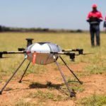
South Africa has a huge potential market for commercial drones, offering opportunities for drone technology in mining, agriculture, delivery, and other areas. Approval for commercial operators, however, has been slow in coming. Commercial drone company Rocketmine is leading the way in the country for new operations by receiving authorization for flight beyond visual line of … [Read more...] about Rocketmine Recieves BVLOS Authorization in South Africa
Mapping Asia’s Largest Copper Ore Mine, Using Drones
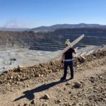
A Czech drone services company, UpVision, has been using UAVs to map the largest copper ore mine in Asia. The mapping mission spanned more than 10km² near the city of Erdenet, Mongolia. In support of Czech geologists investigating the site, the UpVision team deployed a MAVinci Sirius, produced by the German manufacturer acquired by Intel back in 2016. The fixed-wing drone is … [Read more...] about Mapping Asia’s Largest Copper Ore Mine, Using Drones


