
Foxtech is one of China's largest online sources for industrial multicopters, fixed -wing and VTOL products. These commercial-grade drones are suitable for surveying, mapping, power line inspection and a wide variety of other commercial applications. The NIMBUS VTOL Mapping Version is one of their newest offerings: a best-selling and cost-effective drone for mapping and … [Read more...] about FOXTECH: Providing Cost-Effective Solutions for Enterprise Drone Mapping Missions
Construction
Mapping from a Drone vs. Mapping from Manned Aircraft or Satellite Data: The Difference is Getting Smaller All the Time with SimActive
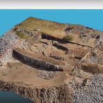
Creating 3D models and maps from aerial footage isn't a new idea. Sophisticated, survey grade models from satellite and aircraft images have been used for large scale environmental surveys, construction projects, and other applications. That functionality is incredibly valuable - and until recently, reserved for government and large industry due to the expense. Drones, … [Read more...] about Mapping from a Drone vs. Mapping from Manned Aircraft or Satellite Data: The Difference is Getting Smaller All the Time with SimActive
Less Buck, More Bang: Surveying with Drones is a Game Changer for Real Estate Developers

The following is a guest post by Jason Worley, CEO & Co-founder of Asset Drone. For real estate and land developers, drone surveys have opened up a world of options. Drone imagery has changed the front end of the project, offering highly accurate and detailed photographs and videos that give the total view of an entire expanse of property. This information can be … [Read more...] about Less Buck, More Bang: Surveying with Drones is a Game Changer for Real Estate Developers
Airobotics Drones Survey $1 Billion Israeli Port Project

Israeli drone provider Airobotics is improving its home country’s coastline, partnering with a major construction developer to survey a new seaport in Haifa. The startup will work with Shapir-Ashtrom – a joint venture of construction and civil engineering companies, Shapir Civil and Marine Engineering Ltd., and Ashtrom Properties Ltd. – to develop Gulf Port, a $1 billion … [Read more...] about Airobotics Drones Survey $1 Billion Israeli Port Project
SimActive Announces Improved Workflow for DJI Users in Surveying and Construction
SimActive Inc., a world-leading developer of photogrammetry software, is announced an improved workflow for DJI users. The company tells us that hours of processing time per project are now saved, with volume measurement, pre-construction planning, land development, and other applications streamlined. Butler & Associates Inc., a professional surveying firm with over 35 … [Read more...] about SimActive Announces Improved Workflow for DJI Users in Surveying and Construction


