
Thermal imaging drones help crews locate underground heat pockets that could reignite after major fires in northwest England.
United Utilities is using thermal imaging drones to find hidden hotspots left behind by recent moorland fires in northwest England.
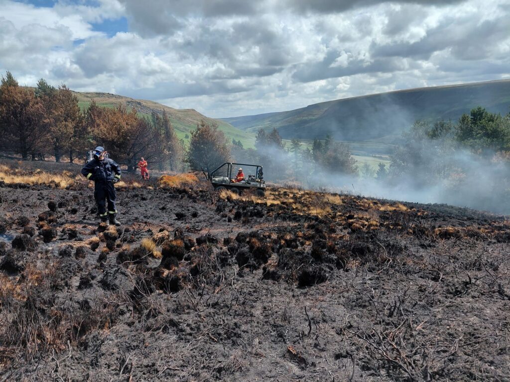
The water company has supported emergency services since fires broke out at the end of June. Although cooler temperatures and rain have helped, heat can remain below the surface of peatland. These pockets create a risk that fires could reignite.
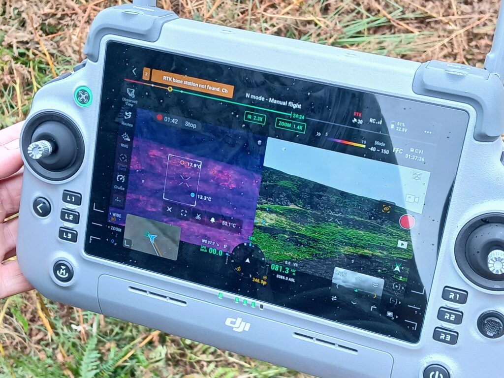
United Utilities is now using drones equipped with thermal cameras to scan large areas from the air. The drones identify hotspots and provide GPS coordinates to crews on the ground.
Lindsay Page, United Utilities’ lead for Water Services in Greater Manchester, said the technology helps teams focus their efforts.
“Bringing these fires under control has been a huge team effort which has seen our teams and other partners including the RSPB, Derbyshire Mountain Rescue, Peak District National Park and others working thousands of hours together alongside fire and rescue services for several weeks.
“Although there are no longer any visible flames and even with the recent rain, our teams are still out there every day. When fire burns on peatland, it can form pockets of heat underground and there is a risk of these re-igniting. Monitoring these from the ground is challenging as teams need to scan large areas for signs of smoke which can be difficult to spot.
“These new thermal imaging drones are game-changing as they pinpoint the problem areas so we can target our resources to the right place at the right time.”
From Aerial Firefighting to Drone Monitoring
At the height of the fires, United Utilities provided several helicopters to support firefighting operations. According to the company, the helicopters made about 2,000 trips and dropped more than 20 million liters of water. Fire and rescue services also pumped water directly from reservoirs.
Major incidents have since been scaled back. However, United Utilities catchment teams continue to patrol areas at Dovestones and Tintwistle to find and extinguish remaining hotspots.
The company had already trained team members as drone pilots for inspections of assets in remote areas. It has now expanded that capability with thermal imaging.
The drones can scan large areas of moorland and identify heat that may be difficult to detect from the ground. When pilots locate a hotspot, they share its GPS coordinates with ground crews.
“It is still a difficult task as team are working in very challenging terrain and carrying heavy loads of water with them but now they can head out knowing just where to go. It really is a case of X marks the spot.
“As well as helping them to be precise in targeting the areas that need attention, it also speeds things up a lot because they aren’t spending hours scanning for hotspots,” Page said.
Temporary dams containing thousands of liters of water remain across the moors. They provide nearby water supplies for crews extinguishing the remaining hotspots.
Broader Applications for Thermal Drones
United Utilities said the drones could continue to provide value after the immediate fire response ends.
The company sees potential applications in environmental monitoring and infrastructure assessments. Thermal imaging could also support efforts to detect water leaks.
The operation highlights a practical advantage of thermal drones in post-fire monitoring. Instead of relying only on visible smoke or other surface signs, crews can use aerial thermal data to locate remaining sources of heat across difficult terrain.
Read more:
- Inside the Counter-UAS Response to Drone Flights Over Spokane Wildfires
- BRINC Brings Wildfire and Smoke Tracking Into Drone Operations
- Students Compete in XPRIZE Wildfire Finals With AI Drone Firefighting

Miriam McNabb is the Editor-in-Chief of DRONELIFE and CEO of JobForDrones, a professional drone services marketplace, and a fascinated observer of the emerging drone industry and the regulatory environment for drones. Miriam has penned over 3,000 articles focused on the commercial drone space and is an international speaker and recognized figure in the industry. Miriam has a degree from the University of Chicago and over 20 years of experience in high tech sales and marketing for new technologies.
For drone industry consulting or writing, Email Miriam.
TWITTER:@spaldingbarker
Subscribe to DroneLife here.






Leave a Reply