
At Commercial UAV Expo, Juan Plaza outlined how drones supported rescue, damage assessment and recovery after the June earthquakes, while warning that disaster response requires a plan for coordinating the aircraft overhead.
When two powerful earthquakes struck Venezuela on June 24, 2026, drones were in the air within minutes.
They gave authorities an early view of widespread destruction, supported search and rescue, and helped assess roads, bridges and damaged buildings.
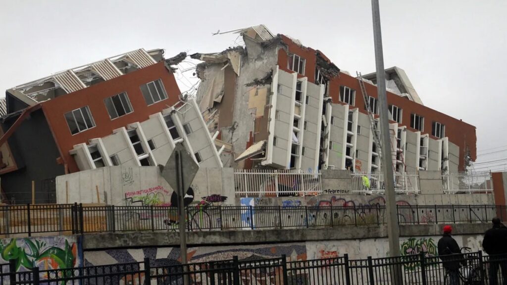
But the response also demonstrated a growing challenge for emergency managers. As more organizations arrived with drones, the same technology providing critical information began competing for limited airspace.
“The result was clarity on the ground, but chaos in the air,” Juan Plaza told an audience at Commercial UAV Expo in Las Vegas this week.
Plaza, author, pilot, and CEO of aviation consulting company Plaza Aerospace, presented images and data from the disaster. His analysis looks closely at how drones were used and what the response could teach authorities preparing for future disasters.
Drones in the First Minutes After the Earthquakes
The earthquakes struck northern Venezuela just seconds apart on June 24. The U.S. Geological Survey recorded the first at magnitude 7.2 and the second at magnitude 7.5. NASA later reported significant ground displacement around Caracas and La Guaira.
The destruction was severe. Plaza cited a confirmed death toll of 6,509 and said 6,462 people had been rescued from collapsed buildings.
For drone operators, the first task was situational awareness.
“Within minutes, authorities had drones in the air and could see plumes of smoke,” Plaza said. “They could begin to understand what was happening.”
That role quickly expanded into search and rescue. Plaza said he has received numerous anecdotal reports that thermal-equipped drones helped locate people in collapsed structures at night. Drones also helped responders determine whether roads and bridges were safe enough to move emergency personnel and supplies into affected areas.
From Rescue to Understanding What Failed
The role of drones has continued long after the immediate emergency.
Plaza said teams are using photogrammetry and LiDAR to document damaged structures. In some cases, collapsed façades have exposed parts of buildings that engineers could not previously see. The resulting models can help engineers study how structures failed, determine what can be saved and potentially improve understanding of why some buildings suffered catastrophic damage.
The progression illustrates the range of aerial data needed after a disaster. Initial imagery provides situational awareness. More detailed data can then support rescue, infrastructure assessment, structural inspection and longer-term scientific analysis.
When Everyone Brings a Drone
For Plaza, the Venezuela tragedy emphasized a problem that will become more important as drones become standard disaster-response tools.
The sky can get crowded very quickly.
Local authorities may launch the first aircraft almost immediately. They can soon be joined by emergency response organizations, international teams, military operators, journalists and others.
Within roughly 18 hours, Plaza said, the number of aircraft can create a dangerous operating environment. Coordination typically begins to restore order after the first day.
Plaza pointed to the 2021 volcanic eruption in the Canary Islands as an earlier example. Hundreds of drones reportedly arrived within the first 24 hours, with operators eventually coordinating through a WhatsApp group.
That kind of improvised solution may work in some circumstances. But Plaza argued that authorities need formal contingency plans.
Strategic deconfliction systems exist, he said, but many assume communications networks and other infrastructure are available. A major disaster may damage precisely those systems.
Emergency planners therefore need procedures that can function under degraded conditions.
Planning for the Next Disaster
The Venezuela response showed both sides of expanding drone use in disasters. Aircraft can reach affected areas quickly and provide information responders need. But growing numbers of drones also make coordination increasingly important.
For Plaza, that makes advance planning essential.
Civil aviation authorities should develop contingency plans for managing drone operations before the next major disaster, he said. Organizations arriving to help must also be prepared to follow established protocols.
“This, to me, is the most fundamental lesson,” Plaza said. “The sky is a limited resource, and we need to use it wisely. Only coordinated responses will be useful.”
As drones become a routine part of disaster response, the question will no longer be simply whether they can help. It will be how to make sure all of those aircraft can safely share the sky.
Read more:
- “If You Fly, We Can’t”: Drone Incursions Still Disrupt Wildfire Response Across the West
- Nearmap and New Light Deploy FEMA Disaster Response System.
- Japan’s Military Teams Up with Drone Industry for Disaster Response Training

Miriam McNabb is the Editor-in-Chief of DRONELIFE and CEO of JobForDrones, a professional drone services marketplace, and a fascinated observer of the emerging drone industry and the regulatory environment for drones. Miriam has penned over 3,000 articles focused on the commercial drone space and is an international speaker and recognized figure in the industry. Miriam has a degree from the University of Chicago and over 20 years of experience in high tech sales and marketing for new technologies.
For drone industry consulting or writing, Email Miriam.
TWITTER:@spaldingbarker
Subscribe to DroneLife here.






Plaza’s 18-hour mark is the operational takeaway: thermal and LiDAR bought situational awareness, then the sky became the second incident. WhatsApp is not deconfliction. Civil aviation authorities need a degraded-comms CONOPS before the next event, and visiting teams need to fly it — not invent it on arrival. Policy announcements (BEYOND expansion, pending Part 108) do not authorize extra aircraft in that airspace.
— Ray
The Drone Pilot Brief
thedronepilotbrief.com