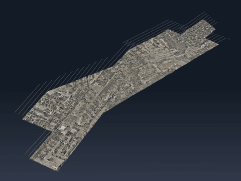
The latest update tackles big data challenges with optimized workflows and multi-platform integration, delivering powerful solutions for commercial and military applications.
by DRONELIFE Staff Writer Ian J. McNabb
Quebec-based software developer SimActive Inc. recently announced the release of the new Correlator3D™ Version 10.3, updating their popular mapping solution to better tackle large-scale projects. This latest version introduces many optimizations of the underlying product architecture to make dealing with larger datasets easier and faster.

In the status quo, large projects (those involving thousands of different images, all of which need to be collated into a legible map) can be bottlenecked by existing technology solutions, with some processing steps taking much longer than others. Version 10.3 brings additional feedback throughout the processing workflow as well as “more fluid interaction” with data, increasing speed and ensuring that clients have the maximum amount of insight into what’s happening at that moment.
“Optimizations made in Version 10.3 greatly enhance user experience when working with very large projects,” said Louis Simard, CTO at SimActive. “Having a fluidity when dealing with huge datasets not only improves user experience, but also allows for the processing of even more extensive projects.”
Initially developed for large-format aerial cameras, Correlator3D™ has since adapted to integrate drone and satellite imagery. This versatility has proven valuable in both commercial and military applications. For example, SimActive recently showcased the work that Correlator3D is doing in New Zealand working in agriculture, environmental assessment, and engineering design. Correlator3D is also used in militaries across the world to provide high-quality aerial mapping that supports a range of mission sets.
One of the standout features of SimActive’s Correlator3D™ is its ability to integrate data from various sources, including drones, manned aircraft, and satellites. This versatility is invaluable in military and commercial operations. “Our software accepts imagery regardless of the platform it is captured on. Imagery from any of the formats can be combined to allow for rapid processing of areas of interest,” says Simard.
SimActive’s software continues to evolve to meet the growing demand for fast, flexible mapping solutions. Its capacity to handle data from multiple platforms ensures it remains a valuable tool for users in a wide range of industries.
More information on Simactive and Correlator3D Version 10.3 is available here.
Want DRONELIFE news delivered to your inbox every weekday? Sign up here.
Read more:
- Mastering Drone Mapping: Expert Tips for Success from SimActive’s Eric Andelin
- How SimActive’s Correlator3D™ is Revolutionizing Military Mapping: An Exclusive Interview with CEO Philippe Simard
- SimActive Software Enhances Construction Mapping for Bullseye Construction
Miriam McNabb is the Editor-in-Chief of DRONELIFE and CEO of JobForDrones, a professional drone services marketplace, and a fascinated observer of the emerging drone industry and the regulatory environment for drones. Miriam has penned over 3,000 articles focused on the commercial drone space and is an international speaker and recognized figure in the industry. Miriam has a degree from the University of Chicago and over 20 years of experience in high tech sales and marketing for new technologies.
For drone industry consulting or writing, Email Miriam.
TWITTER:@spaldingbarker
Subscribe to DroneLife here.