 GeoCue and Tediris Solutions Partner to Provide Spain with Aerial Mapping Solutions
by DRONELIFE Staff Writer Ian M. Crosby
LiDAR mapping leader GeoCue has announced a new partnership with Spanish drone service provider Tediris Solutions. With close to a decade of experience in the UAV market, Tediris Solutions integrates sophisticated sensors, drones, and artificial intelligence software to grant customers important insight from processed data.
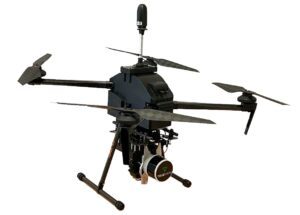
Tediris Solutions’ most recent integration of TrueView 3D Imaging Sensors with Conyca’s Aero 4 drone offers complete aerial mapping solutions for the Spanish and European geospatial sector. In addition to the TrueView sensor and the drone, the integration also incorporates Conyca’s UAV Commander tool developed for flight preparation. Once processed, the data is managed through LP360 Software, resulting in a streamlined and intuitive workflow.
“We’ve been collaborating with Conyca on various topography projects for over five years,” said Eduardo Faro, General Manager at Tediris Solutions. “Their products, like the Aero 4 drone, seamlessly fit into our ecosystem and are an ideal match for the high-end TrueView lidar solutions.”
“Tediris Solutions is a great partner for us because they are committed to not only providing the best in high-end solutions but also helping their customers maximize their products,” said Gorka Zarauz, GeoCue’s Business Development Manager in Europe. “The TrueView integration will empower their customers to gather more information efficiently, and by using LP360 processing software, they will be able to create highly valuable deliverables.”
“What sets this solution apart is the optimization of the TrueView system and workflow, ensuring clean and accurate data,” said Faro. “Furthermore, this system operates without the need for an internet connection, safeguarding data from unauthorized access. Users can download their maps in the UAV Command tool for offline use. Notably, the system minimizes point cloud noise, reducing the amount of post-processing work required. Perhaps most impressively, customers can access data and insights in less than 10 minutes after landing the drone, a remarkable feat in terms of performance.”
Read more:
- NDAA-Compliant LiDAR Drone Surveying System: Microdrones New EasyOne Solution
- GeoCue Expands Reach in Europe for TrueView Imaging Sensors and LiDAR Processing
- ROCK Robotic Releases New LiDAR Systems for Advanced, Survey-Grade Mapping
- Colorizing Lidar: SimActive and LiDARUSA Partner
Ian attended Dominican University of California, where he received a BA in English in 2019. With a lifelong passion for writing and storytelling and a keen interest in technology, he is now contributing to DroneLife as a staff writer.

Miriam McNabb is the Editor-in-Chief of DRONELIFE and CEO of JobForDrones, a professional drone services marketplace, and a fascinated observer of the emerging drone industry and the regulatory environment for drones. Miriam has penned over 3,000 articles focused on the commercial drone space and is an international speaker and recognized figure in the industry. Miriam has a degree from the University of Chicago and over 20 years of experience in high tech sales and marketing for new technologies.
For drone industry consulting or writing, Email Miriam.
TWITTER:@spaldingbarker
Subscribe to DroneLife here.


[…] Miriam McNabb is the Editor-in-Chief of DRONELIFE and CEO of JobForDrones, a professional drone services marketplace, and a fascinated observer of the emerging drone industry and the regulatory environment for drones. Miriam has penned over 3,000 articles focused on the commercial drone space and is an international speaker and recognized figure in the industry. Miriam has a degree from the University of Chicago and over 20 years of experience in high tech sales and marketing for new technologies.For drone industry consulting or writing, Email Miriam. […]