• Skip to main content
  • Skip to secondary menu
  • Skip to primary sidebar
  • Skip to secondary sidebar
  • Skip to footer
  • DroneRacingLife
  • DroneFlyers
  • Newsletter
DroneLife

DRONELIFE

Stay up to date on all the latest Drone News

  • News
  • Products
  • Industries
    • Agriculture
    • Construction
    • Delivery
    • Dual Use
    • Inspection
    • Public Safety
    • Surveying
  • Enthusiasts
  • Regulations
  • Business
  • Video
  • Podcasts

D-Fend Updates EnforceAir: Staying Out in Front of the Drone Threat

October 18, 2021 by Miriam McNabb 11 Comments

D-Fend updates EnforceAirCounter drone solutions continue to evolve: D-Fend updates EnforceAir to add new features, and new services.

by DRONELIFE Staff Writer Ian M. Crosby

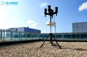
Today, D-Fend Solutions, the award-winning leader in radio frequency (RF), cyber-based, counter-drone takeover technology, revealed a new version of its flagship software product, EnforceAir, as part of the company’s quarterly software enhancement program.

The new version of EnforceAir includes a suite of new features that provide users with additional protection plan options, detailed map information to improve the efficacy of communication with law enforcement, and enhanced safety features. The new version also implements improvements to D-Fend’s Multi-Sensor Command & Control (MSC2) system.

Protection and alert areas within the stationary protection plans can now be circular, as well as the original polygon shape, depending on user needs and the scenario. Circular protection areas are located by default around EnforceAir’s location, and can be adjusted to allow for greater flexibility and to protect more distant areas. This update applies to both single and multi-zone alert and protection areas.

Street names and points of interest have been added to online maps in order to make it easier for users to get oriented and to quickly share information with law enforcement regarding precise drone pilot location. This information is displayed by default but can be manually toggled off.

Creating and editing safe routes for rogue drones now requires a minimum altitude of above 30 meters for safe routes and when landing at the nearest waypoint, and the distance between waypoints to be no less than 20 meters. Additionally, the maximum number of waypoints in a safe route is limited to eight.

“Our customers were instrumental in guiding much of the innovation in this latest version and numerous D-Fend Solutions clients have already installed it,” said D-Fend President and CPO Yaniv Benbenisti. “This new version further differentiates EnforceAir’s anti-drone offerings by facilitating even greater control and safety, to maintain day-to-day continuity in sensitive environments. We remain committed to upgrading our software on a regular basis to stay in front of the continuously evolving drone threat.”

D-Fend Solutions’ Multi-Sensor Command & Control system (MSC2), a central management solution, controls multiple EnforceAir sensors remotely from a single server, empowering organizations to intuitively safeguard vast expanses of land from rogue drones.

As D-Fend updates EnforceAir, the current version supports the new tactical MSC2 configuration, which enables users to easily deploy and operate multiple EnforceAir units through the MSC2 application in the field, or other ad-hoc deployments. The configuration is based on a Dell Latitude 5420 laptop, which functions as the MSC2 server and operating station. It provides the same operation, detection and mitigation capabilities as the MSC2 stationary configuration, while allowing operational agility and flexibility.

Additional features include the ability to set a custom duration for the system’s audio alert notification, the setting of landing-point location for rogue drones can be via coordinates, an “Apply All” option when editing safe routes details, editing of the alert area for moving asset plans via keyboard or slider, and the display of the approximated detection zone for the Long-Range Directional antenna.These additions further improve the already easy-to-use technology and increase the system’s protection capabilities.

Read more about counter drone policy and practice, cUAS strategy in the U.K., and counter drone market solutions.

Ian attended Dominican University of California, where he received a BA in English in 2019. With a lifelong passion for writing and storytelling and a keen interest in technology, he is now contributing to DroneLife as a staff writer

Miriam McNabb

Miriam McNabb is the Editor-in-Chief of DRONELIFE and CEO of JobForDrones, a professional drone services marketplace, and a fascinated observer of the emerging drone industry and the regulatory environment for drones. Miriam has penned over 3,000 articles focused on the commercial drone space and is an international speaker and recognized figure in the industry.  Miriam has a degree from the University of Chicago and over 20 years of experience in high tech sales and marketing for new technologies.
For drone industry consulting or writing, Email Miriam.

TWITTER:@spaldingbarker

Subscribe to DroneLife here.

Filed Under: Anti-drone technology, Drone News Feeds, News, safety and security Tagged With: Counter UAS, counter-drone, cuas, D-Fend

Reader Interactions

Trackbacks

  1. Prévenir une attaque de Drone contre le Pape : Les Solutions D-Fend Déployées Lors de la Messe en Plein Air | Prestations drones, films institutionnels, journal en ligne says:
    January 2, 2022 at 11:51 am

    […] cours de l'incident, qui a eu lieu en septembre, la société a déployé ses Technologie EnforceAir détecter la présence d'un drone non identifié, puis le localiser et le suivre et le prendre en […]

    Reply
  2. Preventing Drone Attack on Pope D-Fend Solutions says:
    December 30, 2021 at 12:41 am

    […] the incident, which took place in September, the company deployed its proprietary EnforceAir technology to detect the presence of an unidentified drone, and then to locate and track it and take it over, […]

    Reply
  3. Preventing Drone Attack on Pope D-Fend Solutions » Certified Drone Pilot says:
    December 29, 2021 at 11:05 pm

    […] the incident, which took place in September, the company deployed its proprietary EnforceAir technology to detect the presence of an unidentified drone, and then to locate and track it and take it over, […]

    Reply
  4. Prévenir une attaque de Drone contre le Pape : Les Solutions D-Fend Déployées Lors de la Messe en Plein Air - Askell Drone says:
    December 29, 2021 at 10:43 pm

    […] cours de l’incident, qui a eu lieu en septembre, la société a déployé ses Technologie EnforceAir détecter la présence d’un drone non identifié, puis le localiser et le suivre et le […]

    Reply
  5. Preventing a Drone Attack on the Pope: D-Fend Solutions Deployed During Open Air Mass | taktik(z) GDI (Government Defense Infrastructure) says:
    December 29, 2021 at 5:41 pm

    […] the incident, which took place in September, the company deployed its proprietary EnforceAir technology to detect the presence of an unidentified drone, and then to locate and track it and take it over, […]

    Reply
  6. Preventing Drone Attack on Pope D-Fend Solutions | Livingo Group says:
    December 29, 2021 at 2:02 pm

    […] the incident, which took place in September, the company deployed its proprietary EnforceAir technology to detect the presence of an unidentified drone, and then to locate and track it and take it over, […]

    Reply
  7. D-Fend Updates EnforceAir: Staying Out in Front of the Drone Threat - DronesOnline.site says:
    October 19, 2021 at 11:25 am

    […] post D-Fend Updates EnforceAir: Staying Out in Front of the Drone Threat appeared first on […]

    Reply
  8. D-Fend Updates EnforceAir New Features – Dronestagram Blog says:
    October 19, 2021 at 3:16 am

    […] More… […]

    Reply
  9. D-Fend Updates EnforceAir New Features – Game Up News says:
    October 18, 2021 at 2:45 pm

    […] Source link […]

    Reply
  10. D-Fend Updates EnforceAir New Features - DRONELIFE - DroneLife - K드론팀 says:
    October 18, 2021 at 2:00 pm

    […] D-Fend Updates EnforceAir New Features – DRONELIFE  DroneLife […]

    Reply
  11. D-Fend Updates EnforceAir: Staying Out in Front of the Drone Threat | Drone Films Limited says:
    October 18, 2021 at 12:15 pm

    […] post D-Fend Updates EnforceAir: Staying Out in Front of the Drone Threat appeared first on […]

    Reply

Leave a Reply Cancel reply

Your email address will not be published. Required fields are marked *

Primary Sidebar

LATEST

5 Federal Drone Policies Flying Under the Radar This Summer

From World Cup airspace restrictions to critical infrastructure rulemaking, several federal initiatives could shape the drone industry in the months…

Continue Reading 5 Federal Drone Policies Flying Under the Radar This Summer

Drone Industry Insights Launches the 9th Edition of the Global Drone Survey — The World’s Largest Annual Industry Survey for the Drone Market

Survey open to all actors in the global drone market ecosystem — manufacturers, operators, investors, associations, regulators, and service providers…

Continue Reading Drone Industry Insights Launches the 9th Edition of the Global Drone Survey — The World’s Largest Annual Industry Survey for the Drone Market

Proposed Patent Bill Could Have Major Implications for Drone Industry Intellectual Property

Prohibiting Adversarial Patents Act would make certain patents unenforceable while leaving ownership intact A newly introduced bill in Congress concerning…

Continue Reading Proposed Patent Bill Could Have Major Implications for Drone Industry Intellectual Property

Seattle Stadium “No-Drone Zone” During FIFA Matches

By Dronelife Features Editor Jim Magill Federal officials on Monday urged drone operators to stay away from Lumen Field, which…

Continue Reading Seattle Stadium “No-Drone Zone” During FIFA Matches

Landair Surveys Uses SimActive Correlator3D for Planned Burns Mapping in Australia

The Australian geospatial firm is using Correlator3D to generate orthomosaics from aerial imagery captured for wildfire prevention and land management…

Continue Reading Landair Surveys Uses SimActive Correlator3D for Planned Burns Mapping in Australia

As Disaster Risks Grow, WingXpand and Verizon Explore New Tools for Emergency Response

WingXpand will work with Verizon Frontline and emergency teams to explore new tools for disaster assessment and community resilience As…

Continue Reading As Disaster Risks Grow, WingXpand and Verizon Explore New Tools for Emergency Response

HOVERAir’s UK Launch Raises a Bigger Question: Who Will Serve America’s Consumer Drone Market?

HOVERAir has announced the UK launch of its new X1 Smart, a 99-gram self-flying camera designed to make aerial content…

Continue Reading HOVERAir’s UK Launch Raises a Bigger Question: Who Will Serve America’s Consumer Drone Market?

DRONELIFE Exclusive Interview: Inside PDW’s Strategy to Build Drones That Can Operate When GPS and Communications Fail

PDW works to develop advanced drone communications systems By DRONELIFE Features Editor Jim Magill As modern warfare increasingly relies on…

Continue Reading DRONELIFE Exclusive Interview: Inside PDW’s Strategy to Build Drones That Can Operate When GPS and Communications Fail

AirData UAV and LeoSight Bring Live Drone Data for DFR Programs

The new LeoSight AirData integration streams real-time flight data, telemetry, and operational insights from AirData directly into LeoCommand, giving dispatchers…

Continue Reading AirData UAV and LeoSight Bring Live Drone Data for DFR Programs

New Boson SX8 Brings High-Resolution Thermal Imaging to NDAA-Compliant Drone Payloads

New thermal imaging module combines SXGA resolution with compact size and U.S. manufacturing Teledyne FLIR OEM has announced the Boson…

Continue Reading New Boson SX8 Brings High-Resolution Thermal Imaging to NDAA-Compliant Drone Payloads

Secondary Sidebar

Footer

SPONSORED

Inspired Flight Gremsy IF800 VIO F1 drones geo week

What Will It Take to Strengthen U.S. Drone Manufacturing? A Conversation with Inspired Flight’s CEO

Global Mapper Mobile data collection

Collection Ground Control Points with Global Mapper Mobile

Military Drone Mapping Solutions

How SimActive’s Correlator3D™ is Revolutionizing Military Mapping: An Exclusive Interview with CEO Philippe Simard

Photogrammetry Accuracy Standards

SimActive Photogrammetry Software: Enabling Users to Meet Accuracy Standards for Over 20 Years

NACT Engineering Parrot ANAFI tether indoor shot

Smart Tether for Parrot ANAFI USA from NACT Engineering

Blue Marble, features global mapper, features Blue Marble

Check Out These New Features in Global Mapper v25 from Blue Marble

About Us | Contact Us | Advertise With Us | Write for Us | Privacy Policy | Terms of Service

The Trusted Source for the Business of Drones.

This website uses cookies and third party services. By clicking OK, you are agreeing to our privacy policy. ACCEPT

Manage consent

Privacy Overview

This website uses cookies to improve your experience while you navigate through the website. Out of these, the cookies that are categorized as necessary are stored on your browser as they are essential for the working of basic functionalities of the website. We also use third-party cookies that help us analyze and understand how you use this website. These cookies will be stored in your browser only with your consent. You also have the option to opt-out of these cookies. But opting out of some of these cookies may affect your browsing experience.
Necessary
Always Enabled
Necessary cookies are absolutely essential for the website to function properly. These cookies ensure basic functionalities and security features of the website, anonymously.
CookieDurationDescription
cookielawinfo-checkbox-analytics11 monthsThis cookie is set by GDPR Cookie Consent plugin. The cookie is used to store the user consent for the cookies in the category "Analytics".
cookielawinfo-checkbox-functional11 monthsThe cookie is set by GDPR cookie consent to record the user consent for the cookies in the category "Functional".
cookielawinfo-checkbox-necessary11 monthsThis cookie is set by GDPR Cookie Consent plugin. The cookies is used to store the user consent for the cookies in the category "Necessary".
cookielawinfo-checkbox-others11 monthsThis cookie is set by GDPR Cookie Consent plugin. The cookie is used to store the user consent for the cookies in the category "Other.
cookielawinfo-checkbox-performance11 monthsThis cookie is set by GDPR Cookie Consent plugin. The cookie is used to store the user consent for the cookies in the category "Performance".
viewed_cookie_policy11 monthsThe cookie is set by the GDPR Cookie Consent plugin and is used to store whether or not user has consented to the use of cookies. It does not store any personal data.
Functional
Functional cookies help to perform certain functionalities like sharing the content of the website on social media platforms, collect feedbacks, and other third-party features.
Performance
Performance cookies are used to understand and analyze the key performance indexes of the website which helps in delivering a better user experience for the visitors.
Analytics
Analytical cookies are used to understand how visitors interact with the website. These cookies help provide information on metrics the number of visitors, bounce rate, traffic source, etc.
Advertisement
Advertisement cookies are used to provide visitors with relevant ads and marketing campaigns. These cookies track visitors across websites and collect information to provide customized ads.
Others
Other uncategorized cookies are those that are being analyzed and have not been classified into a category as yet.
SAVE & ACCEPT