• Skip to main content
  • Skip to secondary menu
  • Skip to primary sidebar
  • Skip to secondary sidebar
  • Skip to footer
  • DroneRacingLife
  • DroneFlyers
  • Newsletter
DroneLife

DRONELIFE

Stay up to date on all the latest Drone News

  • News
  • Products
  • Industries
    • Agriculture
    • Construction
    • Delivery
    • Dual Use
    • Inspection
    • Public Safety
    • Surveying
  • Enthusiasts
  • Regulations
  • Business
  • Video
  • Podcasts

ANAFI USA and Pix4D: Compatible to Create Complete Solutions

October 26, 2020 by Miriam McNabb 8 Comments

ANAFI USA and Pix4D
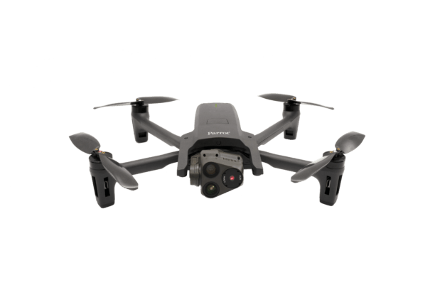
Parrot, the leading European drone group, and Pix4D, the leading professional photogrammetry and drone mapping software company, “are excited to announce the latest generation ANAFI USA drone is now compatible with the Pix4D software suite,” says a Parrot press release.

That’s not a surprise, as Parrot owns 95% of Pix4D.  It does indicate, however, that Parrot is realizing the benefits of it’s partnership strategy.  Through numerous partnerships with software providers and industry groups, Parrot is equipping the ANAFI USA – their made in the U.S., government approved, Blue sUAS – to be a complete solution for a variety of vertical markets.

In recent years, Parrot has been expanding its mature software ecosystem, thanks to its industry-leading complete Software Development Kit, which facilitates the implementation of the best tailored and end-to-end solutions by professionals from all around the world from public safety, search & rescue to defense and inspection fields.

“Parrot Group is the only true end-to-end player in the industry, that has been engineering and designing for years tailored solutions, from equipment to services and software, to meet the most demanding needs of professionals,”said Henri Seydoux, Founder and CEO of Parrot.  “Working with a member of the group such as Pix4D is always an honor, as we are able to fully leverage the exceptional capabilities and potential of our drones with the best software solutions for each use case. We are designing together the future of professional drone use.”

“Following Pix4D’s strategy of focusing on creating value for professional users, the compatibility between Parrot’s ANAFI USA and Pix4D’s product portfolio aims to simplify workflows for professional users of drones in surveying, construction and emergency response applications,” said Christoph Strecha, Founder and CEO of Pix4D.


Find the full list of Pix4D software compatible with ANAFI USA here below:

  • Pix4Dcapture: Easily plan and execute automated drone flights for optimal 2D and 3D mapping and modeling. The app allows first responders to cover an operational area and take the right images for precise measurements to enrich mission reports and improve the preparation of subsequent operations in complex or inaccessible areas.
  • Pix4Dreact: Generate 2D terrain models and maps from images quickly and offline. Emergency response and public safety teams can identify and model priority areas for rapid intervention and detect missing persons or fires, without internet, even in devastated areas following a natural disaster.
  • Pix4Dmapper: The leading 2D and 3D photogrammetry software. Optimal for many fields of applications and missions: law enforcement officers can map an accident scene to quickly clear a road, building inspectors can determine with high precision the conditions of buildings and infrastructure whilst surveyors can easily and quickly access crucial data, such as extraction volumes.
  • Pix4Dcloud: The online platform for drone mapping, progress tracking, and site documentation.

ANAFI USA’s data combined with the use of Pix4Dcloud provides an affordable and easy way for building site surveyors to map, measure, and monitor the progress of their construction site and to adapt their expectations against their project schedules.

  • Pix4Dscan: Professional drone flight app for optimal inspection data, compatible soon with the ANAFI USA. Pix4Dscan guides users to set the right parameters for an actionable dataset, track the mission’s progress with map view or monitor live with camera view. Pix4Dscan provides live telemetry data such as altitude, speed, gimbal pitch and more. Images can be uploaded to Pix4Dinspect to create accurate and easy to inspect 2D and 3D models.
  • Pix4Dinspect: Automate industrial inspection and asset management with ANAFI USA’s images.

With ANAFI USA and Pix4Dinspect, surveyors can easily and automatically detect cell towers antennas andextract their height, dimensions, azimuth, downtilt and plumb.

  • Pix4Dengine: Pix4D’s processing engine is customized to meet the needs of professionals. It can be hosted on Pix4D’s secure cloud computing server or on the client’s side, allowing teams to benefit from Pix4D algorithms with higher flexibility and custom integrations.


Miriam McNabb

Miriam McNabb is the Editor-in-Chief of DRONELIFE and CEO of JobForDrones, a professional drone services marketplace, and a fascinated observer of the emerging drone industry and the regulatory environment for drones. Miriam has penned over 3,000 articles focused on the commercial drone space and is an international speaker and recognized figure in the industry.  Miriam has a degree from the University of Chicago and over 20 years of experience in high tech sales and marketing for new technologies.
For drone industry consulting or writing, Email Miriam.

TWITTER:@spaldingbarker

Subscribe to DroneLife here.

Filed Under: Drone News Feeds, News Tagged With: ANAFI USA, drone manufacturers, drone mapping, Parrot, Pix4D

Reader Interactions

Trackbacks

  1. ANAFI Ai Available in January: First 4G-Connected UAV – DRONELIFE – DroneLife says:
    December 12, 2021 at 4:44 pm

    […] in order to adjust its flight path in complex environments. 4D images are shared in-flight with Pix4Dcloud to display the 3D model of the inspected building on users’ Pix4D accounts 2 hours after the flight.The mobile App’s […]

    Reply
  2. ANAFI Ai Available in January: First 4G-Connected UAV » Certified Drone Pilot says:
    December 11, 2021 at 10:29 pm

    […] in order to adjust its flight path in complex environments. 4D images are shared in-flight with Pix4Dcloud to display the 3D model of the inspected building on users’ Pix4D accounts 2 hours after the […]

    Reply
  3. ANAFI USA and Pix4D Announce Compatability DRONELIFE - Go Drones Blog says:
    October 27, 2020 at 10:57 am

    […] ANAFI USA and Pix4D have announced compatability, emphasizing Parrot's move to garner partnerships for their new Blue sUAS solution. Source […]

    Reply
  4. ANAFI USA and Pix4D: Suitable to Create Full Options - Drone Market says:
    October 27, 2020 at 1:25 am

    […] Supply […]

    Reply
  5. ANAFI USA and Pix4D: Compatible to Create Complete Solutions - Drone Market says:
    October 27, 2020 at 1:24 am

    […] Source […]

    Reply
  6. ANAFI USA and Pix4D: Compatible to Create Complete Solutions | RC Obsessed says:
    October 27, 2020 at 12:36 am

    […] Source […]

    Reply
  7. ANAFI USA and Pix4D: Compatible to Create Complete Solutions | Drone Magazine says:
    October 26, 2020 at 11:23 pm

    […] Source […]

    Reply
  8. ANAFI USA and Pix4D Announce Compatability DRONELIFE says:
    October 26, 2020 at 7:42 pm

    […] The complete article is here […]

    Reply

Leave a Reply Cancel reply

Your email address will not be published. Required fields are marked *

Primary Sidebar

LATEST

The Challenge of Drone Pizza Delivery: Flytrex Finally Solved It

Flytrex, Little Caesars join in first-of-kind pizza delivery By DRONELIFE Features Editor Jim Magill Over the past several years, residents…

Continue Reading The Challenge of Drone Pizza Delivery: Flytrex Finally Solved It

Headed to XPONENTIAL 2026? Don’t Miss These Partners, Panels, and Dual-Use Innovations in Detroit

From May 11-14, the annual AUVSI Xponential conference will bring the global autonomous systems industry to Detroit. This year’s conference…

Continue Reading Headed to XPONENTIAL 2026? Don’t Miss These Partners, Panels, and Dual-Use Innovations in Detroit

Rogue Cortex and UAS Nexus Launch Modular FPV Drone Developer Kit

Salt Lake City partnership pairs UAS Nexus’ Platform One airframe with Rogue Cortex’s SDK to give engineers a production-grade FPV…

Continue Reading Rogue Cortex and UAS Nexus Launch Modular FPV Drone Developer Kit

Titan Batteries Opens European Drone Battery Plant in Tilburg

The Idaho-based UAV power supplier becomes the first major drone battery maker to operate full-scale production on two continents. Titan…

Continue Reading Titan Batteries Opens European Drone Battery Plant in Tilburg

Detroit Trucking Hub Adds Birdstop Drone Monitoring with TSPS

Birdstop’s Fealty drone system delivers real-time truck parking visibility at the U.S.-Canada border in partnership with Detroit-based TSPS. Birdstop has…

Continue Reading Detroit Trucking Hub Adds Birdstop Drone Monitoring with TSPS

NASA Picks Pierce Aerospace for Bay Area Remote ID Sensor Network

Pierce Aerospace to Build Remote ID Network for NASA Across Silicon Valley and Bay Area Metis Technology Solutions taps the…

Continue Reading NASA Picks Pierce Aerospace for Bay Area Remote ID Sensor Network

Laminar-Flow Drone From Otto Aerospace Clears Flight-Test Campaign for DARPA

The Fort Worth aeronautics company validates its low-drag airframe at Spaceport America in support of DARPA’s Energy Web Aircraft program.…

Continue Reading Laminar-Flow Drone From Otto Aerospace Clears Flight-Test Campaign for DARPA

Military Selects First Bases for Directed-Energy Counter-Drone Program

Five military installations selected to support development of advanced drone defense systems The U.S. Department of Defense has announced the…

Continue Reading Military Selects First Bases for Directed-Energy Counter-Drone Program

AirData Joins Commercial Drone Alliance as Industry Prepares for Part 108

Company says its platform is built to support compliance and operational oversight for scaled BVLOS drone operations As the U.S.…

Continue Reading AirData Joins Commercial Drone Alliance as Industry Prepares for Part 108

UK Government Backs Drone Expansion with £50 Million Investment

Windracers among companies recognized as UK moves to scale routine drone operations and advanced air mobility The UK government has…

Continue Reading UK Government Backs Drone Expansion with £50 Million Investment

Secondary Sidebar

Footer

SPONSORED

Inspired Flight Gremsy IF800 VIO F1 drones geo week

What Will It Take to Strengthen U.S. Drone Manufacturing? A Conversation with Inspired Flight’s CEO

Global Mapper Mobile data collection

Collection Ground Control Points with Global Mapper Mobile

Military Drone Mapping Solutions

How SimActive’s Correlator3D™ is Revolutionizing Military Mapping: An Exclusive Interview with CEO Philippe Simard

Photogrammetry Accuracy Standards

SimActive Photogrammetry Software: Enabling Users to Meet Accuracy Standards for Over 20 Years

NACT Engineering Parrot ANAFI tether indoor shot

Smart Tether for Parrot ANAFI USA from NACT Engineering

Blue Marble, features global mapper, features Blue Marble

Check Out These New Features in Global Mapper v25 from Blue Marble

About Us | Contact Us | Advertise With Us | Write for Us | Privacy Policy | Terms of Service

The Trusted Source for the Business of Drones.

This website uses cookies and third party services. By clicking OK, you are agreeing to our privacy policy. ACCEPT

Manage consent

Privacy Overview

This website uses cookies to improve your experience while you navigate through the website. Out of these, the cookies that are categorized as necessary are stored on your browser as they are essential for the working of basic functionalities of the website. We also use third-party cookies that help us analyze and understand how you use this website. These cookies will be stored in your browser only with your consent. You also have the option to opt-out of these cookies. But opting out of some of these cookies may affect your browsing experience.
Necessary
Always Enabled
Necessary cookies are absolutely essential for the website to function properly. These cookies ensure basic functionalities and security features of the website, anonymously.
CookieDurationDescription
cookielawinfo-checkbox-analytics11 monthsThis cookie is set by GDPR Cookie Consent plugin. The cookie is used to store the user consent for the cookies in the category "Analytics".
cookielawinfo-checkbox-functional11 monthsThe cookie is set by GDPR cookie consent to record the user consent for the cookies in the category "Functional".
cookielawinfo-checkbox-necessary11 monthsThis cookie is set by GDPR Cookie Consent plugin. The cookies is used to store the user consent for the cookies in the category "Necessary".
cookielawinfo-checkbox-others11 monthsThis cookie is set by GDPR Cookie Consent plugin. The cookie is used to store the user consent for the cookies in the category "Other.
cookielawinfo-checkbox-performance11 monthsThis cookie is set by GDPR Cookie Consent plugin. The cookie is used to store the user consent for the cookies in the category "Performance".
viewed_cookie_policy11 monthsThe cookie is set by the GDPR Cookie Consent plugin and is used to store whether or not user has consented to the use of cookies. It does not store any personal data.
Functional
Functional cookies help to perform certain functionalities like sharing the content of the website on social media platforms, collect feedbacks, and other third-party features.
Performance
Performance cookies are used to understand and analyze the key performance indexes of the website which helps in delivering a better user experience for the visitors.
Analytics
Analytical cookies are used to understand how visitors interact with the website. These cookies help provide information on metrics the number of visitors, bounce rate, traffic source, etc.
Advertisement
Advertisement cookies are used to provide visitors with relevant ads and marketing campaigns. These cookies track visitors across websites and collect information to provide customized ads.
Others
Other uncategorized cookies are those that are being analyzed and have not been classified into a category as yet.
SAVE & ACCEPT