• Skip to main content
  • Skip to secondary menu
  • Skip to primary sidebar
  • Skip to secondary sidebar
  • Skip to footer
  • DroneRacingLife
  • DroneFlyers
  • Newsletter
DroneLife

DRONELIFE

Stay up to date on all the latest Drone News

  • News
  • Products
  • Industries
    • Agriculture
    • Construction
    • Delivery
    • Dual Use
    • Inspection
    • Public Safety
    • Surveying
  • Enthusiasts
  • Regulations
  • Business
  • Video
  • Podcasts

Drones for Good: Mapping for the Kenyan Red Cross with Altohelix

October 3, 2019 by Miriam McNabb 7 Comments

image courtesy Altohelix

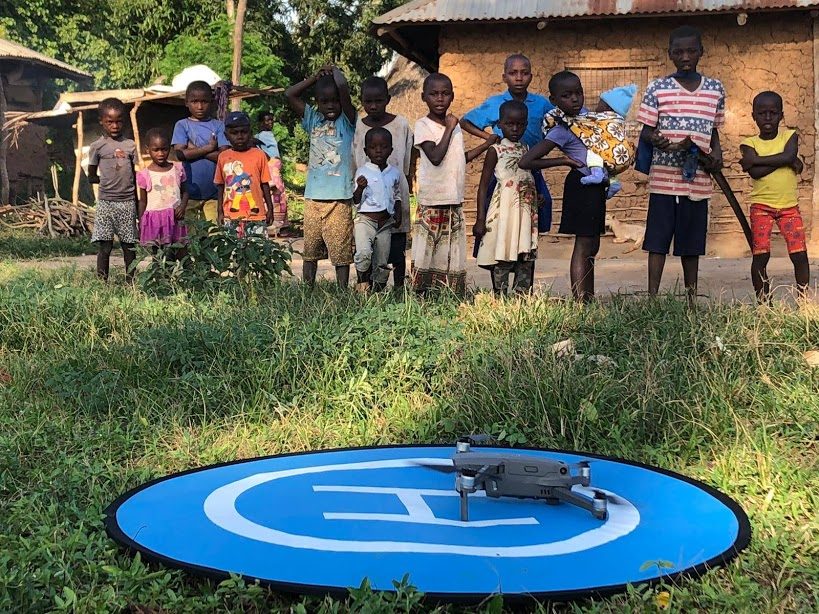
Bringing drone technology to the gobal communities who may benefit most is difficult.  Challenges range from regulatory hurdles, communcation issues, extreme weather, to community acceptance: but aerial imagery and mapping can provide stunning benefits to remote populations.

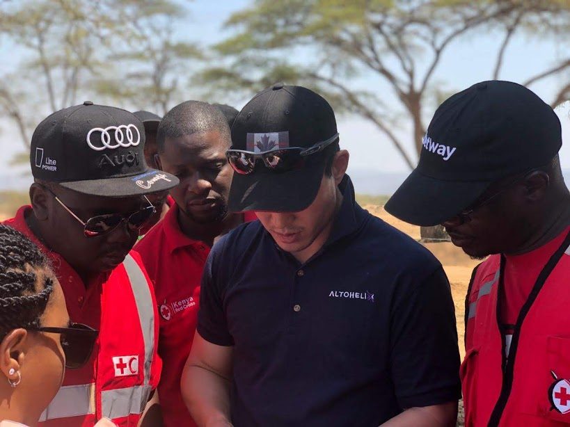
At the Pix4D User Conference in Denver this week Hyun-June Choi, CEO of Canada’s Altohelix, took us inside their mission working with the Kenyan Red Cross.

Altohelix first worked with the Kenyan Red Cross to develop some clear short-term goals: mapping areas of disaster risk; crop monitoring for food security; and aerial video and photography for communications and PR efforts.

Kenya experiences extreme weather cycles – and in some areas, the floods and the rains consistently cause loss of homes, crops, and lives.  “They have a constant cycle of floods and drought – and the cycles are getting worse,”  says Choi.  As a result, the Kenyan government is working to resettle some communities who get flooded every year: a critical and immediate need for aerial data.

image courtesy Altohelix

No Regulations

Mapping areas for resettlement to ensure that they are out of the flood plain and appropriate for new construction was Altohelix’ first mission.   But they immediately ran into a roadblock: “The first thing we had to do was to overcome regulations,” says Choi.  “Kenya does not allow any civilian drone operations.   The Kenyan Civil Aviation Authority (KCAA) is still drafting the drone regulations for the country, and Kenyan Defense Forces (KDF) are the only ones officially allowed to fly.”  Altohelix was able to work with the Kenyan government and KDF to receive permissions: they were accompanied by KDF personnel on all of their flights.

Training and Operations

image courtesy Altohelix

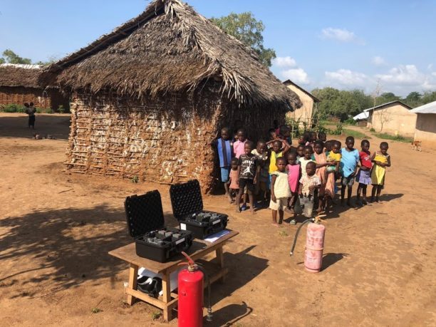
Knowledge transfer was part of the mission, and Altohelix did 5 days of ground school and 5 days of flight training.  They used Mavic 2 Pro aircraft, the cheapest, most available and most practical tool for the job.   Then it was time to execute: but, as Choi explains, conditions weren’t ideal. “No cell phone, no electricity, no wi-fi, no paved roads,” says Choi.  “It was challenging. ”

Using imagery from the Mavic 2 Pro and Pix4D for processing, the team created a digital surface model (DSM) of the proposed resettlement area, to ensure that the area was out of the flood zone and safe for new construction.   “The project showed the full extent of the flood damage, and the changing landscape,” says Choi.  “With a single flood, the entire shape of the river bed changed.”  It’s a model that simply couldn’t be created with satellite imagery, Choi points out: “Satellite data resolution is just too low.”  As a result of that mission, the Kenyan Red Cross constructed 5,715 new shelters, replacing the weather vulnerable traditional huts destroyed by the flooding.

Next Steps

image: courtesy Altohelix

That mission has smoothed the way for expansion of the program, which has now been approved.  The Kenyan team plans to purchase more equipment and expand into new missions.  “We’ll execute more operations,” says Choi. “We’ll purchase Pix4Dreact [real time 2D mapping], Pix4Dmapper, a Wingtra One [fixed wing drone] and sensors, and we’ll make improvements to the SOPs [standard operating procedures.]

The team has already expanded operations to monitor the rapidly expanding refugee camps in the western part of the country and evaluate drought conditions.  They are providing critical data for decision makers when many lives are at stake.  It’s a job that only a drone can do – and Altohelix is helping the Kenyan Red Cross to do it.

Miriam McNabb

Miriam McNabb is the Editor-in-Chief of DRONELIFE and CEO of JobForDrones, a professional drone services marketplace, and a fascinated observer of the emerging drone industry and the regulatory environment for drones. Miriam has penned over 3,000 articles focused on the commercial drone space and is an international speaker and recognized figure in the industry.  Miriam has a degree from the University of Chicago and over 20 years of experience in high tech sales and marketing for new technologies.
For drone industry consulting or writing, Email Miriam.

TWITTER:@spaldingbarker

Subscribe to DroneLife here.

Filed Under: Drone News Feeds, News Tagged With: Altohelix, Drones For Good, Hyun Choi, Kenyan Red Cross

Reader Interactions

Trackbacks

  1. Drones for Good: Mapping for the Kenyan Red Cross with Altohelix | Drone News says:
    October 10, 2019 at 5:26 pm

    […] Source link […]

    Reply
  2. Mapping for the Kenyan Red Cross with Altohelix – ARPAS UK says:
    October 7, 2019 at 9:50 am

    […] Drone Life […]

    Reply
  3. Drones for Good: Mapping for the Kenyan Pink Cross with Altohelix - Gadgets Now Website says:
    October 5, 2019 at 5:59 pm

    […] Supply hyperlink […]

    Reply
  4. Drones for Good: Mapping for the Kenyan Red Cross with Altohelix – Best Drone Company says:
    October 4, 2019 at 2:13 am

    […] Source link […]

    Reply
  5. Drones for Good: Mapping for the Kenyan Red Cross with Altohelix – Top Drones & reviews says:
    October 3, 2019 at 11:10 pm

    […] post Drones for Good: Mapping for the Kenyan Red Cross with Altohelix appeared first on […]

    Reply
  6. Drones for Good: Mapping for the Kenyan Red Cross with Altohelix | Drone Magazine says:
    October 3, 2019 at 5:33 pm

    […] Source […]

    Reply
  7. Drones for Good: Mapping for the Kenyan Crimson Cross with Altohelix - Drone Stuff Pro says:
    October 3, 2019 at 5:06 pm

    […] Supply hyperlink […]

    Reply

Leave a Reply Cancel reply

Your email address will not be published. Required fields are marked *

Primary Sidebar

LATEST

AirData UAV and LeoSight Bring Live Drone Data for DFR Programs

The new LeoSight AirData integration streams real-time flight data, telemetry, and operational insights from AirData directly into LeoCommand, giving dispatchers…

Continue Reading AirData UAV and LeoSight Bring Live Drone Data for DFR Programs

New Boson SX8 Brings High-Resolution Thermal Imaging to NDAA-Compliant Drone Payloads

New thermal imaging module combines SXGA resolution with compact size and U.S. manufacturing Teledyne FLIR OEM has announced the Boson…

Continue Reading New Boson SX8 Brings High-Resolution Thermal Imaging to NDAA-Compliant Drone Payloads

The Next Drone Supply Chain Challenge: Rare Earth Magnets

Bipartisan legislation aims to reduce dependence on China for a critical component inside drone motors A new bipartisan bill introduced…

Continue Reading The Next Drone Supply Chain Challenge: Rare Earth Magnets

DRONELIFE Exclusive Interview: Andrew Giuliani on the Race to Secure the 2026 World Cup

Giulliani lauds ‘Herculean’ effort to build counter-UAS systems By DRONELIFE Features Editor Jim Magill (Editor’s note: This story is part…

Continue Reading DRONELIFE Exclusive Interview: Andrew Giuliani on the Race to Secure the 2026 World Cup

MFE Launches Robotic Gas Detection for Boston Dynamics’ Spot

A new integration streams Blackline Safety’s connected gas data from the Spot quadruped to Blackline Live, layering robotic atmospheric awareness…

Continue Reading MFE Launches Robotic Gas Detection for Boston Dynamics’ Spot

Wing and Walmart Add Seven New Drone Delivery Markets

The partners named Memphis, New Orleans, Philadelphia, Phoenix, San Diego, the San Francisco Bay Area, and Salt Lake City as…

Continue Reading Wing and Walmart Add Seven New Drone Delivery Markets

FCC Expands Drone Exemptions as Product-by-Product Security Review Takes Shape

VEX AIR receives conditional approval through December 2026 as federal agencies continue evaluating individual UAS outside broad Covered List restrictions…

Continue Reading FCC Expands Drone Exemptions as Product-by-Product Security Review Takes Shape

Quantum Cyber Signs LOI for Connecticut Manufacturing Facility as Drone Firms Pursue Domestic Production

Proposed acquisition reflects broader industry shift toward U.S.-based drone manufacturing and vertically integrated supply chains Quantum Cyber (NASDAQ:QUCY) has signed…

Continue Reading Quantum Cyber Signs LOI for Connecticut Manufacturing Facility as Drone Firms Pursue Domestic Production

What Comes After China? Ukraine’s Growing Role in the U.S. Drone Industry

As Washington pushes for secure drone supply chains, a growing number of U.S.-Ukraine partnerships suggest a new model may already…

Continue Reading What Comes After China? Ukraine’s Growing Role in the U.S. Drone Industry

FBI, DHS Take On the Challenge of Building Counter-UAS System

(Editor’s note: This story is part of a series of reports on efforts to establish new counter-UAS protocols in the…

Continue Reading FBI, DHS Take On the Challenge of Building Counter-UAS System

Secondary Sidebar

Footer

SPONSORED

Inspired Flight Gremsy IF800 VIO F1 drones geo week

What Will It Take to Strengthen U.S. Drone Manufacturing? A Conversation with Inspired Flight’s CEO

Global Mapper Mobile data collection

Collection Ground Control Points with Global Mapper Mobile

Military Drone Mapping Solutions

How SimActive’s Correlator3D™ is Revolutionizing Military Mapping: An Exclusive Interview with CEO Philippe Simard

Photogrammetry Accuracy Standards

SimActive Photogrammetry Software: Enabling Users to Meet Accuracy Standards for Over 20 Years

NACT Engineering Parrot ANAFI tether indoor shot

Smart Tether for Parrot ANAFI USA from NACT Engineering

Blue Marble, features global mapper, features Blue Marble

Check Out These New Features in Global Mapper v25 from Blue Marble

About Us | Contact Us | Advertise With Us | Write for Us | Privacy Policy | Terms of Service

The Trusted Source for the Business of Drones.

This website uses cookies and third party services. By clicking OK, you are agreeing to our privacy policy. ACCEPT

Manage consent

Privacy Overview

This website uses cookies to improve your experience while you navigate through the website. Out of these, the cookies that are categorized as necessary are stored on your browser as they are essential for the working of basic functionalities of the website. We also use third-party cookies that help us analyze and understand how you use this website. These cookies will be stored in your browser only with your consent. You also have the option to opt-out of these cookies. But opting out of some of these cookies may affect your browsing experience.
Necessary
Always Enabled
Necessary cookies are absolutely essential for the website to function properly. These cookies ensure basic functionalities and security features of the website, anonymously.
CookieDurationDescription
cookielawinfo-checkbox-analytics11 monthsThis cookie is set by GDPR Cookie Consent plugin. The cookie is used to store the user consent for the cookies in the category "Analytics".
cookielawinfo-checkbox-functional11 monthsThe cookie is set by GDPR cookie consent to record the user consent for the cookies in the category "Functional".
cookielawinfo-checkbox-necessary11 monthsThis cookie is set by GDPR Cookie Consent plugin. The cookies is used to store the user consent for the cookies in the category "Necessary".
cookielawinfo-checkbox-others11 monthsThis cookie is set by GDPR Cookie Consent plugin. The cookie is used to store the user consent for the cookies in the category "Other.
cookielawinfo-checkbox-performance11 monthsThis cookie is set by GDPR Cookie Consent plugin. The cookie is used to store the user consent for the cookies in the category "Performance".
viewed_cookie_policy11 monthsThe cookie is set by the GDPR Cookie Consent plugin and is used to store whether or not user has consented to the use of cookies. It does not store any personal data.
Functional
Functional cookies help to perform certain functionalities like sharing the content of the website on social media platforms, collect feedbacks, and other third-party features.
Performance
Performance cookies are used to understand and analyze the key performance indexes of the website which helps in delivering a better user experience for the visitors.
Analytics
Analytical cookies are used to understand how visitors interact with the website. These cookies help provide information on metrics the number of visitors, bounce rate, traffic source, etc.
Advertisement
Advertisement cookies are used to provide visitors with relevant ads and marketing campaigns. These cookies track visitors across websites and collect information to provide customized ads.
Others
Other uncategorized cookies are those that are being analyzed and have not been classified into a category as yet.
SAVE & ACCEPT