• Skip to main content
  • Skip to secondary menu
  • Skip to primary sidebar
  • Skip to secondary sidebar
  • Skip to footer
  • DroneRacingLife
  • DroneFlyers
  • Newsletter
DroneLife

DRONELIFE

Stay up to date on all the latest Drone News

  • News
  • Products
  • Industries
    • Agriculture
    • Construction
    • Delivery
    • Dual Use
    • Inspection
    • Public Safety
    • Surveying
  • Enthusiasts
  • Regulations
  • Business
  • Video
  • Podcasts

Kansas to Use AirMap in Pioneering Effort at Unmanned Traffic Management

August 8, 2017 by Frank Schroth 5 Comments

Airmap Kansas

Kansas is taking a leadership position in efforts to expand and grow the drone industry in a manner that is safe and responsible. Using Airmap technology Kansas will be the first state in the country to implement an Unmanned Traffic Management (UTM) capability.

Unmanned Traffic Management, or UTM, is the technological infrastructure that facilitates data exchange and air traffic control for drones. By implementing technologies that will one day be part of a nationwide UTM framework, Kansas is the first U.S. state to take a proactive approach to protecting the privacy, safety and security of state residents while empowering drone entrepreneurship. The KDOT-AirMap partnership will foster a thriving drone economy with the potential to contribute billions in economic impact and create thousands of jobs in the state.

The KDOT-AirMap collaboration will lay the foundation for a statewide UTM infrastructure by deploying technology capable of:

  • Delivering safety-critical information from state and local agencies to drones for situational awareness and flight planning
  • Facilitating collaboration, communication and data exchange between state and local authorities and drones and their operators
  • Fostering public awareness about drone regulations and airspace requirements
  • Automating airspace notification and authorization at Kansas airports
  • Demonstrating sophisticated solutions that safeguard public safety and personal privacy, including technology for geofencing and remote identification
  • Enabling high-scale and complex operations beyond visual line of sight

The initiative will make AirMap’s airspace management dashboard available to every airport in Kansas. Using the AirMap platform, participating airports will be able to accept digital flight notices, communicate with drone operators and prepare for UTM milestones on the horizon, including automating airspace notification and authorization for commercial drone flights.

Government entities and agencies throughout the state will be trained to use the AirMap platform to support their own drone operations and provide safety-critical information to drone operators, including first responder activity, locations of critical infrastructure, local landmarks, community events and more.

State colleges and universities will also receive access to the AirMap platform, including AirMap’s APIs and SDKs for developers, to empower students and faculty to participate in research and development to discover new drone applications.

“Drones are already contributing to the Kansas economy as they start to be employed by farmers, ranchers, realtors, first responders and our public agencies,” said Bob Brock, Director of Unmanned Aerial Systems (UAS) and Deputy Director of Aviation at the Kansas Department of Transportation. “By partnering with AirMap, we ensure that the state of Kansas is a perfect place to fly drones and build strong UAS companies. Kansas is open for business.”

“Soon, there will be more drones in our skies than cars on our roads,” said AirMap cofounder Gregory S. McNeal. “The AirMap-KDOT partnership will help Kansas prepare for this next frontier in aviation, creating the digital infrastructure the state will need to safely, securely and efficiently benefit from high-scale drone operations. We’re thrilled to partner with KDOT to open Kansas skies for drones.”

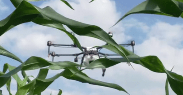
The UTM initiative builds upon Kansas’ long history of aviation innovation, paving the way for the state to mobilize drones for disaster recovery, search and rescue, agriculture, construction, package delivery and other community benefits. Aviation is already the state’s second largest industry, supporting nearly 92,000 jobs and generating an economic output of nearly $20.6 billion. By deploying AirMap airspace management technology across the state – and working with AirMap to demonstrate sophisticated UTM solutions in a series of technical demonstrations – Kansas will be uniquely positioned to capture a significant share of the drone opportunity.

DroneLife Take: Whether this will be the optimal UTM solution is to be determined but the state and Airmap deserve some credit for actually doing something. Finally someone is taking a substantial step in moving this critical technology forward

Here is a video from Airmap discussing the initiative.


AirMap Takes Flight with Kansas from AirMap on Vimeo.


Frank Schroth
Frank Schroth

Frank Schroth is editor in chief of DroneLife, the authoritative source for news and analysis on the drone industry: it’s people, products, trends, and events.
Email Frank
TWITTER:@fschroth

Filed Under: Drone News, Products, UTM Tagged With: AirMap, Kansas, UTM

Reader Interactions

Trackbacks

  1. Kansas to Use AirMap in Pioneering Effort at Unmanned Traffic Management « Best FPV Quadcopters Under 100 USD says:
    August 8, 2017 at 11:34 am

    […] post Kansas to Use AirMap in Pioneering Effort at Unmanned Traffic Management appeared first on […]

    Reply
  2. Kansas to Use AirMap in Pioneering Effort at Unmanned Traffic Management | News and Reviews about Drones, Quadcopter, Camera says:
    August 8, 2017 at 11:32 am

    […] Source link […]

    Reply
  3. Kansas to Use AirMap in Pioneering Effort at Unmanned Traffic Management - Drone Services Company | Aerial Photo and Video | Miami Florida says:
    August 8, 2017 at 11:11 am

    […] post Kansas to Use AirMap in Pioneering Effort at Unmanned Traffic Management appeared first on […]

    Reply
  4. Kansas to Use AirMap in Pioneering Effort at Unmanned Traffic Management – TheDrones.Link says:
    August 8, 2017 at 11:08 am

    […] post Kansas to Use AirMap in Pioneering Effort at Unmanned Traffic Management appeared first on […]

    Reply
  5. Kansas to Use AirMap in Pioneering Effort at Unmanned Traffic Management | DRONEPETS.ORG says:
    August 8, 2017 at 11:02 am

    […] post Kansas to Use AirMap in Pioneering Effort at Unmanned Traffic Management appeared first on […]

    Reply

Leave a Reply Cancel reply

Your email address will not be published. Required fields are marked *

Primary Sidebar

LATEST

Volocopter Unveils VoloXPro and Expands into Pilot Training Market, Air Sports

New ultralight multicopter targets private pilots, training organizations, and future air taxi operators Volocopter has introduced the VoloXPro, a new…

Continue Reading Volocopter Unveils VoloXPro and Expands into Pilot Training Market, Air Sports

Matternet Launches NHS Drone Deliveries in Central London

New service connects major hospital campuses to move critical medical items in minutes Matternet has launched drone delivery operations for…

Continue Reading Matternet Launches NHS Drone Deliveries in Central London

As Drone Delivery Expands, Communities Remain Uncertain

County denies Walmart bid to start drone deliveries By DRONELIFE Features Editor Jim Magill A board of Georgia county officials…

Continue Reading As Drone Delivery Expands, Communities Remain Uncertain

Rogue Drone Detected. Now What?

SkySafe and Motorola Solutions integration highlights the next step in managing low-altitude airspace At the Motorola Solutions Summit 2026 this…

Continue Reading Rogue Drone Detected. Now What?

New DJI Drones Launch Globally, But Not in the U.S.

Court filing highlights FCC restrictions as new products debut without U.S. availability Drone giant DJI has introduced new consumer drones,…

Continue Reading New DJI Drones Launch Globally, But Not in the U.S.

NYC Tests Cargo Drones to Cut Traffic and Speed Medical Deliveries

Port Authority Launches Yearlong Cargo Drone Trial Over East River. Skyports partnership aims to test middle-mile delivery, reduce congestion, and…

Continue Reading NYC Tests Cargo Drones to Cut Traffic and Speed Medical Deliveries

AirData and BRINC Integration Brings Automated Flight Records to Public Safety Drone Programs

New integration captures flight data automatically, supporting scalable and auditable drone operations AirData has announced a new integration with BRINC,…

Continue Reading AirData and BRINC Integration Brings Automated Flight Records to Public Safety Drone Programs

Sentrycs Lands Major Counter-Drone Contracts Across World Cup Cities

Sentrycs systems to protect skies in U.S., Mexico, Canada By DRONELIFE Features Editor Jim Magill (Editor’s note: This is part…

Continue Reading Sentrycs Lands Major Counter-Drone Contracts Across World Cup Cities

Kraus Hamdani Aerospace Demonstrates Wireless Power Beaming to K1000ULE at Shaw AFB

Kraus Hamdani Aerospace and PowerLight Technologies sustain the K1000ULE in flight using laser-based wireless power beaming, maintaining continuous ISR operations…

Continue Reading Kraus Hamdani Aerospace Demonstrates Wireless Power Beaming to K1000ULE at Shaw AFB

Sion Power Launches Two High Energy Density Batteries for Military Drones

Sion Power’s Licerion Strike and Echo cells exceed 500 Wh/kg, enabling combat drones to fly two to three times longer…

Continue Reading Sion Power Launches Two High Energy Density Batteries for Military Drones

Secondary Sidebar

Footer

SPONSORED

Inspired Flight Gremsy IF800 VIO F1 drones geo week

What Will It Take to Strengthen U.S. Drone Manufacturing? A Conversation with Inspired Flight’s CEO

Global Mapper Mobile data collection

Collection Ground Control Points with Global Mapper Mobile

Military Drone Mapping Solutions

How SimActive’s Correlator3Dâ„¢ is Revolutionizing Military Mapping: An Exclusive Interview with CEO Philippe Simard

Photogrammetry Accuracy Standards

SimActive Photogrammetry Software: Enabling Users to Meet Accuracy Standards for Over 20 Years

NACT Engineering Parrot ANAFI tether indoor shot

Smart Tether for Parrot ANAFI USA from NACT Engineering

Blue Marble, features global mapper, features Blue Marble

Check Out These New Features in Global Mapper v25 from Blue Marble

About Us | Contact Us | Advertise With Us | Write for Us | Privacy Policy | Terms of Service

The Trusted Source for the Business of Drones.

This website uses cookies and third party services. By clicking OK, you are agreeing to our privacy policy. ACCEPT

Manage consent

Privacy Overview

This website uses cookies to improve your experience while you navigate through the website. Out of these, the cookies that are categorized as necessary are stored on your browser as they are essential for the working of basic functionalities of the website. We also use third-party cookies that help us analyze and understand how you use this website. These cookies will be stored in your browser only with your consent. You also have the option to opt-out of these cookies. But opting out of some of these cookies may affect your browsing experience.
Necessary
Always Enabled
Necessary cookies are absolutely essential for the website to function properly. These cookies ensure basic functionalities and security features of the website, anonymously.
CookieDurationDescription
cookielawinfo-checkbox-analytics11 monthsThis cookie is set by GDPR Cookie Consent plugin. The cookie is used to store the user consent for the cookies in the category "Analytics".
cookielawinfo-checkbox-functional11 monthsThe cookie is set by GDPR cookie consent to record the user consent for the cookies in the category "Functional".
cookielawinfo-checkbox-necessary11 monthsThis cookie is set by GDPR Cookie Consent plugin. The cookies is used to store the user consent for the cookies in the category "Necessary".
cookielawinfo-checkbox-others11 monthsThis cookie is set by GDPR Cookie Consent plugin. The cookie is used to store the user consent for the cookies in the category "Other.
cookielawinfo-checkbox-performance11 monthsThis cookie is set by GDPR Cookie Consent plugin. The cookie is used to store the user consent for the cookies in the category "Performance".
viewed_cookie_policy11 monthsThe cookie is set by the GDPR Cookie Consent plugin and is used to store whether or not user has consented to the use of cookies. It does not store any personal data.
Functional
Functional cookies help to perform certain functionalities like sharing the content of the website on social media platforms, collect feedbacks, and other third-party features.
Performance
Performance cookies are used to understand and analyze the key performance indexes of the website which helps in delivering a better user experience for the visitors.
Analytics
Analytical cookies are used to understand how visitors interact with the website. These cookies help provide information on metrics the number of visitors, bounce rate, traffic source, etc.
Advertisement
Advertisement cookies are used to provide visitors with relevant ads and marketing campaigns. These cookies track visitors across websites and collect information to provide customized ads.
Others
Other uncategorized cookies are those that are being analyzed and have not been classified into a category as yet.
SAVE & ACCEPT