• Skip to main content
  • Skip to secondary menu
  • Skip to primary sidebar
  • Skip to secondary sidebar
  • Skip to footer
  • DroneRacingLife
  • DroneFlyers
  • Newsletter
DroneLife

DRONELIFE

Stay up to date on all the latest Drone News

  • News
  • Products
  • Industries
    • Agriculture
    • Construction
    • Delivery
    • Dual Use
    • Inspection
    • Public Safety
    • Surveying
  • Enthusiasts
  • Regulations
  • Business
  • Video
  • Podcasts

What NDVI Drones Can Do for an Ag Business – part 1

January 18, 2016 by Frank Schroth Leave a Comment

by the staff of DroneDeploy, republished with permission

Misconceptions and advice from agriculture industry experts
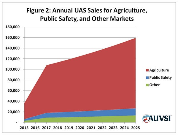
Source: auvsi.org/econreport

There’s a lot of hype about agriculture drones. By AUVSI’s own estimates, the U.S. drone industry will be worth $82 billion by 2025, with agriculture generating the lion’s share.

For the most part, the hype is warranted — but there’s also a decent amount of confusion surrounding ag drones. Just try some quick Googling and you’ll start noticing trends; everyone is talking about NIR (near infrared) cameras, vegetation indices, and of course, the ubiquitous NDVI.

We’re going to attempt to answer the why, how, and when so that you’ll be able to manage your expectations of what NDVI can (and can’t) do for you.

Why do I need NDVI, how do I make NDVI maps, and when do I use them?

To answer these questions and give insight, we’ve assembled four industry experts — a veritable pantheon of ag pros.

Let’s roll up our sleeves and get our hands dirty as we delve into part one of our two-parter on NDVI, drones, and the agriculture industry.

At DroneDeploy, we’ve built some popular and effective tools for analysis of various vegetation indices, including NDVI. If you want to get started making NDVI maps today, you can sign up free at DroneDeploy.com.

Norm Lamothe
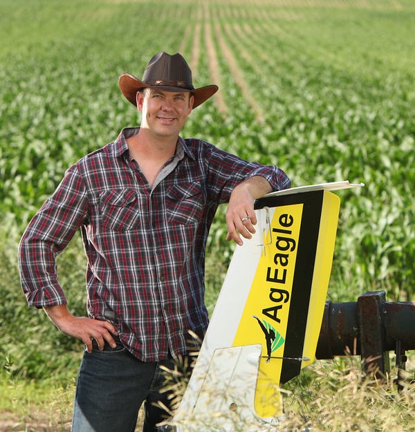
Norm was previously featured in DroneDeploy’s Soybean case study

Norm, a manned aircraft pilot, is one of DroneDeploy’s most active mappers. He mainly uses his AgEagle. All of Norm’s flights are focused on generating actionable aerial imagery. In his business, Deveron UAS, Norm flies drones as a service for growers and farmers — and business is good.

Farming runs in his blood; besides merely looking the part (he’s literally Mr. October in the 2016 Faces of Farming calendar), he also walks the walk.

It is extremely important to put your boots on the ground.

What is NDVI to you?

NDVI is not a new formula by any means. It’s been available to farmers from satellites as an entry-level aerial perspective for a while. It has been very easy to get into and produce. I think that’s why it’s been so widely used.
Ag Toolbox: real-time vegetation index analysis

What is the value of NDVI?

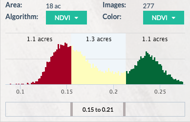
Where we see value is variability. There is always variability in all fields. NDVI highlights this variability and makes it easier for your eyes to see. When you can easily see variability, you can make quicker decisions.

What are some of the challenges with using NDVI?

One of the challenges with using NDVI is that you’re not always dealing with absolute values. When lighting conditions and cloud cover change, the camera lens gives you a value of what it sees but doesn’t account for the atmospheric change. If you fly over the same fields on different days with the same camera, you should get the same values… but you don’t. You’ll get the same variability but you won’t get the same numbers on the NDVI scale.

Because of this, it is extremely important to put your boots on the ground — every NDVI map should still be ground-truthed.
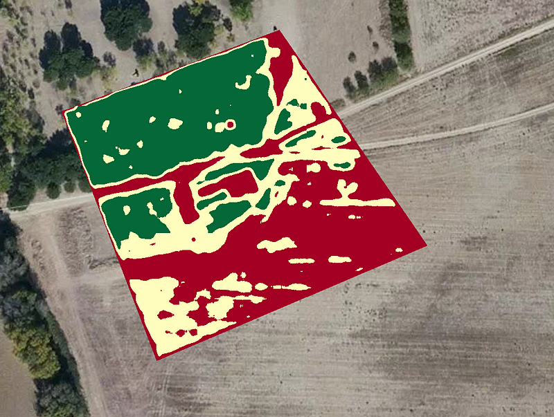
Thresholded NDVI map showing variability

What’s your advice to people who are new to using agriculture drones?

People see a relatively cheap price tag on a drone and think that’s all it takes. I come from the aviation industry. Yeah, $50k can get you a Cessna, but that’s just the starting point. There are hidden costs.

It’s easy not to see the amount of time you spend maintaining the equipment, all the hours uploading and manipulating the images, putting data in specific formats, or the regulatory side of things.

In Canada there are restrictions for operating and permits to obtain. You have to be compliant and safe to run a legitimate business. Be prepared for a lot of work, not just in the fields and at the computer but on the regulatory side as well.

Click here to read Norm’s case study, ‘Drones — a Soybean Grower’s Best Friend’

Chad Colby

Chad Colby is a complex guy: drone evangelist, public speaker, technology early-adopter, professional snowmobiler.

The son of a farmer and the husband of an agronomist, Chad does it all and has fun doing it. His garage of toys puts others to shame. But in Chad’s garage, the drones don’t classify as toys — they’re tools.

The power right now is in understanding your own field. Truly understanding it. Soil type, history — all of it.

What is your experience with NDVI?

NDVI has been around for a long time. Drones are a bit newer. Just three years ago we were so focused on putting a drone in the air and getting this NDVI image. It was all that mattered. Stick a modified GoPro on the drone, send it on up, and create the best image ever!

After flying, it took 15–20 hours to process the data. That’s what we did back then. These days it’s easier. We want to see the inconsistencies in our fields.
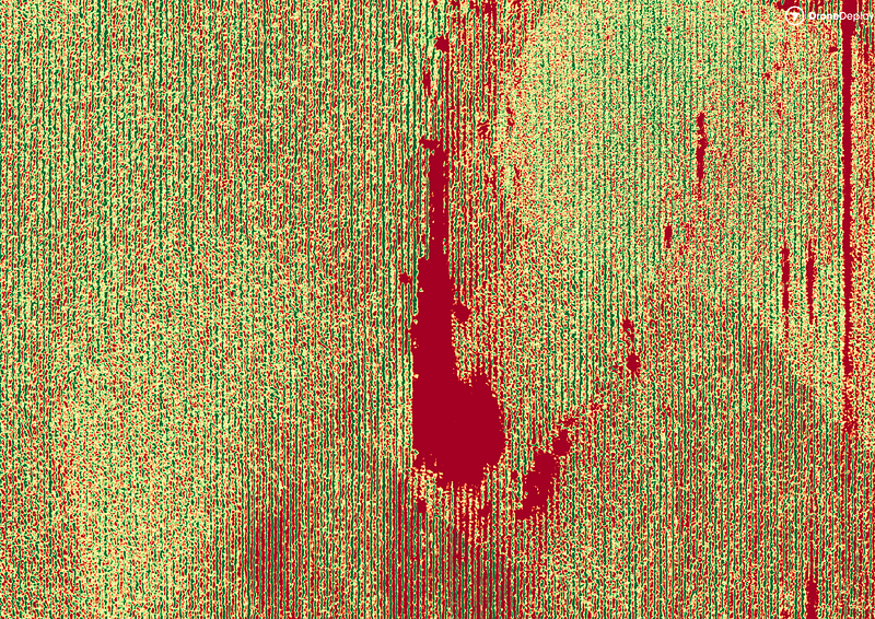
NDVI imagery processed from a modified camera

What are some misconceptions about NDVI?

I don’t care what NIR camera you’re using — it takes no account for the soil, the fertility, or other problems in the field. It’s just basing the decision off of the vegetation algorithm and imagery from that day. It’s not necessarily the holy grail. NDVI maps do not replace an agronomist in the field.
Are yield estimations valuable to a grower?

Not as much as you’d think. Guessing yield is not a critical or unknown component to a farmer. Growers have known how to do that their whole lives. They can take a small section of field, make a quick count, and extrapolate that across the entirety for an accurate estimation.

So what do growers want to know?

They want to know if they have problems on this 160 acre field today or can they move on to the next field and continue their daily routine. The immediacy of the data is what can make a big difference. False NDVI imagery from RGB cameras can even be valuable if they highlight inconsistency — it can be a huge time saver to quickly detect variance and then go to the spot and make a decision.
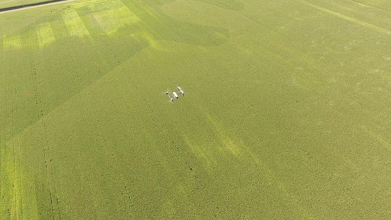
A DJI Inspire 1 on a mapping mission above a field

Any advice for those who are starting a new drone business?

Lots of people are asking how to get into ag with drones. Farmers and growers need to be able to rely on their service provider. You have a huge advantage if you can be at your client’s field immediately during, or after a weather event.

Stay tuned for Part 2: Want to get started making aerial agriculture maps with your drone?
Visit dronedeploy.com and sign up today for free—no credit card required.


Frank Schroth
Frank Schroth

Frank Schroth is editor in chief of DroneLife, the authoritative source for news and analysis on the drone industry: it’s people, products, trends, and events.
Email Frank
TWITTER:@fschroth


Filed Under: Agriculture, News, Uncategorized Tagged With: Agriculture, DroneDeploy

Reader Interactions

Leave a Reply Cancel reply

Your email address will not be published. Required fields are marked *

Primary Sidebar

LATEST

White House Imposes New Tariffs on Imported Drones and Components

Section 232 action sets tariffs of 25% to 100%, with lower rates for qualifying allied supply chains and incentives for…

Continue Reading White House Imposes New Tariffs on Imported Drones and Components

Pennsylvania National Guard Becomes Hub for Pentagon’s Drone Dominance Program

Fort Indiantown Gap trains soldiers on new military drones while developing hands-on counter-UAS tactics By DRONELIFE Features Editor Jim Magill…

Continue Reading Pennsylvania National Guard Becomes Hub for Pentagon’s Drone Dominance Program

Powerful Public Safety Technology Needs Powerful Guardrails: What Flock’s Camera Controversy Means for Drones

Recent cases involving misuse of automated license plate readers offer a broader lesson for public safety agencies adopting increasingly capable…

Continue Reading Powerful Public Safety Technology Needs Powerful Guardrails: What Flock’s Camera Controversy Means for Drones

Engineering Without Compromise: How HP Additive Manufacturing Helped EIVIE Build an NDAA-Compliant Drone

For one startup drone manufacturer, additive manufacturing made it possible to preserve an ambitious aerodynamic design while adapting quickly to…

Continue Reading Engineering Without Compromise: How HP Additive Manufacturing Helped EIVIE Build an NDAA-Compliant Drone

Two Shenzhen Rivals, Two Different Paths to the U.S. Market

As Insta360 expands across cameras and drones, restrictions on DJI could create an opening for its increasingly direct Chinese competitor.…

Continue Reading Two Shenzhen Rivals, Two Different Paths to the U.S. Market

SimActive Correlator3D Supports Large-Scale Green Hydrogen Mapping in Chile

Geo4D used the photogrammetry platform to process high-resolution aerial imagery covering more than 100,000 hectares in Patagonia. SimActive’s Correlator3D photogrammetry…

Continue Reading SimActive Correlator3D Supports Large-Scale Green Hydrogen Mapping in Chile

Michigan Drone Lawsuit Challenges Restrictions on Flights Near Police Operations

Michigan man sues sheriff’s department over state’s drone law By DRONELIFE Features Editor Jim Magill A Michigan-based freelance journalist has…

Continue Reading Michigan Drone Lawsuit Challenges Restrictions on Flights Near Police Operations

Michigan Awards $2 Million for Five Advanced Air Mobility Projects

State agencies will test drones and aerial technologies for environmental monitoring, wildfire response, infrastructure, public safety and agriculture. Michigan has…

Continue Reading Michigan Awards $2 Million for Five Advanced Air Mobility Projects

FCC Revokes Drone Approvals After U.S. Assembler Denies Any Connection

Odyssey Robot claimed its equipment was made and assembled in the U.S.; an FCC investigation found otherwis The Federal Communications…

Continue Reading FCC Revokes Drone Approvals After U.S. Assembler Denies Any Connection

FlybyOps Launches Enterprise Platform for Scaling BVLOS and Autonomous Drone Operations

Finland-based platform aims to help operators manage compliance, risk and operational oversight as drone programs grow in size and complexity…

Continue Reading FlybyOps Launches Enterprise Platform for Scaling BVLOS and Autonomous Drone Operations

Secondary Sidebar

Footer

SPONSORED

Inspired Flight Gremsy IF800 VIO F1 drones geo week

What Will It Take to Strengthen U.S. Drone Manufacturing? A Conversation with Inspired Flight’s CEO

Global Mapper Mobile data collection

Collection Ground Control Points with Global Mapper Mobile

Military Drone Mapping Solutions

How SimActive’s Correlator3D™ is Revolutionizing Military Mapping: An Exclusive Interview with CEO Philippe Simard

Photogrammetry Accuracy Standards

SimActive Photogrammetry Software: Enabling Users to Meet Accuracy Standards for Over 20 Years

NACT Engineering Parrot ANAFI tether indoor shot

Smart Tether for Parrot ANAFI USA from NACT Engineering

Blue Marble, features global mapper, features Blue Marble

Check Out These New Features in Global Mapper v25 from Blue Marble

About Us | Contact Us | Advertise With Us | Write for Us | Privacy Policy | Terms of Service

The Trusted Source for the Business of Drones.

This website uses cookies and third party services. By clicking OK, you are agreeing to our privacy policy. ACCEPT

Manage consent

Privacy Overview

This website uses cookies to improve your experience while you navigate through the website. Out of these, the cookies that are categorized as necessary are stored on your browser as they are essential for the working of basic functionalities of the website. We also use third-party cookies that help us analyze and understand how you use this website. These cookies will be stored in your browser only with your consent. You also have the option to opt-out of these cookies. But opting out of some of these cookies may affect your browsing experience.
Necessary
Always Enabled
Necessary cookies are absolutely essential for the website to function properly. These cookies ensure basic functionalities and security features of the website, anonymously.
CookieDurationDescription
cookielawinfo-checkbox-analytics11 monthsThis cookie is set by GDPR Cookie Consent plugin. The cookie is used to store the user consent for the cookies in the category "Analytics".
cookielawinfo-checkbox-functional11 monthsThe cookie is set by GDPR cookie consent to record the user consent for the cookies in the category "Functional".
cookielawinfo-checkbox-necessary11 monthsThis cookie is set by GDPR Cookie Consent plugin. The cookies is used to store the user consent for the cookies in the category "Necessary".
cookielawinfo-checkbox-others11 monthsThis cookie is set by GDPR Cookie Consent plugin. The cookie is used to store the user consent for the cookies in the category "Other.
cookielawinfo-checkbox-performance11 monthsThis cookie is set by GDPR Cookie Consent plugin. The cookie is used to store the user consent for the cookies in the category "Performance".
viewed_cookie_policy11 monthsThe cookie is set by the GDPR Cookie Consent plugin and is used to store whether or not user has consented to the use of cookies. It does not store any personal data.
Functional
Functional cookies help to perform certain functionalities like sharing the content of the website on social media platforms, collect feedbacks, and other third-party features.
Performance
Performance cookies are used to understand and analyze the key performance indexes of the website which helps in delivering a better user experience for the visitors.
Analytics
Analytical cookies are used to understand how visitors interact with the website. These cookies help provide information on metrics the number of visitors, bounce rate, traffic source, etc.
Advertisement
Advertisement cookies are used to provide visitors with relevant ads and marketing campaigns. These cookies track visitors across websites and collect information to provide customized ads.
Others
Other uncategorized cookies are those that are being analyzed and have not been classified into a category as yet.
SAVE & ACCEPT