• Skip to main content
  • Skip to secondary menu
  • Skip to primary sidebar
  • Skip to secondary sidebar
  • Skip to footer
  • DroneRacingLife
  • DroneFlyers
  • Newsletter
DroneLife

DRONELIFE

Stay up to date on all the latest Drone News

  • News
  • Products
  • Industries
    • Agriculture
    • Construction
    • Delivery
    • Dual Use
    • Inspection
    • Public Safety
    • Surveying
  • Enthusiasts
  • Regulations
  • Business
  • Video
  • Podcasts

DARTdrones and DroneDeploy Announce Partnership to Train Drone Mappers

July 14, 2017 by Miriam McNabb 5 Comments

DroneDeploy DARTdronesTwo industry leaders have partnered to offer professional training the industry sorely needs: drone mapping.

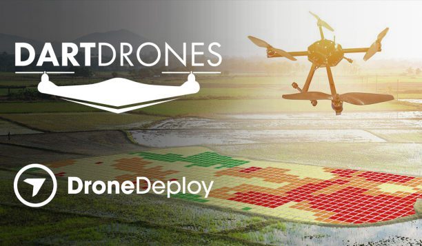
DARTdrones and DroneDeploy will collaborate on a series of workshops and courses to educate drone pilots on aerial mapping, a sought after skill in the enterprise.  Mapping is heavily used in agriculture, construction, transportation and other major verticals that commonly use drone technology.

The program will begin this fall with its first workshop, Aerial Mapping and Modeling with DroneDeploy.

“The need for drone mapping services for contractors, farmers, miners, and building inspectors is increasing each day, ” says the program announcement. “The Federal Aviation Administration (FAA) calculated the agriculture and construction industries alone constituted for 47 percent of commercial drone use in 2016. So far, more than 30,000 remote pilots that have been licensed by the FAA since August. This new workshop will provide a clear training path for remote pilots interested in offering drone mapping services.”

DroneDeploy is the leading cloud-based drone data platform, providing a robust ecosystem of apps and solutions.  The company provides a database of operators specializing in drone mapping to meet their customers’ needs, but demand often outweighs supply for the valuable expertise.   DARTdrones – seen earlier this year on ABC’s “Shark Tank”- is the industry’s leading drone training and consulting company.

The flagship course is a two-day intensive workshop designed to teach drone pilots how to collect, analyze and export high-quality drone mapping and modeling data. Topics include: aerial mapping use cases, fundamentals of drone image capture, techniques for capturing aerial data for mapping, use of the DroneDeploy platform, and ways to improve map accuracy.

“Many of our students are interested in offering their aerial mapping services to architects, engineering firms, construction companies, farmers, and environmentalists,” said CEO and Co-founder of DARTdrones, Abby Speicher. “Mapping can be confusing and complex to get into. We are excited that our Workshop will increase the number of qualified aerial mappers in the market.”

“We’re thrilled to partner with DARTdrones to create a training program for the commercial drone industry,” said Mike Winn, CEO of DroneDeploy. “Our goal is to provide commercial pilots with the training and tools to expand drone mapping into every industry.”

The Workshop will be offered three times in 2017:
· September 9th and 10th in Las Vegas, Nevada
· September 30th and October 1st in San Francisco, California
· November 2nd and 3rd in Ashburn, Virginia

The October course in Virginia will be hosted in partnership with the National Transportation Safety Board (NTSB) at the NTSB Training Center. A team from the NTSB has already been using drones for site documentation, which can include mapping, 3D modeling, wreckage search, terrain mapping, and viewpoint photography and video. The NTSB will use the Workshop to expand their team of trained drone pilots.

The Aerial Mapping and Modeling with DroneDeploy Workshop is launching in conjunction with three other DARTdrones workshops: Rapid Daytime Aerial Search and Rescue, Drone Journalism, and Aerial Roof Inspections.


Miriam McNabb

Miriam McNabb is the Editor-in-Chief of DRONELIFE and CEO of JobForDrones, a professional drone services marketplace, and a fascinated observer of the emerging drone industry and the regulatory environment for drones. Miriam has penned over 3,000 articles focused on the commercial drone space and is an international speaker and recognized figure in the industry.  Miriam has a degree from the University of Chicago and over 20 years of experience in high tech sales and marketing for new technologies.
For drone industry consulting or writing, Email Miriam.

TWITTER:@spaldingbarker

Subscribe to DroneLife here.

Filed Under: Business and Finance, News Tagged With: commercial drone jobs, Commercial Drones, DartDrones, drone mapping, DroneDeploy, Mike Winn

Reader Interactions

Trackbacks

  1. DARTdrones and DroneDeploy Announce Partnership to Train Drone Mappers – DRONEPETS.ORG says:
    July 17, 2017 at 3:00 am

    […] post DARTdrones and DroneDeploy Announce Partnership to Train Drone Mappers appeared first on […]

    Reply
  2. DARTdrones and DroneDeploy Announce Partnership to Train Drone Mappers | News and Reviews about Drones, Quadcopter, Camera says:
    July 16, 2017 at 5:43 pm

    […] Source link […]

    Reply
  3. DARTdrones and DroneDeploy Announce Partnership to Train Drone Mappers – ratemyrotors.com says:
    July 14, 2017 at 8:42 am

    […] post DARTdrones and DroneDeploy Announce Partnership to Train Drone Mappers appeared first on […]

    Reply
  4. DARTdrones and DroneDeploy Announce Partnership to Train Drone Mappers – TheDrones.Link says:
    July 14, 2017 at 7:38 am

    […] post DARTdrones and DroneDeploy Announce Partnership to Train Drone Mappers appeared first on […]

    Reply
  5. DARTdrones and DroneDeploy Announce Partnership to Train Drone Mappers | causality.io | causality.io says:
    July 14, 2017 at 7:33 am

    […] post DARTdrones and DroneDeploy Announce Partnership to Train Drone Mappers appeared first on […]

    Reply

Leave a Reply Cancel reply

Your email address will not be published. Required fields are marked *

Primary Sidebar

LATEST

To Our Readers: We Appreciate You

Yes, we’re celebrating.  It’s been more than 10 years since DRONELIFE started – and we’ve been growing ever since.  It’s…

Continue Reading To Our Readers: We Appreciate You

El Paso Airspace Closures Highlight What Counter-Drone Deployment Still Needs

Two airspace restrictions in West Texas within weeks of each other have pushed counter-drone operations back into the spotlight. The…

Continue Reading El Paso Airspace Closures Highlight What Counter-Drone Deployment Still Needs

Archer Aviation Brings Starlink Connectivity to Midnight Air Taxi

Archer Aviation announced on February 27, 2026 that it will integrate Starlink’s low-Earth-orbit (LEO) satellite internet system into its Midnight…

Continue Reading Archer Aviation Brings Starlink Connectivity to Midnight Air Taxi

Dallas Police Launch Drone First Responder Program

By Dronelife Features Editor Jim Magill While initiating a drones as first responders’ program, the Dallas Police Department is seeking…

Continue Reading Dallas Police Launch Drone First Responder Program

Designing the Optimal Drone: How HP Additive Manufacturing Enables Speed, Scale, and Supply-Chain Flexibility

The drone industry is under pressure from multiple directions at once. Manufacturers are expected to move faster, iterate more often,…

Continue Reading Designing the Optimal Drone: How HP Additive Manufacturing Enables Speed, Scale, and Supply-Chain Flexibility

TRIPLE7 and JR West Test Heavy-Lift Drone Logistics on Japan’s Hokuriku Shinkansen

This article published in collaboration with JUIDA, the Japan UAS Industrial Development Association.     Tokyo-based drone operator TRIPLE7 completed a…

Continue Reading TRIPLE7 and JR West Test Heavy-Lift Drone Logistics on Japan’s Hokuriku Shinkansen

Vector and Nammo Partner on Kinetically-Integrated UAS Platforms

Vector, a Bluffdale, Utah-based defense-as-a-service company, has announced an agreement with Nammo Defense Systems Inc. to integrate and supply munitions…

Continue Reading Vector and Nammo Partner on Kinetically-Integrated UAS Platforms

Unprepared for Drone War? Europe and the US Face Procurement Crisis

Military drone procurement is becoming one of the defining defense challenges of this decade. Europe is confronting a paradox at…

Continue Reading Unprepared for Drone War? Europe and the US Face Procurement Crisis

Designing Resilient Roads on Java’s Southern Coast: A Blue Marble Geographics Case Study

As governments invest in infrastructure to unlock tourism and regional growth, the challenge is no longer just building roads. It…

Continue Reading Designing Resilient Roads on Java’s Southern Coast: A Blue Marble Geographics Case Study

Woolpert and Saildrone Deploy Autonomous USV for NOAA Seafloor Mapping Near Mariana Islands

Woolpert and Saildrone have partnered to collect and process bathymetric survey data for NOAA’s Ocean Exploration and Office of Coast…

Continue Reading Woolpert and Saildrone Deploy Autonomous USV for NOAA Seafloor Mapping Near Mariana Islands

Secondary Sidebar

Footer

SPONSORED

Inspired Flight Gremsy IF800 VIO F1 drones geo week

What Will It Take to Strengthen U.S. Drone Manufacturing? A Conversation with Inspired Flight’s CEO

Global Mapper Mobile data collection

Collection Ground Control Points with Global Mapper Mobile

Military Drone Mapping Solutions

How SimActive’s Correlator3D™ is Revolutionizing Military Mapping: An Exclusive Interview with CEO Philippe Simard

Photogrammetry Accuracy Standards

SimActive Photogrammetry Software: Enabling Users to Meet Accuracy Standards for Over 20 Years

NACT Engineering Parrot ANAFI tether indoor shot

Smart Tether for Parrot ANAFI USA from NACT Engineering

Blue Marble, features global mapper, features Blue Marble

Check Out These New Features in Global Mapper v25 from Blue Marble

About Us | Contact Us | Advertise With Us | Write for Us | Privacy Policy | Terms of Service

The Trusted Source for the Business of Drones.

This website uses cookies and third party services. By clicking OK, you are agreeing to our privacy policy. ACCEPT

Manage consent

Privacy Overview

This website uses cookies to improve your experience while you navigate through the website. Out of these, the cookies that are categorized as necessary are stored on your browser as they are essential for the working of basic functionalities of the website. We also use third-party cookies that help us analyze and understand how you use this website. These cookies will be stored in your browser only with your consent. You also have the option to opt-out of these cookies. But opting out of some of these cookies may affect your browsing experience.
Necessary
Always Enabled
Necessary cookies are absolutely essential for the website to function properly. These cookies ensure basic functionalities and security features of the website, anonymously.
CookieDurationDescription
cookielawinfo-checkbox-analytics11 monthsThis cookie is set by GDPR Cookie Consent plugin. The cookie is used to store the user consent for the cookies in the category "Analytics".
cookielawinfo-checkbox-functional11 monthsThe cookie is set by GDPR cookie consent to record the user consent for the cookies in the category "Functional".
cookielawinfo-checkbox-necessary11 monthsThis cookie is set by GDPR Cookie Consent plugin. The cookies is used to store the user consent for the cookies in the category "Necessary".
cookielawinfo-checkbox-others11 monthsThis cookie is set by GDPR Cookie Consent plugin. The cookie is used to store the user consent for the cookies in the category "Other.
cookielawinfo-checkbox-performance11 monthsThis cookie is set by GDPR Cookie Consent plugin. The cookie is used to store the user consent for the cookies in the category "Performance".
viewed_cookie_policy11 monthsThe cookie is set by the GDPR Cookie Consent plugin and is used to store whether or not user has consented to the use of cookies. It does not store any personal data.
Functional
Functional cookies help to perform certain functionalities like sharing the content of the website on social media platforms, collect feedbacks, and other third-party features.
Performance
Performance cookies are used to understand and analyze the key performance indexes of the website which helps in delivering a better user experience for the visitors.
Analytics
Analytical cookies are used to understand how visitors interact with the website. These cookies help provide information on metrics the number of visitors, bounce rate, traffic source, etc.
Advertisement
Advertisement cookies are used to provide visitors with relevant ads and marketing campaigns. These cookies track visitors across websites and collect information to provide customized ads.
Others
Other uncategorized cookies are those that are being analyzed and have not been classified into a category as yet.
SAVE & ACCEPT