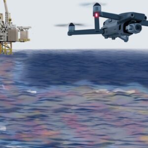
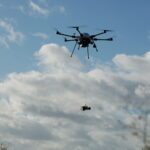
By Dronelife Features Editor Jim Magill When an offshore platform experiences a massive blowout resulting in an oil spill covering a vast expanse of ocean waters, recovery teams require accurate data on ocean currents to quickly initiate the cleanup. In past years, it was often difficult and expensive to collect such data, but over the last decade or so, a team of … [Read more...] about Texas A&M Team Uses Drones to Map Ocean Currents
Remote sensing
Windracers ULTRA to Map Greenland’s Petermann Glacier
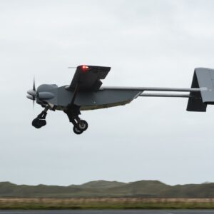
By Dronelife Features Editor Jim Magill An international team of researchers plans to deploy Windracers’ dual-use heavy-lift drone technology to study the interactions of ice and ocean water in the frigid Arctic region of northwestern Greenland. The study, which is expected to get under way this summer, will be a critical part of the so-called GIANT (Greenland Ice sheet … [Read more...] about Windracers ULTRA to Map Greenland’s Petermann Glacier
Drone America and SpecTIR Partner to Expand Hyperspectral UAS Capabilities
Nevada-Based Companies Collaborate on Advanced Aerial Imaging for Government and Commercial Use A New Collaboration for Enhanced Aerial Sensing Drone America, a U.S. manufacturer of uncrewed aerial systems (UAS), and SpecTIR, a specialist in hyperspectral imaging technologies, have signed a new strategic agreement. The partnership will focus on delivering advanced aerial … [Read more...] about Drone America and SpecTIR Partner to Expand Hyperspectral UAS Capabilities
Unlocking the Power of Drones: Free Online Course on UAVs in Precision Agriculture
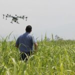
Learn Remote Sensing and Data-Driven Farming Techniques to Optimize Crop Health, Irrigation, and Yield with UAV Technology from the University of Twente by DRONELIFE Staff Writer Ian J. McNab Florian Ellsäßer, an assistant professor in the Department of Natural Resources ITC - Faculty of Geoinformation Science and Earth Observation, at the University of Twente in the … [Read more...] about Unlocking the Power of Drones: Free Online Course on UAVs in Precision Agriculture
Skyports Drone Services and Makutu Transform Water Quality Monitoring with Pioneering Drone Flights
Skyports Drone Services and Makutu Launch Water Quality Survey Drone Flights in Partnership with Northumbrian Water In a groundbreaking collaboration, Skyports Drone Services and Makutu have successfully conducted maiden test flights for a revolutionary drone inspection service designed to enhance water quality monitoring for river and coastal waters. This innovative … [Read more...] about Skyports Drone Services and Makutu Transform Water Quality Monitoring with Pioneering Drone Flights


