At DJI Airworks in LA today, Angad Singh of Pix4D demonstrated a product that hasn't yet been officially launched, but is being used by emergency responders all over the country: Pix4Dreact. Pix4Dreact is designed to provide fire, police and public safety personnel with high resolution 2D mapping - "instantly, and anywhere." "In the last year and a half from the industry … [Read more...] about From the Floor at DJI AirWorks: Introducing Pix4Dreact, Fast Mapping for Emergency Response
Pix4D
Going to INTERGEO and INTERAERIAL? Check Out Some of Our Friends and Sponsors
Going to Stuttgard, Germany next week? INTERGEO is one of the largest shows of it's kind, focused on geodesy, geoinformation and land management. They're expecting over 18,000 attendees and 680 exhibitors - and as commercial drones have risen to be a significant aspect of the industry, INTERAERIAL SOLUTIONS is the intern ational drone show part of INTERGEO. INTERAERIAL … [Read more...] about Going to INTERGEO and INTERAERIAL? Check Out Some of Our Friends and Sponsors
Getting New Drone Programs for Firefighters Off the Ground: Inside a Public Safety Training Event
Public safety organization are one of the fastest growing verticals in the drone industry. With the clear benefits of using aerial technology for public safety applications including search and rescue, suspect pursuit, accident reconstruction, and fire management, agencies all over the globe are implementing drone programs. Public Safety professionals, however, have special … [Read more...] about Getting New Drone Programs for Firefighters Off the Ground: Inside a Public Safety Training Event
VTOL Drone Firm Wingtra Creates Certification Service Process with RDO
Swiss drone manufacturer Wingtra is teaming up with distributor RDO Equipment to roll out a certified repair center servicing the company’s vertical-takeoff-and-landing drone solutions. The certification program will reduce downtown for Wingtra’s survey drones within RDO’s domestic coverage area across the American Upper Midwest, Pacific Northwest, and Southwest. RDO will … [Read more...] about VTOL Drone Firm Wingtra Creates Certification Service Process with RDO
Anywhere, Anytime: Wingtra Drones Map the Alps
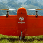
The WingtraOne is an unusual drone, both in looks and functionality. A VTOL (vertical takeoff and landing) design allows the WingtraOne to work in a wide variety of environments. Now xyHt reports that the Wingtra is being used to map the Alps. Swiss engineering firm Cavigelli Ingeniuere AG has been tasked with mapping Lumnezia, a Swiss Alpine valley, for the planning of a … [Read more...] about Anywhere, Anytime: Wingtra Drones Map the Alps


